Last Updated: 28th Sep 2023

Beginner - Intermediate

Save Trail Save

I've done it Done

Fat Man's Run

Rotorua, Bay of Plenty

Submitted by Mike Tennent

Last Updated: 28th Sep 2023

Beginner - Intermediate

Save Trail Save

I've done it Done

Open

Grunt Factor: 24 ?

Gnarl Factor: 34 ?

17.8km

630m

630m

759m


Login as a VIP to see driving directions, distance and time.

Trail Map

Type of Run

Front country - easily accessible

Loop

Undulating, some big hills

Dog Friendly

Native bush

Lakeside

Run Makeup

25%
20%
10%
20%
25%

Gravel Road

Farm Road / 4WD Track

Easy Single Track

Moderate Single Track

Technical Single Track

Average Uphill Gradient: +8.1%

Average Downhill Gradient: -7.4%

Trailhead

Login as a VIP to see the trailhead information.

Estimated Times to Run

3:30

Slow

2:30

Moderate

1:50

Fast

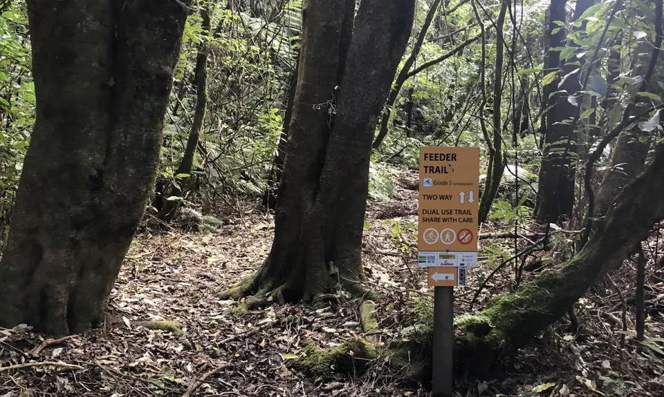
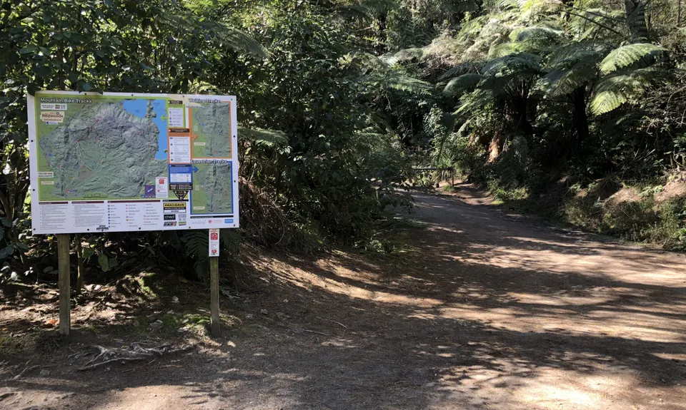
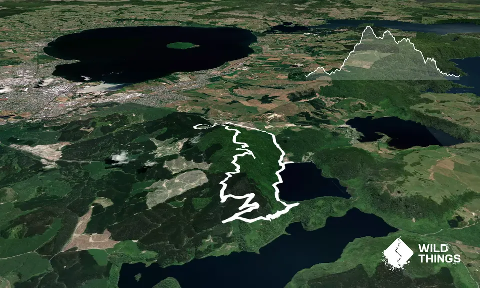
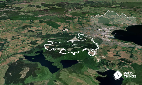
Starting at the Blue Lake by the Ski Club with the lake in front of you, head to your right looking for the trail entry about 20 metres from the lake. Follow this trail for about 100m looking for a not obvious trail off to the right. When you find it turn up and follow it until you reach the MTB trail. At the MTB track turn right and follow the track until you come to a sign on your left saying Feeder Trail. Take that trail and follow it for the next 700m or so ignoring all side trails.

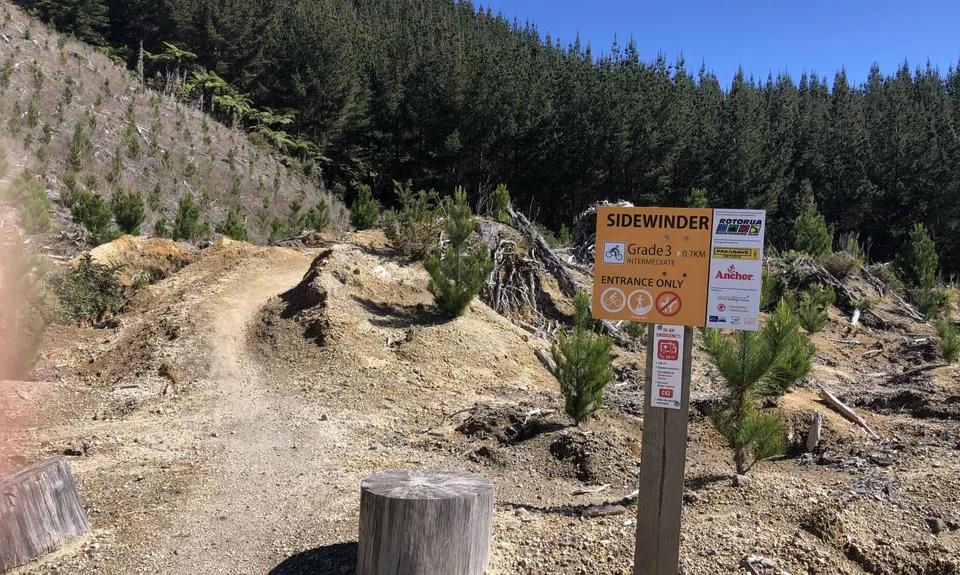
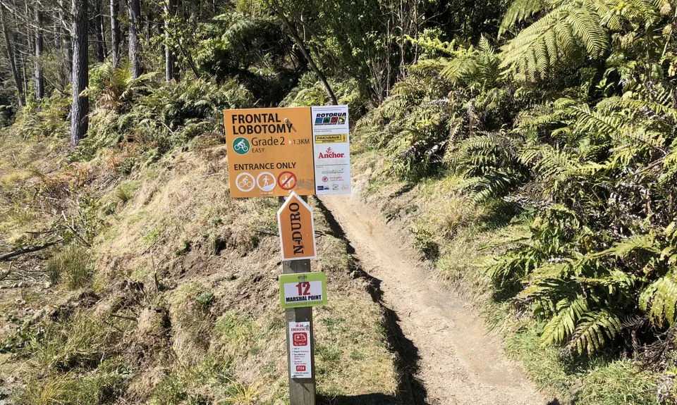
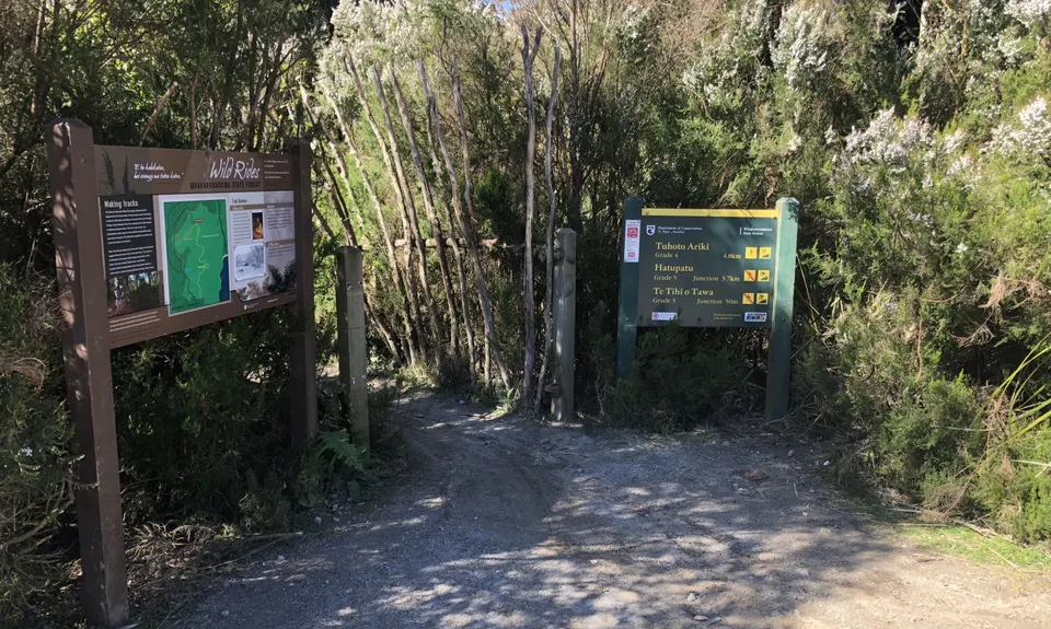
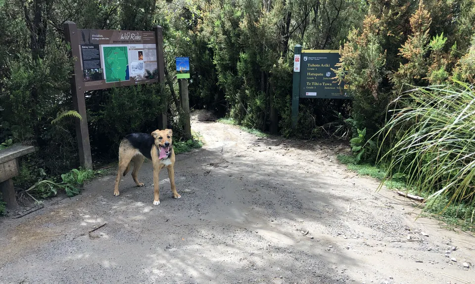
Eventually it will spit you out of the lovely native bush onto 4WD track along parallel to the road. Follow this for the next 1.5km or so until there is a major split in the road. Take the left hand road, the road quickly splits again, this time stay straight and ignore the road off to the left. Follow this road through a few ups and downs watching for a trail call Sidewinder on your left. This is a shared trail but only one directional so this is where the climbing starts.Head all the way up Sidewinder to the top ignoring the couple of side trails on the way. Once you come out on the road turn left and follow the forestry road for about 500m to the junction of the road, at the junction you will see a large map board and to the left of that the very appropriately name Frontal Lobotomy.

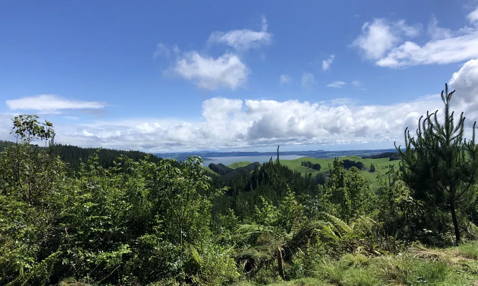
This too is a shared uphill only trail and much more runnable than the previous one. Follow this to the very top where you will come to another map board, to the right of the map the road carries on up the hill and so do you. Keep going to the very top to the entrance of Tuhoto Ariki... a magic bit of trail. Head on in, early on there is a trail split, follow Tuhoto Ariki and head left. Then enjoy some lovely technical running for the next 4 to 5km. There is one clearing you come into, just a round patch of green grass in the middle of the bush and the trail is not obvious, it is back left and marked with a DOC orange triangle. Other than that here are only a couple of trails off and they are clearly labelled as MTB only.

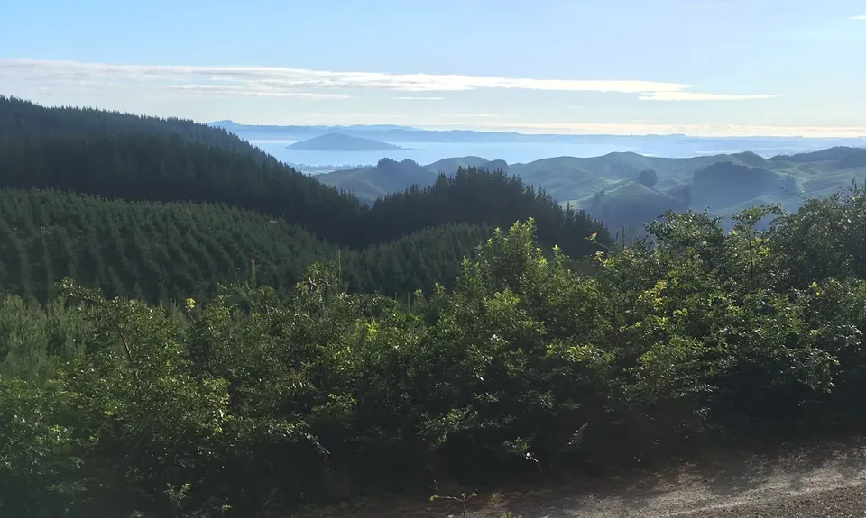
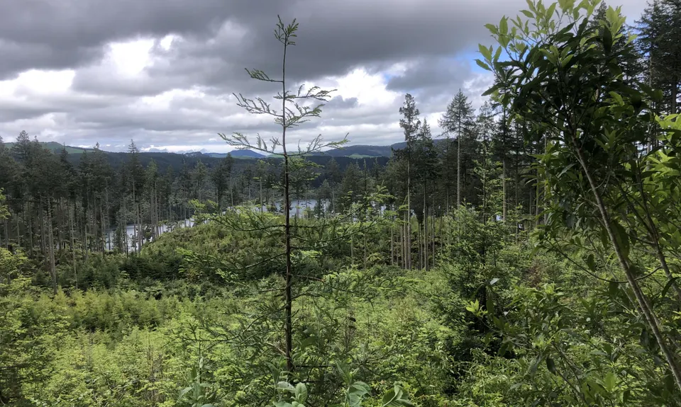
Once out of Tuhoto you will hit forestry road again, head left up the hill to the top, past one side road. At the top is yet another map board (you wont get lost)... head left here and follow the 4WD/Forestry road... after a couple of hundred metres you will come to a clearing with what looks like a trail on the right. Take the time to head over there and run the 20 or so metres to a magic view. Then back to the road and head right for nearly a kilometre... watching all the time for a post on your right (no sign) that marks a trail start.

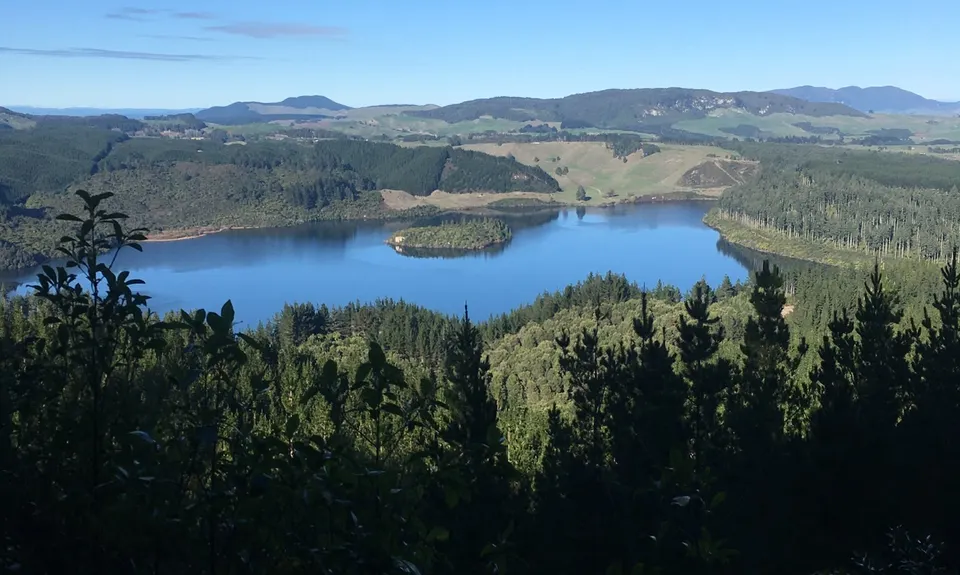
Once on this trail follow some lovely technical downhill single trail until you reach another 4WD road, turn left again and once again run a few hundred metres looking again for a post that use to have a sign on it. The trail is reasonably clear, follow that as it heads through and then at the clearing veer to the right onto the main trail again. Follow this until you reach a more well formed forestry road (Tikitapu Road). Turn left here up the hill and follow this road until you reach a 4 way intersection (keep an eye out for some cool through the trees views of Green Lake). Once at the intersection turn lef onto the main Blue Lake Trail and follow it back to the start - about 2.4km. Alternatively you can follow the trail the other way for about 3.2km to the same place.

Two Lakes (Blue and Green) This run has been a regular of the authors for many years and was used as the basis for an event he ran for Hospice in 2013 called the Fat Man's Run... hence the name! (the Author is the Fat Man)

Generally a few vehicles around and as long as you are in the main carparks you should be ok.

11 km

13 minutes

Yes

No

Hard.

I suggest that you print out this guide and take it with you. You will pass 3 Map Boards so at each time you can check where you are. And if you are navigationally challenged you can track down the author and maybe he will come show you!

Patchy.

Waterproof leggings, Long-sleeved thermal top, Seam-sealed waterproof jacket, Gloves, Beanie/thermal headwear, Whistle, First aid kit, Extra food for emergencies, Survival blanket, Cellphone, Map

Only water at the very start and the end.

Tuhoto gets a bit muddy after lots of rain, but really that just makes it more fun, not likely to be closed at all.

While you are never far from civilization, there are lots of trails in the Rotorua Forests, so take time to make sure you go the right way. Also lots of tree roots in the technical sections.

SEQUOIA EATERY
10 Tarawera Road, right next to the Outdoorsman - you had to drive past it on the way out.
https://sequoiaeatery.co.nz/
Great food, great coffee and he is a trail runner as well!!!

You and Fat Man's Run

As a VIP member you can record private notes for this trail, see all of your times and more.

Register Now

Already have an account? Login now

Trail Reviews

Love running this with the dog but they have recently upgraded bush road to a proper foresty road (😕) and the track off it can be hard to see. They have created a culvert where the entrance was

Rebecca Maltby

April 14

Amazing run and well worth tacking on Moerangi Peak as a slight detour. Need to turn right up Time Warp track which is opposite Bush Road and retrace your steps back as it is dual direction for walkers/runners. There are a few trees down from recent cyclone but completely navigable.

Anthony Sowerby

February 19, 2023

This trail was awesome. Description was pretty good, wouldn't have made it without it.
Very wet and soggy in the rain.

Allysia Kraakman

July 17, 2021

This is a really beautiful trail. Like other reviewers, it tested my navigation skills and I even had GPX maps loaded on my Fenix. I would really recommend this but be sure to save a copy of the instructions (no reception in some areas) to refer too.

James Gribble

February 8, 2021

Login to submit a review

Trail Running Community

Find people who are interested in or have completed this trail run.

You must register or login to view this feature.

Register Now

Overlapping Trails

These overlap with this trail to some degree. You may wish to combine them but please note that to qualify for FKTs on these runs you should record a separate activity for each.

Whakarewarea Circuit - the Black Track

Whakarewarea Circuit - the Black Track

Length: 32.6km

Level: Beginner - Intermediate

RTRC Club Track Loop

RTRC Club Track Loop

Length: 12.0km

Level: Beginner - Intermediate

Whakarewarewa Rainbow

Whakarewarewa Rainbow

Length: 61.0km

Level: Beginner - Intermediate

Other trails nearby
Single Rainbow

Single Rainbow

Length: 6.7km

Level: Beginner

Yellow Plus Cardiac

Yellow Plus Cardiac

Length: 8.3km

Level: Beginner

The Tarawera Trail

The Tarawera Trail

Length: 29.8km

Level: Beginner - Intermediate

Okataina...Eastern & Western

Okataina...Eastern & Western

Length: 33.7km

Level: Beginner - Intermediate

Find more trails and peaks nearby