Last Updated: 7th Mar 2025
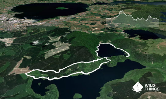
Blue and Green Lake Loops
Last Updated: 7th Mar 2025
Grunt Factor: 14 ?
Gnarl Factor: 13 ?
14.0km
300m
300m
540m
Last Updated: 7th Mar 2025
Last Updated: 7th Mar 2025
Grunt Factor: 14 ?
Gnarl Factor: 13 ?
14.0km
300m
300m
540m
Front country - easily accessible
Loop
Undulating, some big hills
Dog Friendly
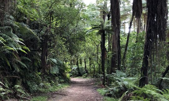
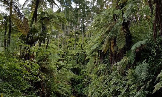
Native bush
Lakeside
Sealed Road
Farm Road / 4WD Track
Easy Single Track
Average Uphill Gradient: +8.3%
Average Downhill Gradient: -7.7%
VIP Feature: Send this route to your Garmin account so you can follow the course on your Garmin device.
Login as a VIP to see the trailhead information.
2:00
Slow
1:30
Moderate
1:00
Fast
Start from Blue Lake car park and head up the road towards Green lake. There's a slight drag up the hill to Lookout car park, or if weather allows there is a walking track that angles off into the bush and takes you up some stairs to Lookout car park. Follow the trail from the right hand corner of the car park through gate and continue along the track. At the crossroads, continue straight on up the hill. What follows is around 4km of steady downhill until you reach Branch Road on your left.
Turn down Branch Road and at the bottom take the left hand turn onto Green Lake Road. Follow this track until you reach the Green Lake Picnic Area. Left turn onto Lakefront Road and stay on this track until the top of the Green Lake Hill, steepest climb! At the crossroads, again go straight on and down to complete the loop of the Blue Lake. The trail naturally leads you back to the Blue Lake Car Park.
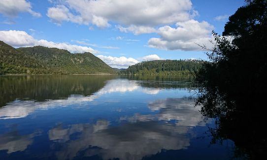
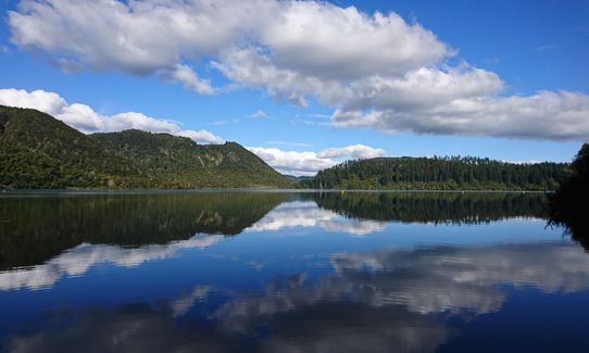
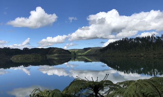
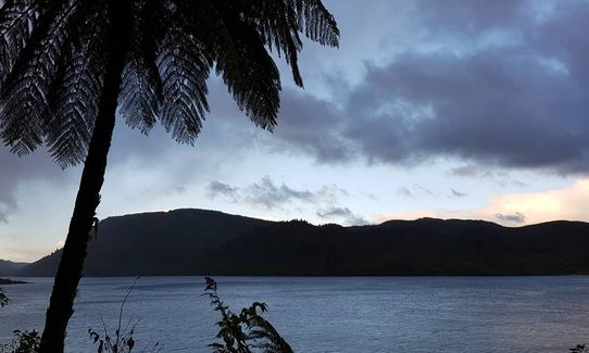
Lake views, native bush
If you know of any public toilets near the trail start or on the route, please login and then let us know so we can update this section.
Ample free parking at Lakefront
11 km
12 minutes
Yes
No
Moderate.
Be sure to take Branch Road as Eight Mile Gate Road is closed due to logging truck traffic. Do not use Mountain Bike Tracks either.
Very patchy.
Seam-sealed waterproof jacket, Beanie/thermal headwear, Whistle, First aid kit, Extra food for emergencies, Cellphone, Map
Water tap at Blue Lake car park, no other water sources
Can be prone to muddiness of Lake Front Road and on return leg of Blue Lake
Be careful of walkers around Blue Lake, trail can narrow at points
Sequioa Eatery
Tarawera Road
https://sequoiaeatery.co.nz/
Operated by a member of Rotorua Trail Running Club, great supporter of Trail Running. Amazing food options.
Fastest Known Times (FKTs)
You and Blue and Green Lake Loops
As a VIP member you can record private notes for this trail, see all of your times and more.
Already have an account? Login now
Good trail but as Ruth mentioned you can't complete the Green Lake loop part. The Western end of Lake Front road is blocked with a gate and signs stating Private Property, absolutely no entry. Not sure if its blocked at the Eastern end. Just means you have to run back up Tikitapu 4x4 track as the other track closer to the lake is a one way MTB track.
June 6, 2024
A fantastic run if you're wanting a taste of the famous and amazing Rotorua trails. It's tracks that are used in most of the Rotorua off trail (and some road) events too so worth doing to get yourself familiar with the tracks.
October 3, 2020
RB
Great trail but the bottom part of the green lake track was closed so we headed back, took moerangi Rd then Hill Rd and back around to the green lake . So many different types of terrain. Lots of great trails everywhere just keep checking the maps and your gps as not well sign posted.
January 25, 2020
These overlap with this trail to some degree. You may wish to combine them but please note that to qualify for FKTs on these runs you should record a separate activity for each.
Send to your phone
Scan the below QR code to open this trail on your phone.

Tip: position the QR code in your phone camera screen.


