Last Updated: 12th Oct 2023

Beginner - Intermediate

Save Trail Save

I've done it Done

Double Rainbow

Rotorua, Bay of Plenty

Submitted by Mike Tennent

Last Updated: 12th Oct 2023

Beginner - Intermediate

Save Trail Save

I've done it Done

Open

Grunt Factor: 31 ?

Gnarl Factor: 31 ?

20.9km

1085m

1085m

747m


Login as a VIP to see driving directions, distance and time.

Trail Map

Type of Run

Front country - easily accessible

Loop

Very hilly

Native bush

Plantation/exotic forest

Lakeside

Open tussock/grasslands

Volcanic

Run Makeup

30%
30%
30%
10%

Gravel Road

Easy Single Track

Moderate Single Track

Technical Single Track

Average Uphill Gradient: +10.4%

Average Downhill Gradient: -10.4%

Trailhead

Login as a VIP to see the trailhead information.

Estimated Times to Run

3:30

Slow

2:30

Moderate

1:30

Fast

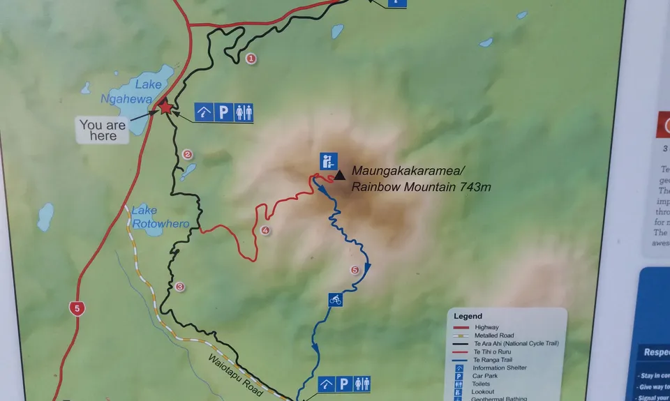
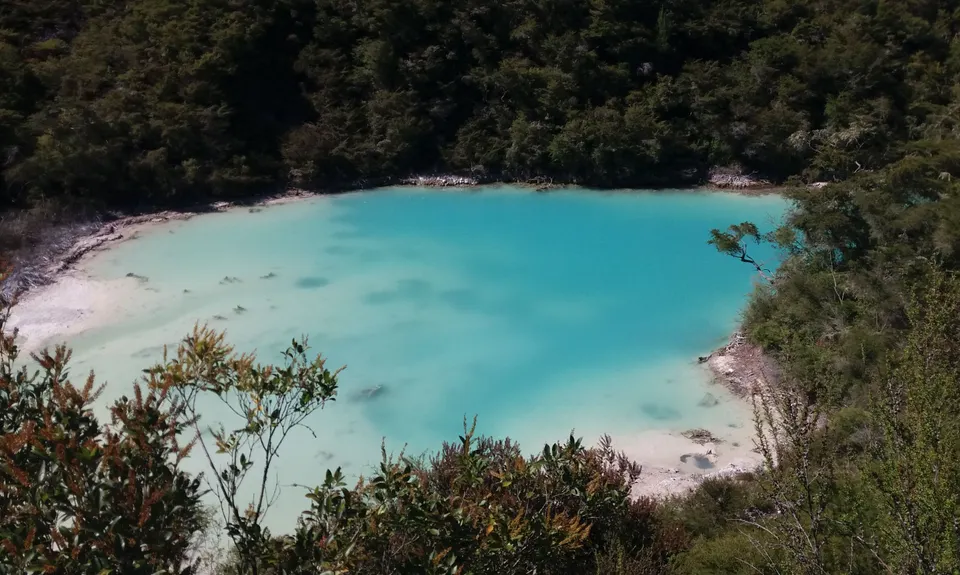
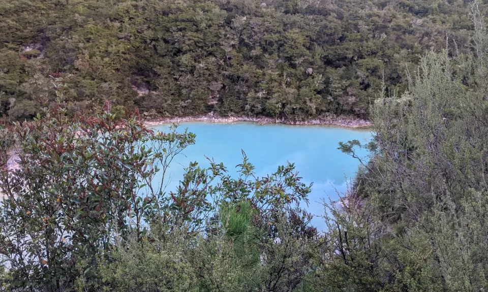
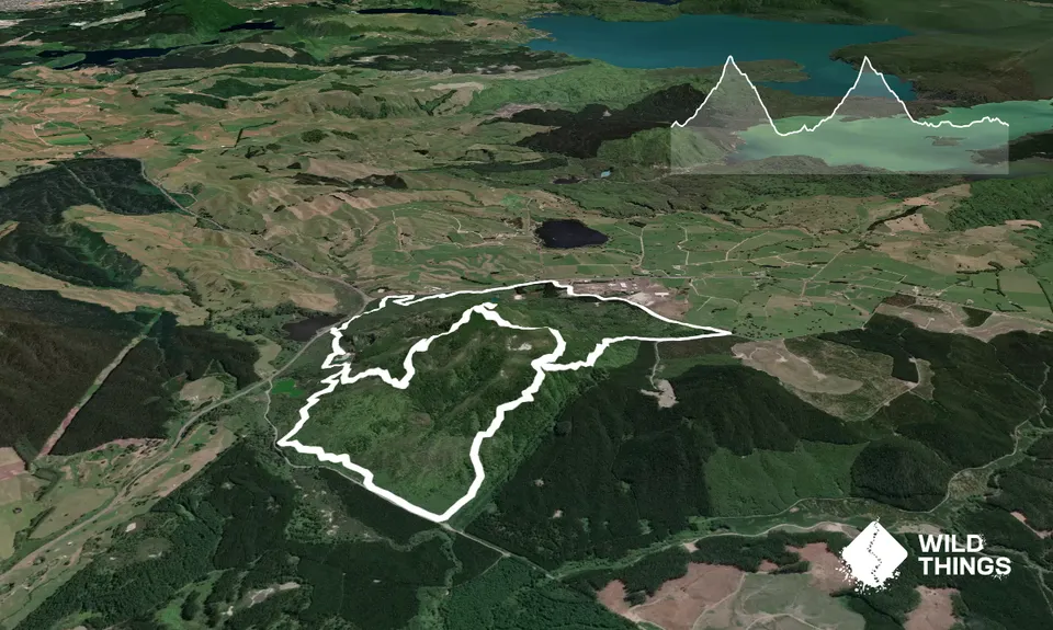
From the carpark follow the main trail, take the left turn a few hundred metres up on your left to the Crater Lake... well worth a look, then return to the main trail and continue slowly climbing until you come to some signs and an intersection.

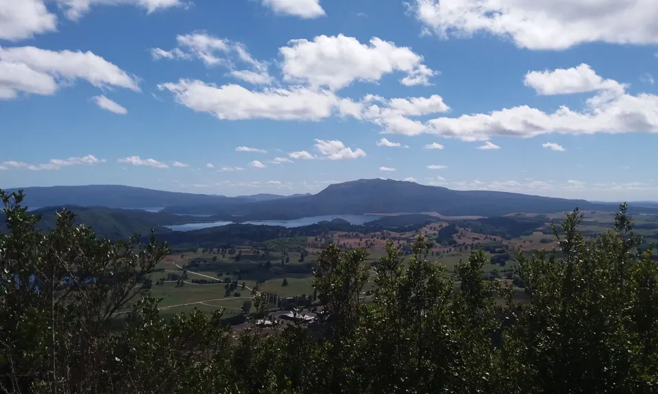
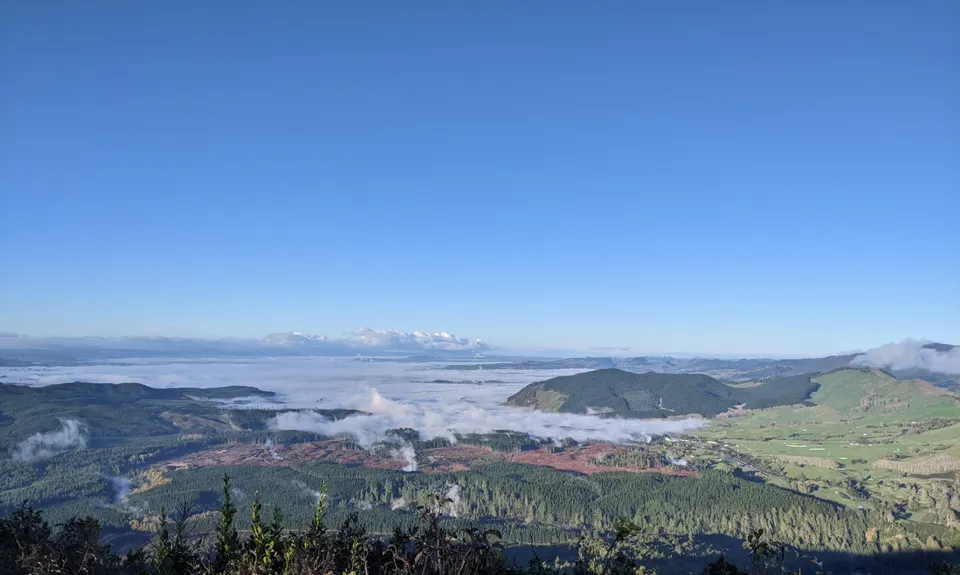
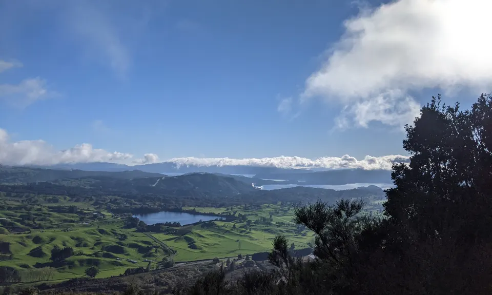
Take the left trail signposted to the Summit and start climbing in earnest. Follow the trail to the road at the top (stopping for the views and photos of course), when you hit the road, turn left, a wee way up on the left is another trail, head onto that and climb to the road above that, turn left again and you are at the summit.

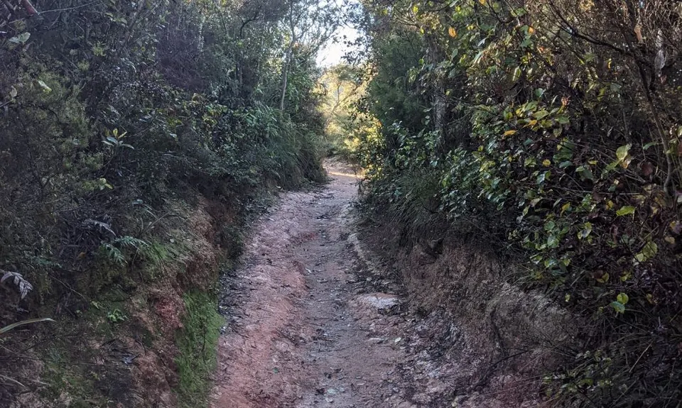
Once you have taken that all in and snapped some pics, head down the road for about 1.3km, ignoring the trails you came up and the MTB Trail. Then at a sharp corner in the road you will see a trail sign for Te Ranga Trail. This is the bottom half of the MTB trail that started further up and is generally treated as dual use, but be aware of any MTB riders and give way to them at all times. Follow the trail down, there is one split but both branches take you to the same place so suit yourself.

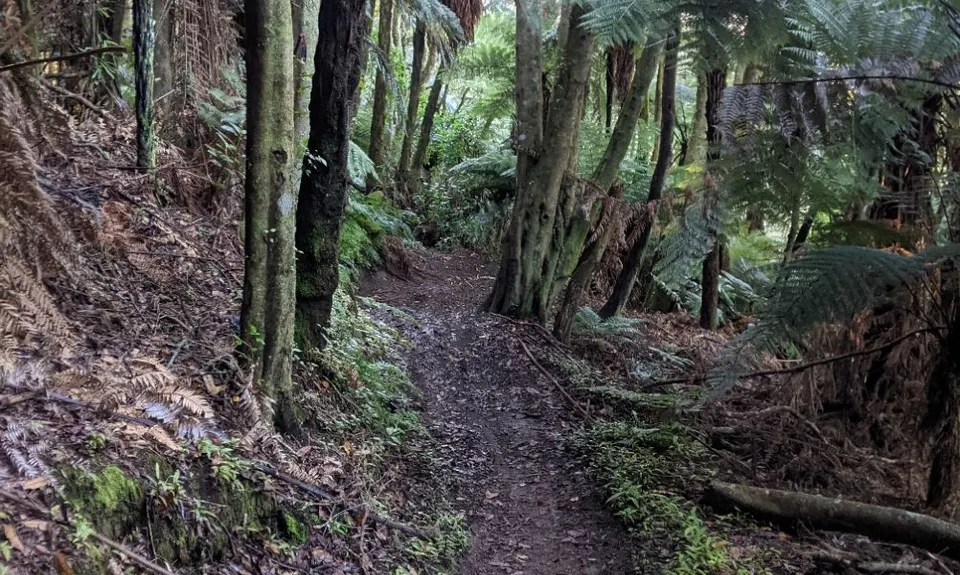
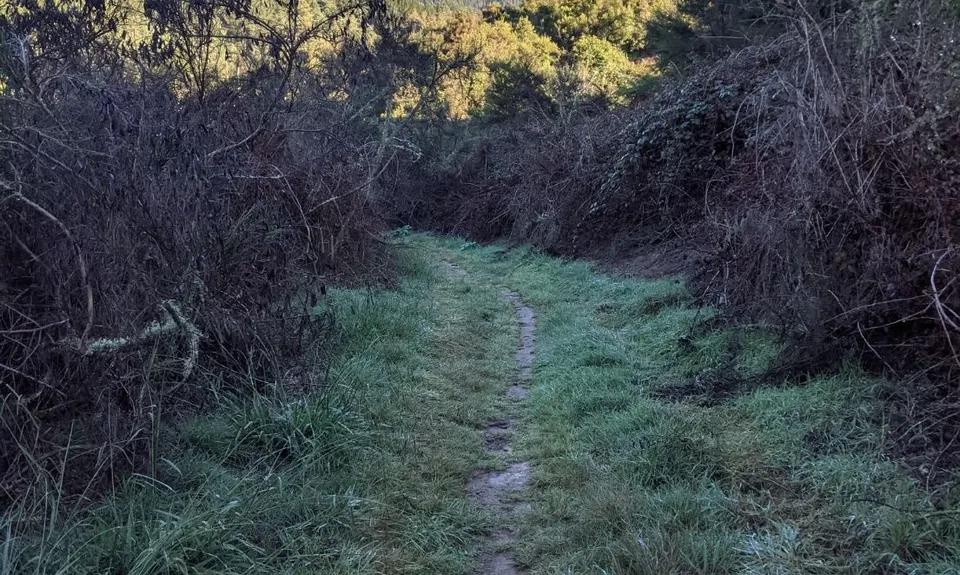
At the end of the trail (unless you need the loo, which is to the left in the Kerosene Creek Carpark) head right and follow the orange triangle route. This goes straight for about 500m and then turns left into lovely single trail, slowly climbing. Follow this trail, ignoring the one exit to the left and eventually it will bring you to the same intersection you were at earlier. Turn right this time and head up the mountain again... all the way to the top.

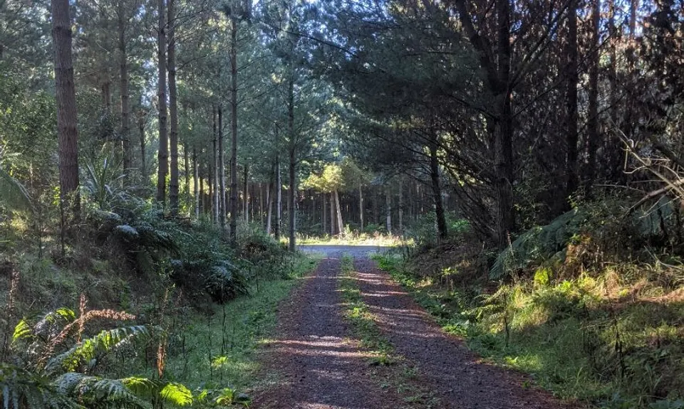
Once at the top and you've had a drink and boasted to the tourists about how it's your second time up today, head down the road again, but this time run straight past the previous turnoff and follow the road all the way to the bottom. There you will come out onto another road amongst the pine trees, turn left and then in about 500m left again. This turn may be a bit overgrown today so watch out for it. Carry on this road (you may even see a couple of red arrows from the Double Rainbow event) - past two gates - all the way to the highway. At the highway turn left and run for about 200m along the verge until you see the entrance for the trail. Follow this wonderful bush single trail for 2.5km to your car.

Route Update January 2023:

After summiting for the second time and running down gravel road you can't turn left to hook back onto SH38. Instead, continue down the gravel (Rainbow Road) it will eventually terminate at SH38 then you'll run 1.5km on road to get back onto the course.

This trail includes the peak Rainbow Mountain.

Plenty here... volcanic lakes, 360 degree views as far as Ruapehu on a fine day, great views most days of Lakes Tarawera, Ruataniwha, Rerewhakaitu and Okaro plus a few more small ones... and of course you can see Mount Tarawera.

Plenty of parking although it can be a bit pot-holed.

26 km

21 minutes

Unknown

No

Easy.

Generally good.

Waterproof leggings, Long-sleeved thermal top, Seam-sealed waterproof jacket, Gloves, Beanie/thermal headwear, Personal Locator Beacon (PLB), Whistle, First aid kit, Extra food for emergencies, Survival bag, Cellphone, Map, Headtorch and spare batteries

No drinkable water - there is water about but it is all thermal.

Generally pretty good all year round, may get a bit slippery in places after prolonged rain.

A couple of steep fall-offs on the climb, tree roots and trippable rocks on the single trail.

Kerosene Creek - How Water Swimming Stream
About 300 metres further towards Taupo from the Rainbow Mountain Carpark
https://www.newzealand.com/in/feature/kerosene-creek/
It's free and it's awesome, lots of small swimming areas in the stream at a lovely warm temperature. Don't put your head under, as with all termal water that is dangerous. But a great place to unwind after your Double Rainbow.

You and Double Rainbow

As a VIP member you can record private notes for this trail, see all of your times and more.

Register Now

Already have an account? Login now

Trail Reviews

Nice run with plenty of views to take in along the way. Some steep bits to keep you honest and after reaching the 2nd summit reasonably fast running if you don't mind barrelling down a gravel road! Thanks for sharing Mike.

Anthony Sowerby

April 9, 2022

A great run with epic views across to Tarawera and down to Ruapehu. Blackberry needs a trim on the lower levels of the run but the track to the summit is really good.

chris atkinson

February 1, 2021

Have completed this course twice now as part of the Double Rainbow event, so total distance covered each time was approx 25-27km! PHEW!

Toni Grace

January 29, 2020

Login to submit a review

Trail Running Community

Find people who are interested in or have completed this trail run.

You must register or login to view this feature.

Register Now

Overlapping Trails

These overlap with this trail to some degree. You may wish to combine them but please note that to qualify for FKTs on these runs you should record a separate activity for each.

Single Rainbow

Single Rainbow

Length: 6.7km

Level: Beginner

Other trails nearby
Tarawera Trail Route Recce

Tarawera Trail Route Recce

Length: 21.0km

Level: Beginner - Intermediate

The Other Okataina Trails

The Other Okataina Trails

Length: 19.1km

Level: Beginner - Intermediate

Orange Kakapiko

Orange Kakapiko

Length: 9.2km

Level: Beginner

The Tarawera Trail

The Tarawera Trail

Length: 29.8km

Level: Beginner - Intermediate

Find more trails and peaks nearby