Last Updated: 13th May 2024

Beginner

Save Trail Save

I've done it Done

Kawatiri River Trails

Westport, West Coast

Submitted by Katie Smith

Last Updated: 13th May 2024

Beginner

Save Trail Save

I've done it Done

Open

Grunt Factor: 7 ?

Gnarl Factor: 10 ?

7.9km

10m

10m

4m


Login as a VIP to see driving directions, distance and time.

Trail Map

Type of Run

Urban fringe

Loop

Totally/mostly flat

Dog Friendly

Native bush

Beach

Coastal

Riverside

Run Makeup

5%
95%

Sealed Road

Easy Single Track

Average Uphill Gradient: +0.3%

Average Downhill Gradient: -2.2%

Trailhead

Login as a VIP to see the trailhead information.

Estimated Times to Run

1:00

Slow

0:45

Moderate

0:35

Fast

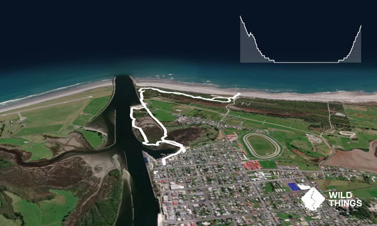
This is a good little run around the Kawatiri River trails. These head out around the estuary then along North Beach before looping back again. They are well-used by people on foot and on bikes, so just keep an eye out. They are well-marked throughout, with frequent sign boards and maps.

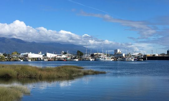
Start by the wharf and have a look at all the fishing boats. Head east along the waterline, down past the boat ramps and the yacht club and rowing club buildings, heading for the boardwalk that is visible from the wharf. The tracks start by this. Head across the boardwalk then shortly afterwards take the first track junction to the left. This loops around past a fishing platform and the remains of an old wharf before rejoining the main track.

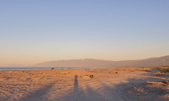
Take a hard left here and head on across the Volunteers Bridge and below the shipping marker. Here the track splits again - again take the lefthand option, heading along the river. The track pops out by a little river beach - run across the gravel and rejoin the trail. It splits again - stay left. After crossing a gravel road the track runs along behind North Beach. It is worth a quick detour out to have a look at the surf and huge driftwood piles.

Continue on the trail until it splits yet again - here it become single direction trail, and meanders back and forth through bush, with some loops almost doubling back on themselves (this bit is designed for biking but is open to runners). At the end of this track you come out by a freedom camping area, with toilets and a water fountain. Head back into the bike tracks (there are three options here - the one you arrived on and two others - take the middle option) and meander back again to the junction near the river beach. This time take the track on the left. After crossing another road take the lefthand option once again, and follow it until you reach the original boardwalk to the boat ramps and wharf, completing the loop.
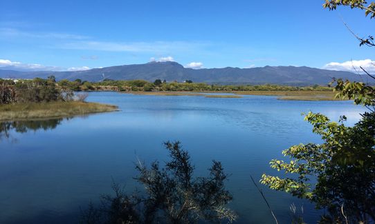
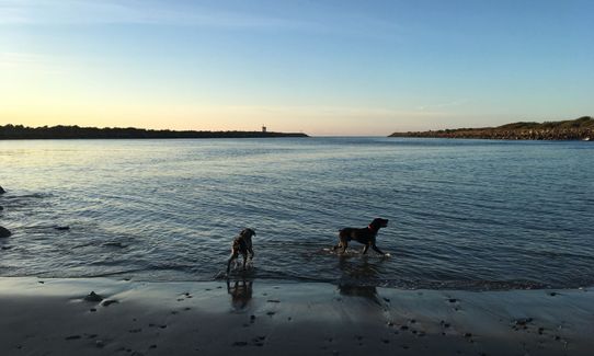
The estuary has a wide range of bird life, particularly at low tide - spoonbills, stilts, swans, shags, pukeko, weka and lots of gulls.

If you know of any public toilets near the trail start or on the route, please login and then let us know so we can update this section.

Plenty of on-street parking

2 km

3 minutes

Yes

No

Easy.

If you get confused there is never far to go to the next map board!

Generally good.

Short-sleeved thermal top, Long-sleeved thermal top, Cellphone

There is a water fountain at the far end by the freedom camping area

The tracks are good in any conditions

Trail Legend

Mark De Goldi

Mark De Goldi

has completed Kawatiri River Trails once in the last year.

Learn about Trail Legends.

You and Kawatiri River Trails

As a VIP member you can record private notes for this trail, see all of your times and more.

Register Now

Already have an account? Login now

Trail Reviews

Enjoyable little jaunt taking in scenery of river and beach. Nice trail through bush. Great to not have to ‘think’ where to run when just in town for one night

Nicola Fox

January 3, 2021

Have put off doing this trail from the directory because it was so close to town I thought it would be pretty boring... well I was wrong, lovely wee gem, interesting, nice views and fun. The only suggestion is that you wear road shoes or padded Hokas, because it is very hard underfoot for pretty much the whole run.

Mike Tennent

November 19, 2020

Great trails and a very helpful description!

Daniel Parkinson

November 13, 2020

This trail makes up part of my almost daily run. I include a lap around the Westport Domain, then through the millenium track (under the Westport Bridge). Better than pounding along the streets. Not very technical, but the tracks at the beach are very looping and twisting - so good for practising speed work into and out of sharp turns. Mixture of surfaces from soft sands to lumpy hard fills and rocks. Strava segment back over the main walkbridge toward town is hotly contested.

Brent Oldham

July 4, 2019

Login to submit a review

Trail Running Community

Find people who are interested in or have completed this trail run.

You must register or login to view this feature.

Register Now

Other trails nearby
The Old Ghost Road

The Old Ghost Road

Length: 85.0km

Level: Intermediate

Charming Creek Walkway

Charming Creek Walkway

Length: 20.0km

Level: Beginner - Intermediate

Buckland Peaks

Buckland Peaks

Length: 22.0km

Level: Beginner - Intermediate

The Nile

The Nile

Length: 5.3km

Level: Beginner

Find more trails and peaks nearby