Last Updated: 21st Sep 2023

Beginner - Intermediate

Save Trail Save

I've done it Done

Down in Denniston

Westport, West Coast

Submitted by Vicki Woolley

Last Updated: 21st Sep 2023

Beginner - Intermediate

Save Trail Save

I've done it Done

Open

Grunt Factor: 10

Gnarl Factor: 25

9.0km

100m

660m

612m


Login as a VIP to see driving directions, distance and time.

Trail Map

Type of Run

Front country - easily accessible

Point to Point (one way)

Totally/mostly flat

Native bush

Run Makeup

100%

Easy Single Track

Average Uphill Gradient: +15.2%

Average Downhill Gradient: -17.5%

Trailhead

Login as a VIP to see the trailhead information.

Estimated Times to Run

2:00

Slow

1:30

Moderate

1:00

Fast

This is not a run to set a PB on: rather, take your camera and sense of curiousity and wonder.
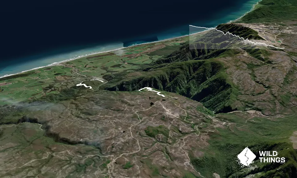
Explore at your leisure from the top carpark. Follow the signs: run the Brakehead Walk to Banbury Arch (1.1km): the Town Walk (1.3km) through the old town and past the bowling green, and the Coalbrookdale Walk (2km) for authentic mining relics. Venture to the vertiginous edge of the Brakehead and once you have taken an epic selfie, set off down the Denniston Bridle Track: a 4.2km descent to Conns Creek Road (Waimangaroa). Between 1884-1902 the only way to/from Denniston was via this track (by horse or foot) or the railway.
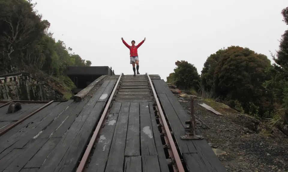
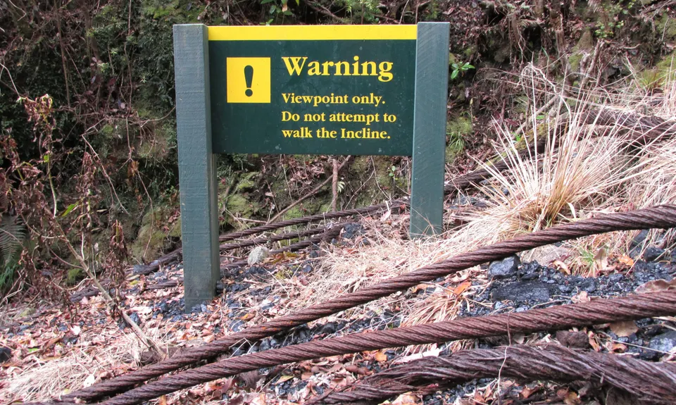
After a few zig-zags on rocky trails through dense bush, you will have the opportunity to venture out to the Incline itself via a short side-track off to the right: it is truly terrifying to witness the 1:2.22 gradient and look down to Middle Brake, an almost token gesture safety reprieve.
Return to the Denniston Bridle Track and continue down through bush. At the only junction, stay right and continue down the trail to Conns Creek Road carpark.
If your ride isn't meeting you here, turn left and jog 500m out to the junction with Denniston Road.
*Note: gpx route turns left and goes down the road to Conns Creek: stay right to stay on trail.

Denniston Plateau towers abruptly 600m above the West Coast and is a hostile, barren, windswept environment. Denniston was once NZ's largest producer of coal: the modern-day visitor is hard pushed to visualise the bustling town with schools, hotels, shops, churches and sports clubs that existed in the early days of the 20th century. Denniston's primary claim to fame is 'The Incline': dubbed the eighth engineering wonder of the world, this steeply graded railway falls 510 metres in 1.7km: unsurprisingly, a number of workers and travelers met their demise on this notorious descent.

Several companies offer walking tours of Denniston. Ask around until you find one who will be happy to pick you up at the bottom of the Incline.

25 km

27 minutes

Unknown

No

Easy.

Good signage and interpretation panels adorn the Plateau. Once on the Bridle Track there are only two junctions as described.

Patchy.

Lightweight fleece top, Long-sleeved thermal top, Seam-sealed waterproof jacket, Gloves, Beanie/thermal headwear, Whistle, First aid kit, Extra food for emergencies, Cellphone, Map.

Carry own water.

Denniston has its own peculiar microclimate and is mired in cloud more often than not. Prepare for cold, wet, windswept conditions and celebrate any departure from this.

The Townhouse
13-15 Cobden Street, Westport
We went for lunch... stayed on for afternoon tea.. probably would have settled in for dinner if we didn't have a plane to catch. Modern food, great service, lovely ambiance.

You and Down in Denniston

As a VIP member you can record private notes for this trail, see all of your times and more.

Register Now

Already have an account? Login now

Trail Reviews

Track reopen but take care! Feels slippery and exposed at least in bad weather- and that was doing it in the uphill direction. Really fun grunt though if you like that kind of thing :-)

Mike McManaway

December 17, 2021

Track is closed. Long term by the looks, big slip

Tony Sharpe

July 18, 2020

The track is unfortunately closed at the moment due to a slip halfway down

Joe Benbow

February 26, 2020

Fantastic place to explore. I did the upper tracks with the family. Then I ran down the bridle track while they drove down to visit the bottom of the Incline. Highly recommend

Ian Buunk

January 29, 2018

Login to submit a review

Trail Running Community

Find people who are interested in or have completed this trail run.

You must register or login to view this feature.

Register Now

Other trails nearby
Charming Creek Walkway

Charming Creek Walkway

Length: 20.0km

Level: Beginner - Intermediate

Oparara Valley  Dreamtime

Oparara Valley Dreamtime

Length: 20.0km

Level: Beginner - Intermediate

Cape Foulwind

Cape Foulwind

Length: 10.9km

Level: Beginner

Mt William Loop

Mt William Loop

Length: 12.9km

Level: Intermediate - Experienced

Find more trails and peaks nearby