Last Updated: 16th Dec 2024
St James Walkway
Submitted by George Mitchell
Last Updated: 16th Dec 2024
Grunt Factor: 88 ?
Gnarl Factor: 39 ?
66.0km
1550m
1750m
1138m


Last Updated: 16th Dec 2024
Submitted by George Mitchell
Last Updated: 16th Dec 2024
Grunt Factor: 88 ?
Gnarl Factor: 39 ?
66.0km
1550m
1750m
1138m
Back country - remote
Point to Point (one way)
Undulating, some big hills
Native bush
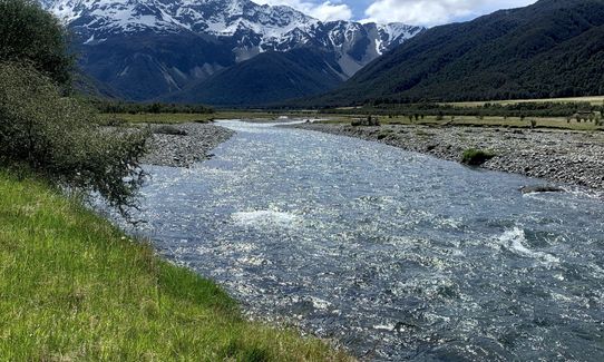
Riverside
Lakeside
Open tussock/grasslands
Easy Single Track
Moderate Single Track
Technical Single Track
Average Uphill Gradient: +4.1%
Average Downhill Gradient: -4.4%
VIP Feature: Send this route to your Garmin account so you can follow the course on your Garmin device.
Login as a VIP to see the trailhead information.
Not suitable
Slow
11:00
Moderate
8:00
Fast
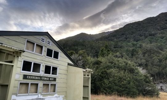
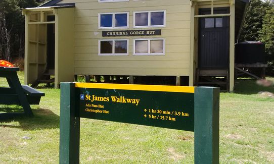
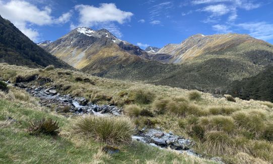
10 km from Lewis Pass to Ada Pass Hut via Cannibal Gorge Hut. The track enters the bush, crosses Cannibal Gorge and goes to the Cannibal Gorge Hut. Past the hut the track follows an easy grade to Ada Pass Hut. Nice location between the mountains.
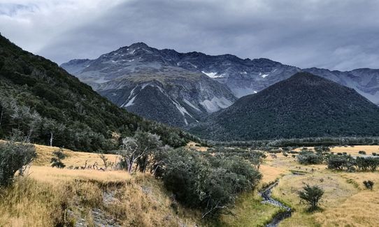
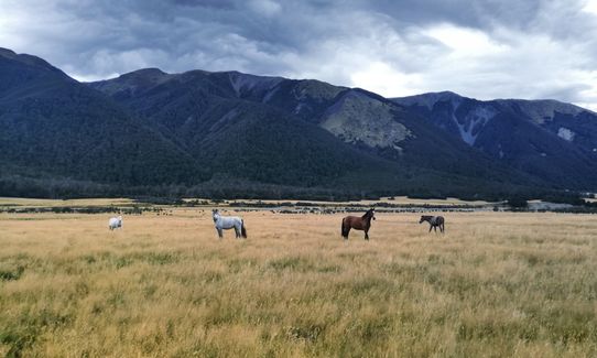
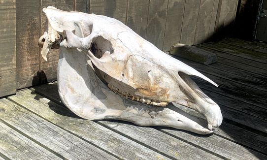
10.5 km from Ada Pass Hut to Christopher Hut. Travel over Ada Pass into the Ada valley. Beech opens up into clear valley alongside small lakes with great mountain views. Pass the Christopher cullers hut and continue to Christopher Hut. Great location in a big valley, wild horses were not far from the hut.
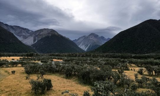
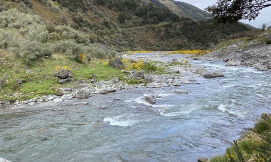
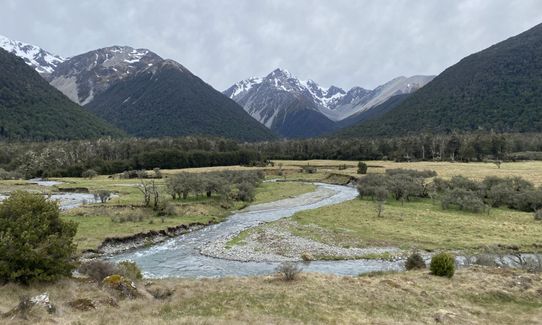
13 km from Christopher Hut to Anne Hut. Some nice country to run (when not boggy) to where the open flats converge with the river and toe of the hill. You can see the Ada homestead in the distance (private). Some sections of vehicle track in this section. Pass the Henry / Waiau valley confluence and continue to a suspension bridge over the Henry River. Follow the track to the Anne Hut.
17 km from Anne Hut to Boyle Flat Hut. A tough section for tired legs over Anne Saddle and into the Boyle Valley. Continue past the basic Rokeby Hut. Continue to the suspension bridge over the Boyle River, 100 metres from the Boyle Flat Hut.
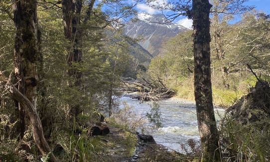
14.5 km from Boyle Flat Hut to the Boyle settlement. Follow markers to the start of the track through the gorge. Cross the river a few times on bridges and continue to the Magdalen Hut. Follow down the valley on an undulating track to the Boyle Settlement which is 13 km down the state highway from the start.
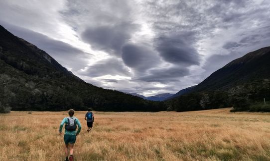
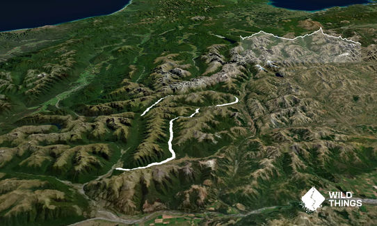
Starts in Lewis Pass, crosses through the St James Conservation area which was formerly St James Station. Finishes via the beautiful Magdalen Valley which is private farmland. A number of historic huts to be seen on the way.
If you know of any public toilets near the trail start or on the route, please login and then let us know so we can update this section.
Good carpark beside road to leave car.
71 km
54 minutes
No
No
Moderate.
Generally easy to navigate, however watch for the next marker on the river valleys.
Non-existent.
Thermal leggings, Long-sleeved thermal top, Beanie/thermal headwear, Personal Locator Beacon (PLB), Whistle, First aid kit, Extra food for emergencies, Cellphone, Map, Headtorch and spare batteries, Gaiters
Huge rivers for water, seems okay to use, choose fast flowing areas for supply
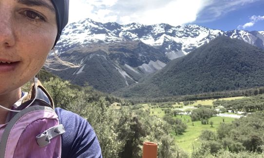
Can be subject to massive amounts of snow in winter and high alpine area any time of year. Pick a good day in settled weather, very remote spot.
Would recommend to do in mid-summer to get full advantage of daylight. Wouldn't be easy in the dark.
Subject to avalanche risk and heavy snow
Hanmer Springs Pools / Town
Hanmer Springs
https://hanmersprings.co.nz/
Great shops and hot pools to relax
Trail Legend
Login as a VIP to become a Trail Legend. Learn about Trail Legends.
Fastest Known Times (FKTs)
You and St James Walkway
As a VIP member you can record private notes for this trail, see all of your times and more.
Already have an account? Login now
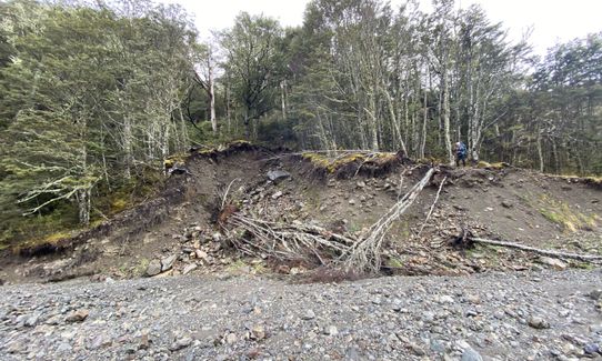
An awesome trail for running, except for the section from Margaret Swing Bridge to Boyle Village, which has a lot of fallen trees, muddy and rocky terrain. I recommend doing it in the winter; it's so beautiful with snowy mountains and empty huts if want stay overnight.
October 2, 2023
I ran the St James in one day today. It was roasting hot and the middle third of the route is pretty exposed to the sun. The huts are a great source of water, although Boyle Flats had none when I passed through. The track is much more gnarly than I was expecting (fallen trees, tree roots, rocky and overgrown track, and boggy sections). This really slowed me down, and I’d recommend spending two days on the track unless you’re speedy or want a very long day out. Having said all that, it’s a great route with some amazing views.
January 5, 2022
Great route and very enjoyable run - followed Sam's advice (previous review) and did this over 2 days. Pretty much 6/6.5 hours of running each day, sleeping at Anne's hut which is about half way.
Feels quite remote - I encountered lots and lots of pairs of Canadian Geese, giving them a wide berth...
Note recent update from Doc - 'There are a lot of fallen over trees on the St James Walkway between Ada Pass and Anne Hut. Allow extra time. This section is currently not recommended for family groups or inexperienced trampers.' this was a bit sketchy but passable if you keep your wits about you.
Great to not have to carry water.
If you're doing the shuttle from Boyle Education - allow extra time for niceties, tea, and general good spirited chit chat from the volunteers who run the shuttle on weekends. I had a 9am shuttle booked, in reality started the run at 9.50 which was fine as i had heaps of sun light that time of year.
January 4, 2021
SS
Great track. Expect some parts to be quite boggy/muddy if there's been rain recently (still very doable, but give up on the idea of keeping your feet dry).
Lots of water available from huts/streams. I carried one 750ml bottle and that was sufficient.
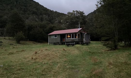
I ran it in one day but another cool way to do this would be a 'fastpack' with an overnight stay at Anne Hut, which is about halfway and is in a sweet spot and has a fire.
Note: the friendly folks at Boyle Village education centre will do a car shuttle if you want to avoid having to hitch/bike at the end (earliest drop-off is 9am - book in advance).
November 3, 2020
Send to your phone
Scan the below QR code to open this trail on your phone.

Tip: position the QR code in your phone camera screen.


