Last Updated: 11th Nov 2025
Maling Fowler Pass Loop
Last Updated: 11th Nov 2025
Grunt Factor: 57 ?
Gnarl Factor: 24 ?
46.7km
1095m
1095m
1307m

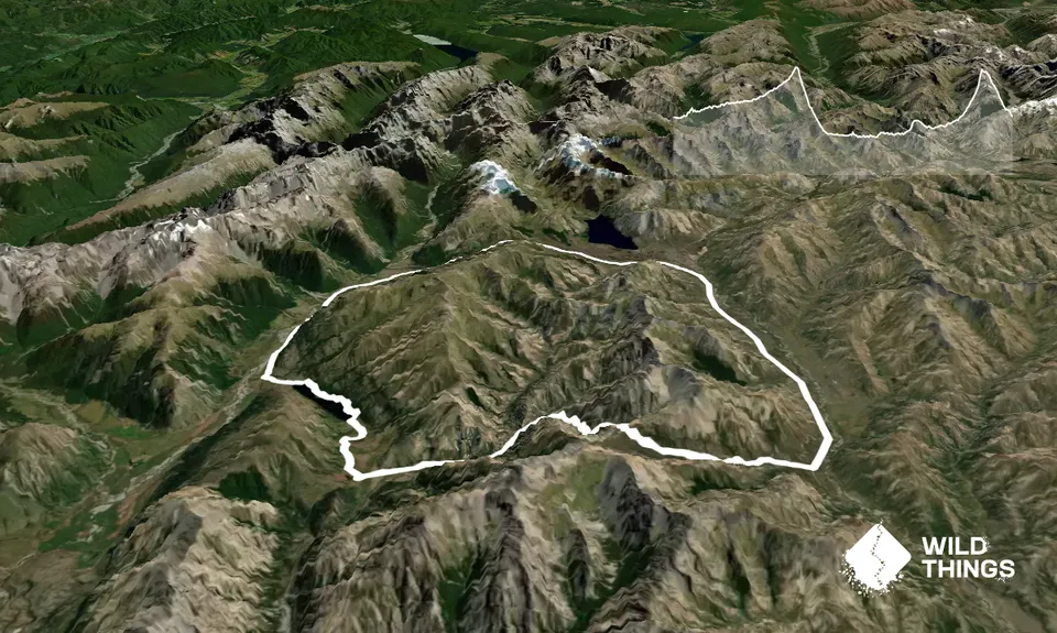
Trail Map
This Topo layer only covers NSW/ACT.
Switch to another map layer when viewing outside this area.
Switch to another map layer when viewing outside this area.


