Last Updated: 17th Apr 2024
Mt Isobel
Submitted by Matt Doherty
Last Updated: 17th Apr 2024
Grunt Factor: 35 ?
Gnarl Factor: 57 ?
17.0km
1210m
1210m
1304m
Last Updated: 17th Apr 2024
Submitted by Matt Doherty
Last Updated: 17th Apr 2024
Grunt Factor: 35 ?
Gnarl Factor: 57 ?
17.0km
1210m
1210m
1304m
Front country - easily accessible
Combo
Mountainous
Dog Friendly
Native bush
Plantation/exotic forest
Open ridges/tops
Easy Single Track
Moderate Single Track
Technical Single Track
Average Uphill Gradient: +17.0%
Average Downhill Gradient: -15.8%
Login as a VIP to see the trailhead information.
5.00:00
Slow
3.00:00
Moderate
2.20
Fast
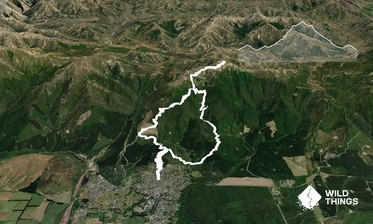
Izzy Stradlin CCW - Counter clockwise loop of Mt Isobel using a couple of short & easy to follow mtb tracks to access the waterfall track up to the summit.
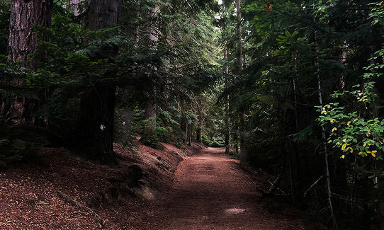
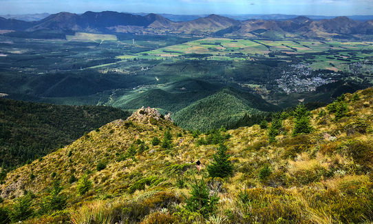
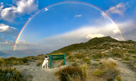
From the village follow the wide smooth trail up Conical Hill to the lookout, on a clear day you can just make out the trig that is your goal.
From the lookout take the top track past the picnic bench and follow the fast & flowy Eagles Nest, C Line & Swoop tracks to descend to the forest floor.
Turn left at the junction and after 100m cross Pawsons Rd and pick up the Jolliff Saddle trail where you climb to the 1st saddle a couple of minutes away. Turn left here (1 way track sign) and carry on up and over a small hill, when you get to the bottom turn left & cross the bridge then left on the forest road for 100m to the Waterfall Track.
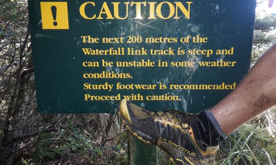
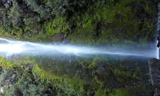
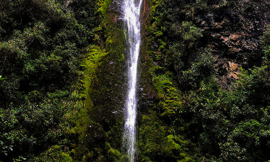
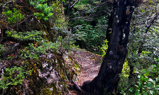
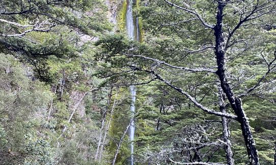
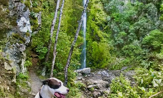
This is the start of the major climb of the day, it starts of quite gentle & well formed but gets steeper & rougher the higher you go particularly once past the waterfall. On the way follow the signs for the waterfall & ignore the Spur Track. The waterfall is just a few meters off the main track but worth checking out.
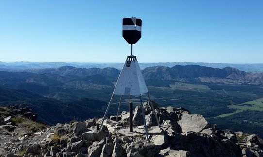
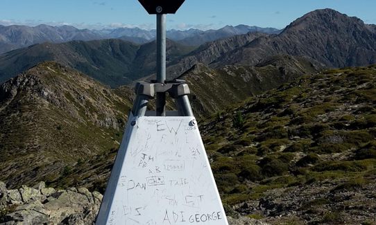
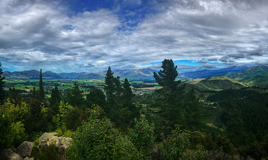
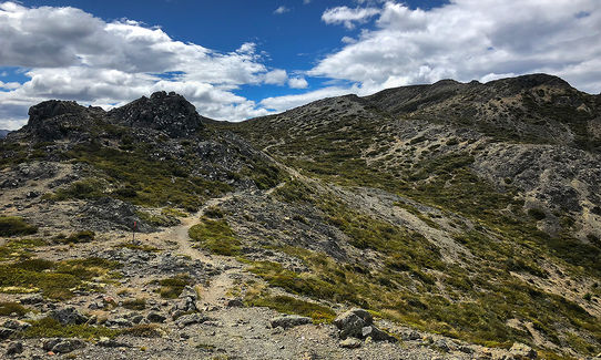
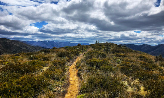
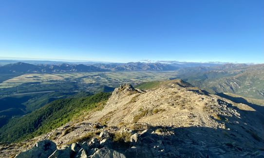
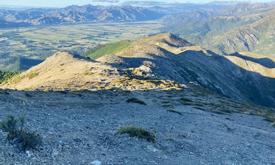
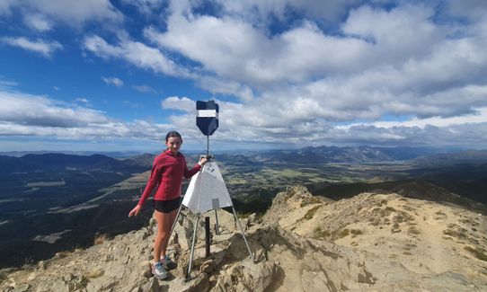
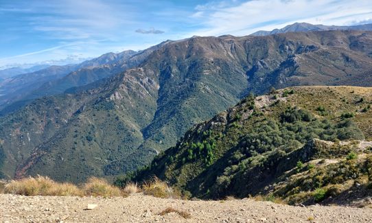
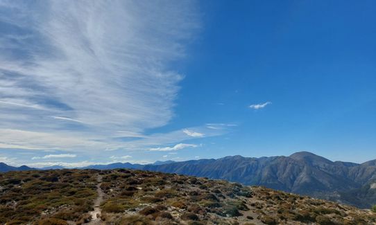
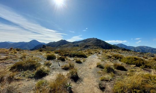
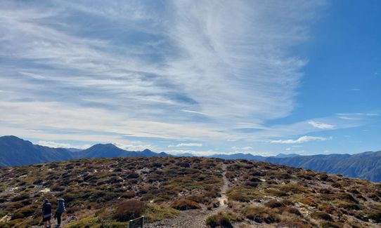
Carry on up from the waterfall to the next intersection and veer right & up. Continue up to the saddle and veer right. From here it's around 1.5 -2 km following a poled route and a few cairns to the trig at the summit
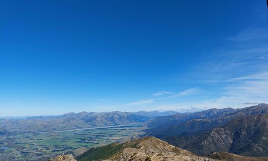
From the summit it's a fantastic descent all the way down to the valley floor if your quads hold up. Retrace your steps back to the saddle, veering left & then straight on past the junction with the waterfall track and carry on until you come to the intersection at 2 gravel roads. Cross the smaller (Pawsons) road and jump onto the 1 way Tank Track (Mtb) - at the end of this track you will see an intersection of several tracks a few meters in front of you. Follow the one signed Conical hill lookout & return, from the top head back to Hanmer the way you started.
This trail includes the peaks Conical Hill and Mount Isobel.
Nice waterfall on the way up. 360 views from the sumit. Lots of short n sweet bike trails to play on in the afternoon as if you go to Hanmer make sure you take your bike.
Pleanty of parking in Hanmer Springs village.
1 km
3 minutes
Yes
No
Easy.
Pretty straightforward really, although it could get tricky on the tops if it claggs out.
All of the mtb trails in the forest are on a brochure that costs a couple of bucks, all proceeds go to track building & maintanance. You can get a copy in Wildlife (shop on the right before the crossroads in Hanmer) & probably the information centre. Worthwhile having a copy as you can use it to figure out where you are & how to get to where you want to go if you get turned around. There is lots of new signage on most of the trails.
Generally good.
Thermal leggings, Long-sleeved thermal top, Seam-sealed waterproof jacket, Gloves, Beanie/thermal headwear, Whistle, First aid kit, Extra food for emergencies, Survival bag, Cellphone, Map, Crampons / microspikes (for winter conditions)
There is the waterfall but as that is on the way up I'd take what I need with me.
Can get muddy in winter. Expect snow at any level in winter. Can be strong cold winds up top.
Exposed up top, Annual race over the summit has previously been diverted over the saddle when the wind is too strong to stand up in.
No shortage of places in Hanmer
Trail Legend
Fastest Known Times (FKTs)
You and Mt Isobel
As a VIP member you can record private notes for this trail, see all of your times and more.
Already have an account? Login now
Gratuitous trauma to calves on the little warm up on conical hill. Tracks from the top closed for logging. Admittedly I didn't quite notice the torn red tape (I definitely found it that way). Then managed to get lost in my way down the complicatedly named mountain bike tracks. Google refuses to acknowledge road names. More tracks anhilated by forestry so just trotted along two forestry roads until hitting the Jolliff Saddle trail. where you climb to the 1st saddle. Waterfall track and then some menacing signage warning me of my inadequacy to handle the trail ahead (we must persist in spite of low self esteem). Perhaps the most amusing moment was popping my head above 1000 m only to find out there was a parking lot 1km away and some relaxed tourists strolling along the ridge line (I initially just thought these South Island folks are all super fit). I refused to climb conical hill again (I got slightly lost so I had done a good 1300m ascent by then). Thought about submitting my lost ramblings as a new trail. What some of us will do for points on this website. Sigh. In summary - A truly awesome day out.
April 10, 2023
Gorgeous loop. The wind stopped me hitting the summit but the rest was magical. Loved the downhill at the end and the waterfall and views from the top were stunning. I went very early on a weekday to avoid MTBs.
April 23, 2022
BP
My kind of running this! Definitely recommend downloading the GPX file (open it in NZTopo on your phone if you don't have special sports app), triply so if you start early in the dark - it's a wee bit confusing linking the tracks from Conical Hill to Waterfall Track. Great grind and scramble upwards, to a wicked summit... then fly back down! Note the turn off for the return leg when you head up as it isn't signposted and could be difficult to miss. Don't be a dafty like me and get suckered onto tempting looking bike trails off Conical Hill at the end, chances are you'll find yourself dropping into the wrong side of the village and negotiating the random tracks between houses back to where you started ;) I found a 6am start on a Sunday meant I was through before most bikers were out of bed.
March 23, 2021
Great run, the GPX and description are great, so even if you don't know Hanmer at all, you can still get a great run in. Most of the uphill is runnable (if you are feeling strong :-D) until the stairs before the waterfall with the steep section past the waterfall and continues on at a fair climbing rate until the summit.
January 9, 2021
These overlap with this trail to some degree. You may wish to combine them but please note that to qualify for FKTs on these runs you should record a separate activity for each.
The Wild Things Trail Directory is proudly supported by 
Send to your phone
Scan the below QR code to open this trail on your phone.

Tip: position the QR code in your phone camera screen.


