Last Updated: 6th Mar 2025
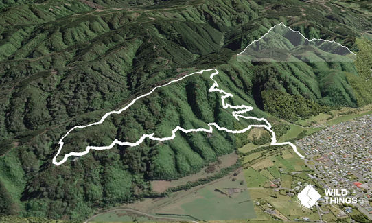
Cannon Point Trig via Zig Zag
Submitted by Jamie Calder
Last Updated: 6th Mar 2025
Open
Grunt Factor: 8 ?
Gnarl Factor: 21 ?
5.8km
280m
280m
335m


Last Updated: 6th Mar 2025
Submitted by Jamie Calder
Last Updated: 6th Mar 2025
Open
Grunt Factor: 8 ?
Gnarl Factor: 21 ?
5.8km
280m
280m
335m
Urban fringe
Loop
Undulating, small hills only
Dog Friendly
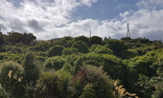
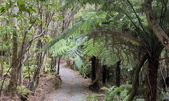
Native bush
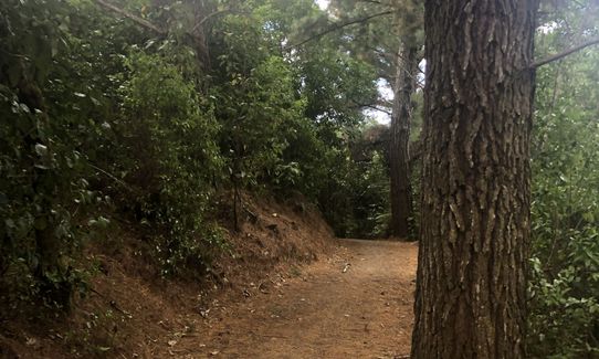
Farm Road / 4WD Track
Easy Single Track
Average Uphill Gradient: +14.9%
Average Downhill Gradient: -12.6%
VIP Feature: Send this route to your Garmin account so you can follow the course on your Garmin device.
Login as a VIP to see the trailhead information.
1:00
Slow
0:45
Moderate
0:30
Fast
Dogs allowed if on a lead. No pig hunting dogs though!
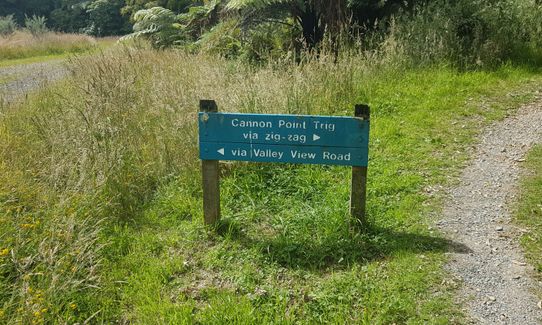
Very easy route to follow. From Tulsa Park follow the only track that takes you in to the hills. There are a couple of wooden steps and a couple of stiles on the route. Single track takes you to a Y junction which is signposted 'Cannon Point Trig via zig-zag' (right) and 'via Valley View Road' (left). Go right for a shorter but steeper climb to the trig. At the top of zig-zag U turn left and you'll see the track that takes you up to the trig, if you had turned right you would end up at Birchville Dam.
From the trig (there's a bench if you need a breather) head downhill until you come to another junction, turn left and keep going downhill. This will bring you back to the Y junction, follow the sign for Totara Park. Track is used by walkers, runners and mountain bikers, there is enough space to overtake, at the narrowest you may want to stand side on for bikes.
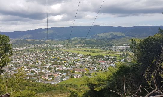
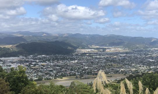
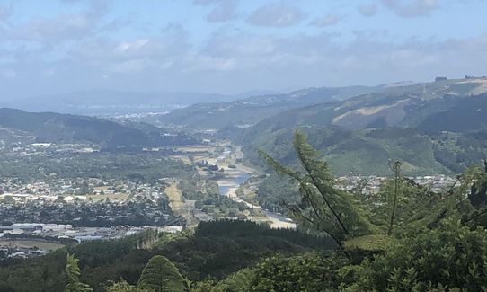
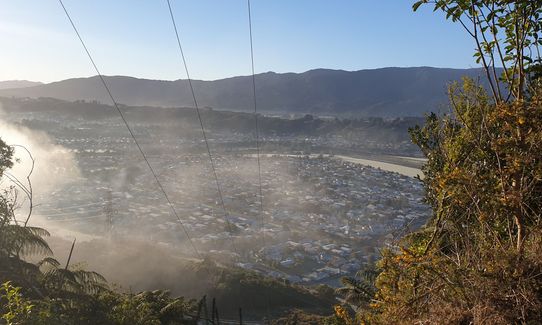
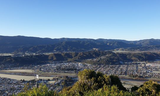
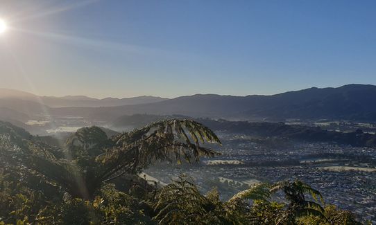
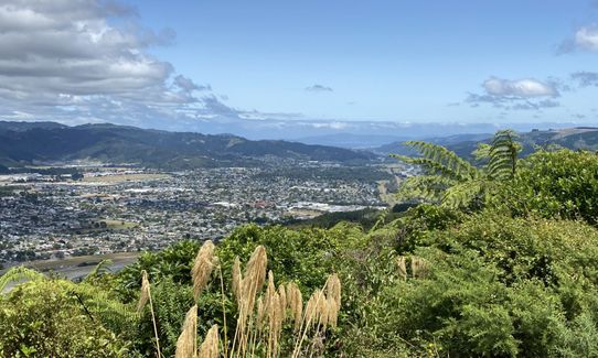
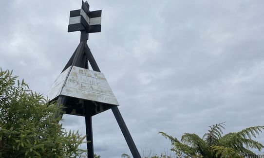
High point is Cannon Point Trig that has the sprawling metropolis that is Upper Hutt as it's vista.
If you know of any public toilets near the trail start or on the route, please login and then let us know so we can update this section.
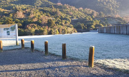
Car park can hold approx 10 cars (safety of car park unknown but it is a busy one and in a residential area).
21 km
22 minutes
Yes
No
Easy.
Follow the signs.
Generally good.
Short-sleeved thermal top, Windproof jacket, Whistle, First aid kit, Cellphone
Nil
None
Mountain bikes in either direction, Valley View Rd is accessible to authorised 4WDs and may be in the area.
Trail Legend
Login as a VIP to become a Trail Legend. Learn about Trail Legends.
Fastest Known Times (FKTs)
You and Cannon Point Trig via Zig Zag
As a VIP member you can record private notes for this trail, see all of your times and more.
Already have an account? Login now
Due to the creation of a new subdivision and road, the start of the path is closed. There is a clearly marked detour around the road which connects you to the zigzag track. Follow the orange signs
April 28, 2024
Nice little loop with some decent elevation. Due to the steep uphill I would consider running in reverse next time. Was very wet and muddy when I ran it today.
September 11, 2020
Enjoyable trail with options to extend distance. Made good use of the water fountain in the carpark.
February 5, 2020
Even though I've put up there it's not dog friendly (due to Brodifacoum) I see people up there with dogs all the time (some on and some off the lead, grr to the off). Interestingly if you were to come over from Birchville side then it is dog friendly if they're on the lead, so work that out.Other than that I usually do my 2 and 3 hour training sessions up and down this track alternating direction each lap. Handy as it's less than 5km from my house.
October 13, 2019
Send to your phone
Scan the below QR code to open this trail on your phone.

Tip: position the QR code in your phone camera screen.


