Last Updated: 21st Sep 2023

Very Experienced

Save Trail Save

I've done it Done

Purple Peak Perpendicular

Castle Hill Village, Canterbury

Submitted by Tony Sharpe

Last Updated: 21st Sep 2023

Very Experienced

Save Trail Save

I've done it Done

Open

Grunt Factor: 47 ?

Gnarl Factor: 105 ?

12.0km

1060m

1060m

1680m


Login as a VIP to see driving directions, distance and time.

Trail Map

Type of Run

Back country - remote

Loop

Mountainous

Lakeside

Open farmlands

Open tussock/grasslands

Open ridges/tops

Run Makeup

20%
80%

Technical Single Track

Untracked / Route only

Average Uphill Gradient: +18.6%

Average Downhill Gradient: -17.7%

Trailhead

Login as a VIP to see the trailhead information.

Estimated Times to Run

6:00

Slow

5:00

Moderate

4:00

Fast

You won't find many routes that have you ascending so relentlessly for 1000m plus of vertical, and then the icing on the cake is a magnificent technical scree running descent. This is true mountain goat country.

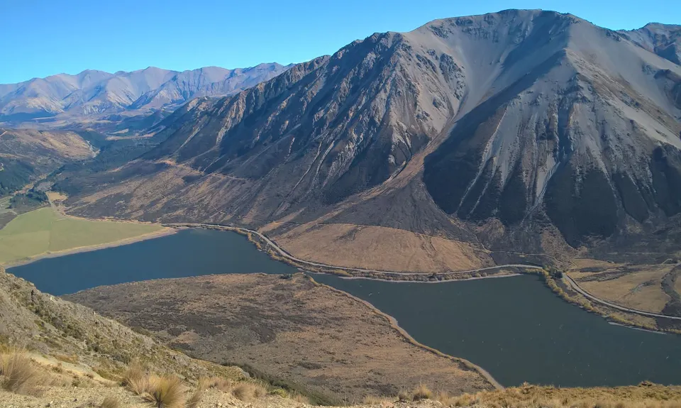
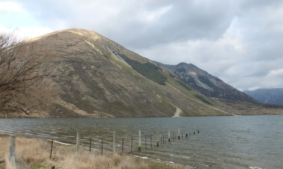
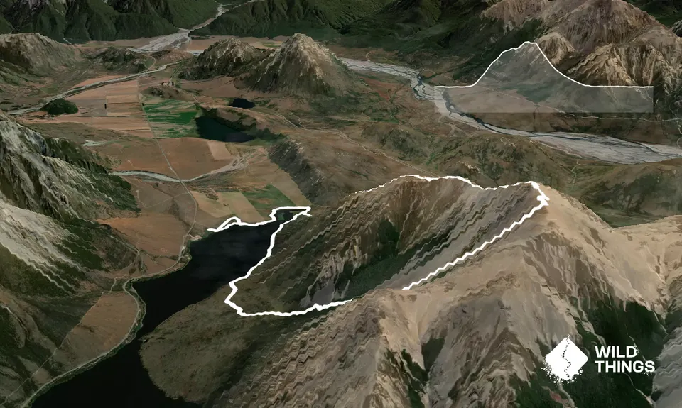
Starting and finishing at the camping/ carpark area just beside the highway and the top of Lake Pearson you initially need to pick your way around the lake shore around towards a low saddle to the north end of Purple Peak. If the lake is low, this is straightforward around the rocky and occasionally boggy shore. Beware though, quicksand like conditions can prevail at times so where in doubt skirt back around the firmer vegetated perimeter. Don't be tempted to take a shortcut across the last bit of lake head, you will sink knee to thigh deep into the mud, stay on firm land here!

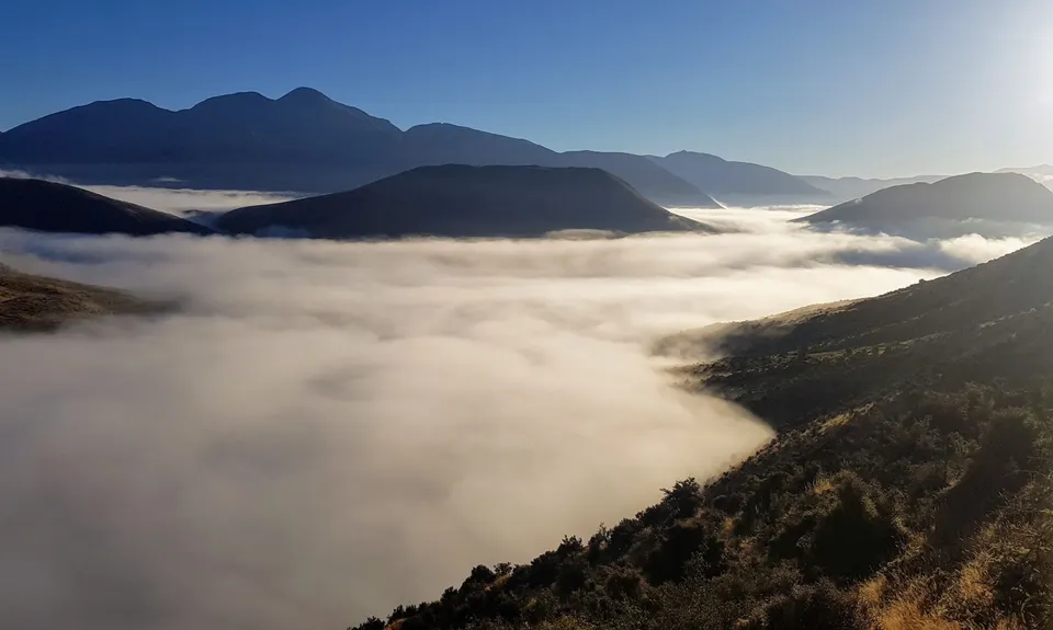
Once you've made it across to the northern slopes of the hill commence your ascent. Just follow your nose really, either head straight up the ridge or zig zag your way if the calves are screaming too hard at you. It's steep but steady going as you relentlessly scale the hillslopes and it gradually steepens more until you hit more defined ridgeline nearer to the top. From here you are likely to find a trail of sorts and even the odd cairn. Don't forget to look back when you stop for breathers, the views rapidly improve as you slog your guts out on the way up.

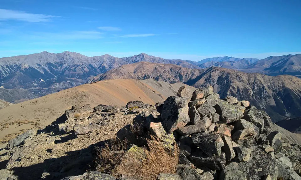
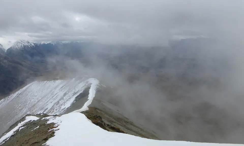
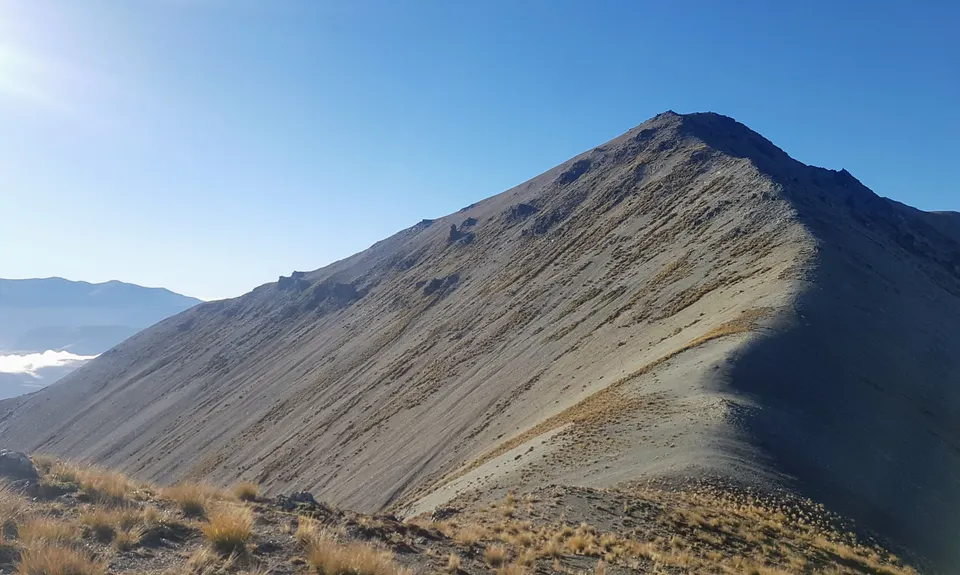
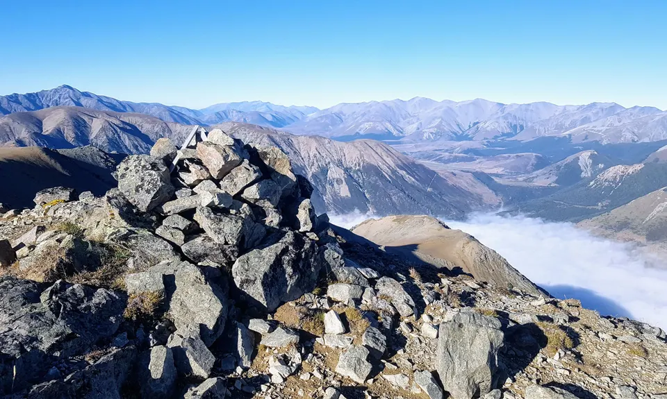
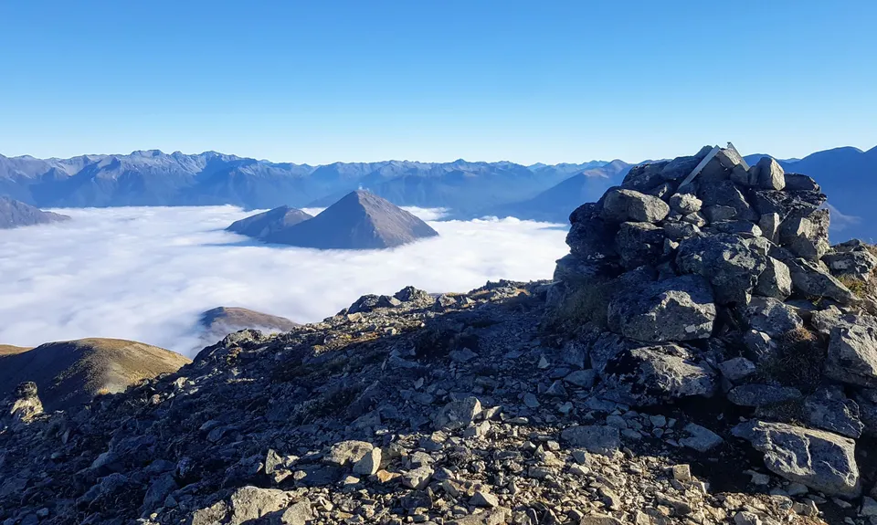
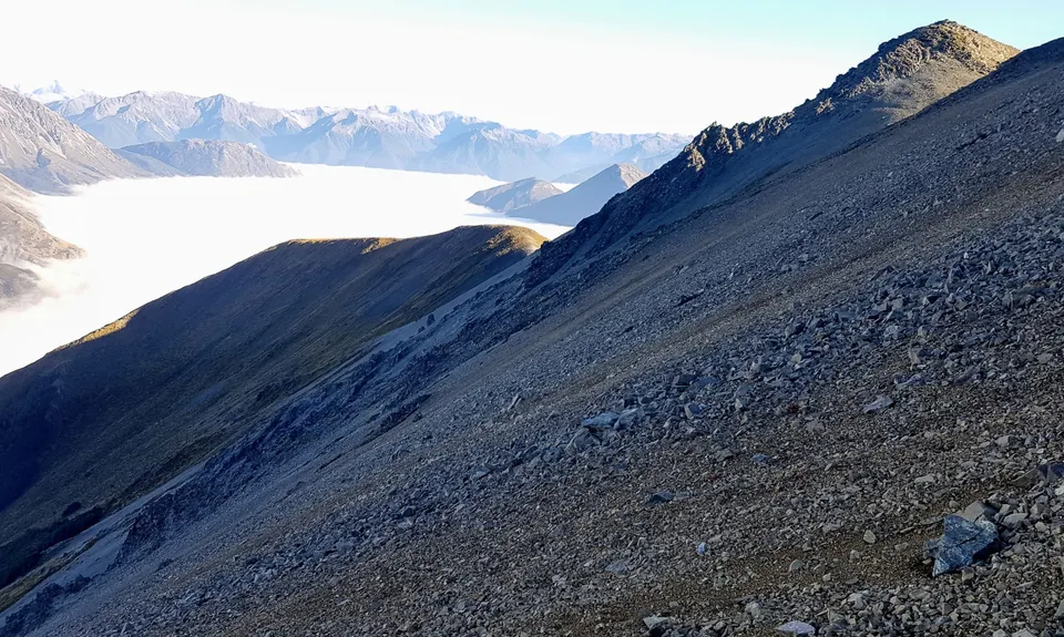
The ridgeline along the top is pretty straightforward but very exposed. It would pay to give it a miss on a windy day, in fact if the weather is not good you really shouldn't be here at all. After maybe two hours of sweat and effort you'll gain the Purple Peak summit and here you can sit down and take in the 360 degree world of wonder at your feet. The views are really something to behold here.

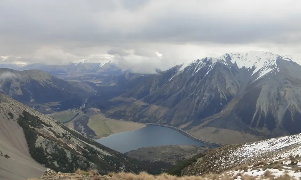
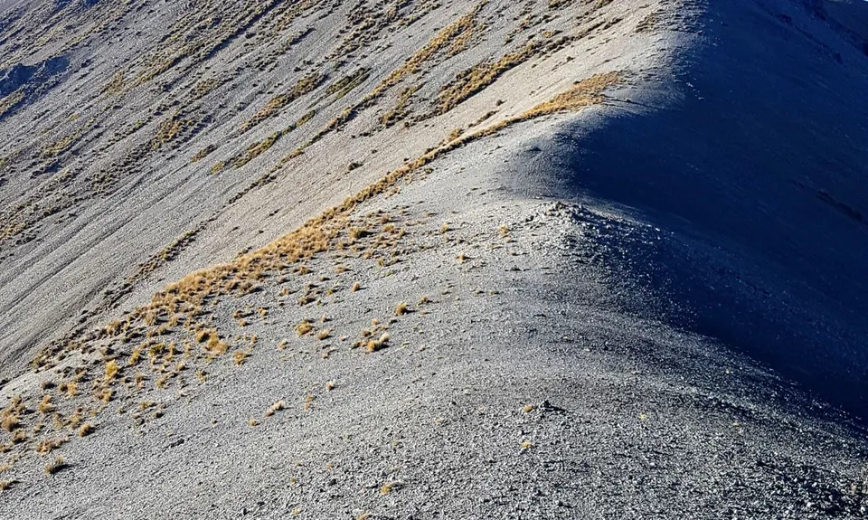
Having fueled and watered up at the summit you need to continue a wee bit further along the ridgeline summit until you are positioned at the middle of the top of the massive screes that flow practically down to the middle of the lake. You'll want good footwear here, perhaps even an older pair of shoes that you are willing to sacrifice to the scree gods. And gaiters to keep the rocks out! Perhaps even tramping boots.

The descent is fast for the first half, wonderful elevator like scree running if you have the right technique and confidence levels. Don't get too cocky though, it can rip you up pretty bad if you take a tumble! Further down ,the scree gets a little more bony and less runnable. Pick your way though the thickening matagoury shrublands through obvious gaps and faint animal trails out onto the tussock/ grassland fan that slowly leads out and round to the right to lake level.

From here pick your way around the lake shore to regain the route taken to the ascent area. A short 20 mins or so retracing your steps around the top of the lake and you'll be back at the car with a real adventure under your belt, and the ability to look up that scree slope every time you drive past in the further and say with a steely eyed grin that you have been up there.

NB: if you want a shortcut from the scree to the highway, its only a quick 5 minute swim from the fan across the narrow neck of lake. Less if the lake is low. But you will get everything wet!


This trail includes the peak Purple Hill.

Astounding views of the Craigieburn area and surrounding mountains

Park at the public camping area beside the lake

17 km

13 minutes

Unknown

No

Hard.

Take a map, and map your route as you go in case the weather clags out and you need to retrace your steps. Make sure someone knows where you are!

Very patchy.

Thermal leggings, Lightweight fleece top, Long-sleeved thermal top, Seam-sealed waterproof jacket, Windproof jacket, Gloves, Beanie/thermal headwear, Personal Locator Beacon (PLB), Whistle, First aid kit, Extra food for emergencies, Survival bag, Cellphone, Compass, Map, Headtorch and spare batteries, Crampons / microspikes (for winter conditions), Gaiters

Carry all your water from home

Winter can be extreme, ice axe crampons and specialist skills may be needed. Summer can be hot and dry, and very exposed to wind. Choose your day for this one carefully!

As per seasonality. This is a committing circuit.

Springfield or Bealey/ Arthurs pass cafes, depending on your direction home

You and Purple Peak Perpendicular

As a VIP member you can record private notes for this trail, see all of your times and more.

Register Now

Already have an account? Login now

Trail Reviews

Fantastic views from the top. Mostly easy to follow but beware that returning along the lake is not fun when the lake levels are high. For about 1-1.5km along the edge of the lake heading back towards the carpark, the scrub is very thick and impassable and this necessitates going along the shoreline, which was waist to chest deep and very cold when we did it. Very slow going and unpleasant.

Daniel Parkinson

October 3, 2021

What a great wee adventure, perfectly described by Tony. It's grovel to get to the top, but the views are amazing and the scree slide down is great fun.

Steve Hanmer

March 18, 2021

Fun cruisey outing with Jarrod finally ticking off this interesting loop. I always wondered how it was driving past so many times. Agree not much running but doing it again could find a quicker way which we found on our return. Was a bit of fun coasteering around after the scree run- water felt really warm. Views deserves a stop as great place for orientating you in this area and checking out other mountain runs. Also you have great view over the waimak and the braided river flow.

Sia Svendsen

January 11, 2021

A lot of walking, rewarding views from the top and great scree

Claire Hennigan

December 27, 2019

Login to submit a review

Trail Running Community

Find people who are interested in or have completed this trail run.

You must register or login to view this feature.

Register Now

Other trails nearby
Craigieburn Tops

Craigieburn Tops

Length: 25.0km

Level: Intermediate - Experienced

Helicopter Hill

Helicopter Hill

Length: 7.2km

Level: Beginner

The Loop of Depression

The Loop of Depression

Length: 6.0km

Level: Beginner - Intermediate

Dracophyllum / Camp Saddle Loop

Dracophyllum / Camp Saddle Loop

Length: 24.0km

Level: Intermediate

Find more trails and peaks nearby