Last Updated: 6th Jan 2024

Intermediate - Experienced

Save Trail Save

I've done it Done

Craigieburn Tops

Castle Hill Village, Canterbury

Submitted by Emily Oliver

Last Updated: 6th Jan 2024

Intermediate - Experienced

Save Trail Save

I've done it Done

Open

Grunt Factor: 58 ?

Gnarl Factor: 59 ?

25.0km

1650m

1650m

1920m


Login as a VIP to see driving directions, distance and time.

Trail Map

Type of Run

Back country - remote

Loop

Mountainous

Native bush

Open ridges/tops

Run Makeup

15%
60%
25%

Gravel Road

Moderate Single Track

Untracked / Route only

Average Uphill Gradient: +15.1%

Average Downhill Gradient: -14.6%

Trailhead

Login as a VIP to see the trailhead information.

Estimated Times to Run

Not suitable

Slow

6:00

Moderate

4:00

Fast

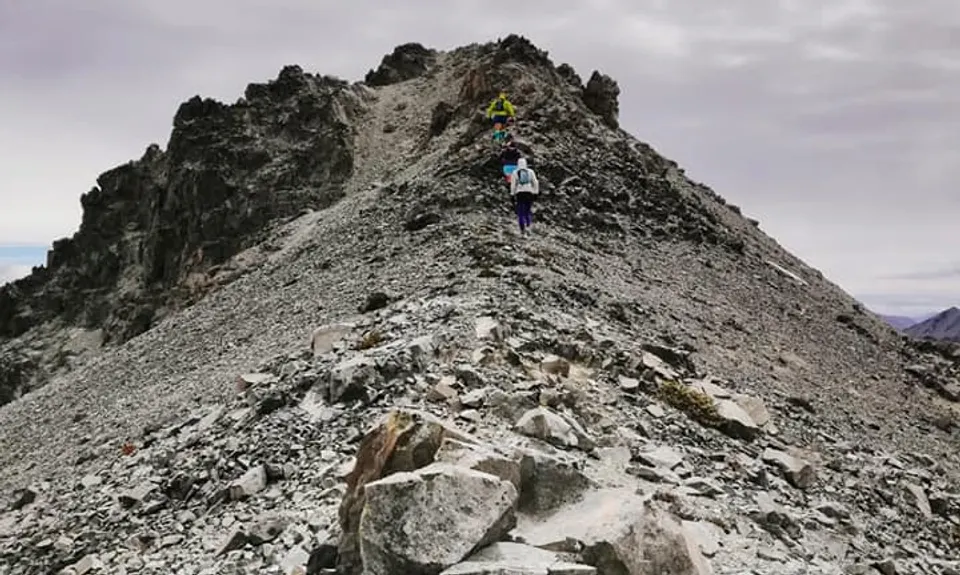
Only take this route if you are confident on scree!

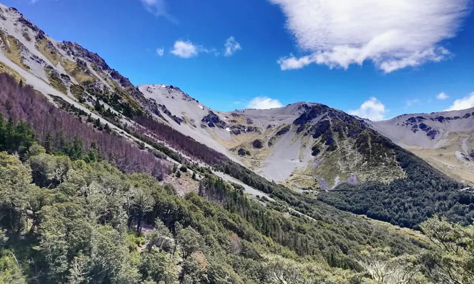
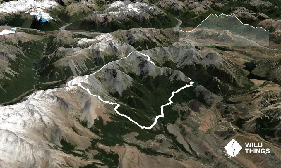
Start with a cruisy warm-up along Dracophyllum Flat Track for just over 3 km. Look out for the turn-off to Cuckoo Creek Track on your right and head straight uphill for about 2 km until the track joins Mt Cheeseman Skifield Road. A bit of a slog up the gravel road, or cut the switchbacks by scrambling straight up.

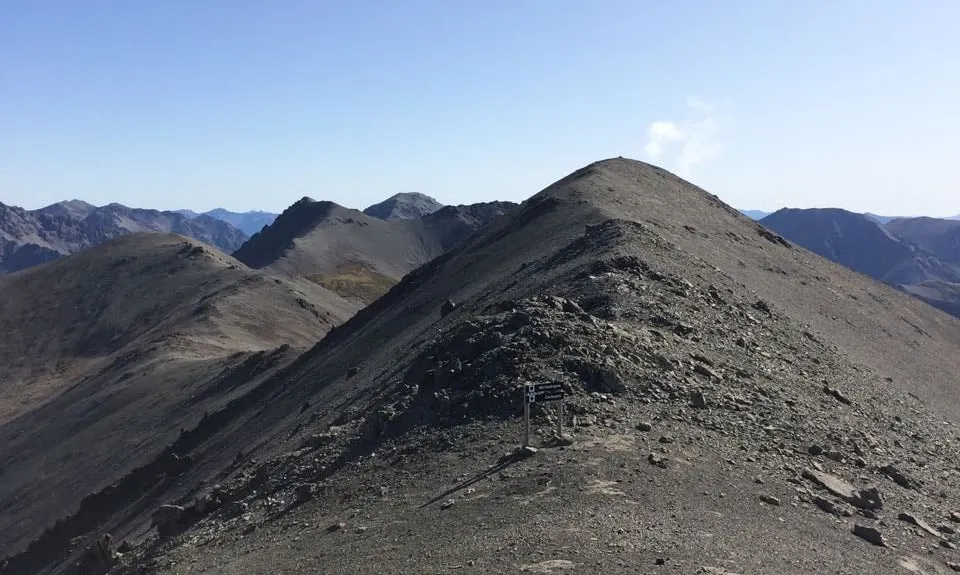
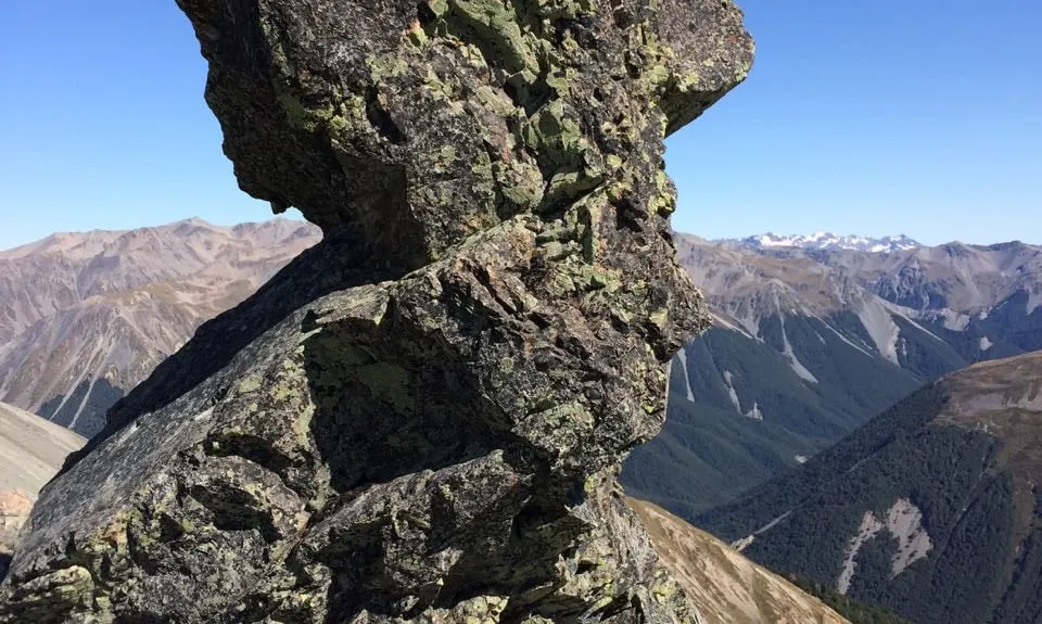
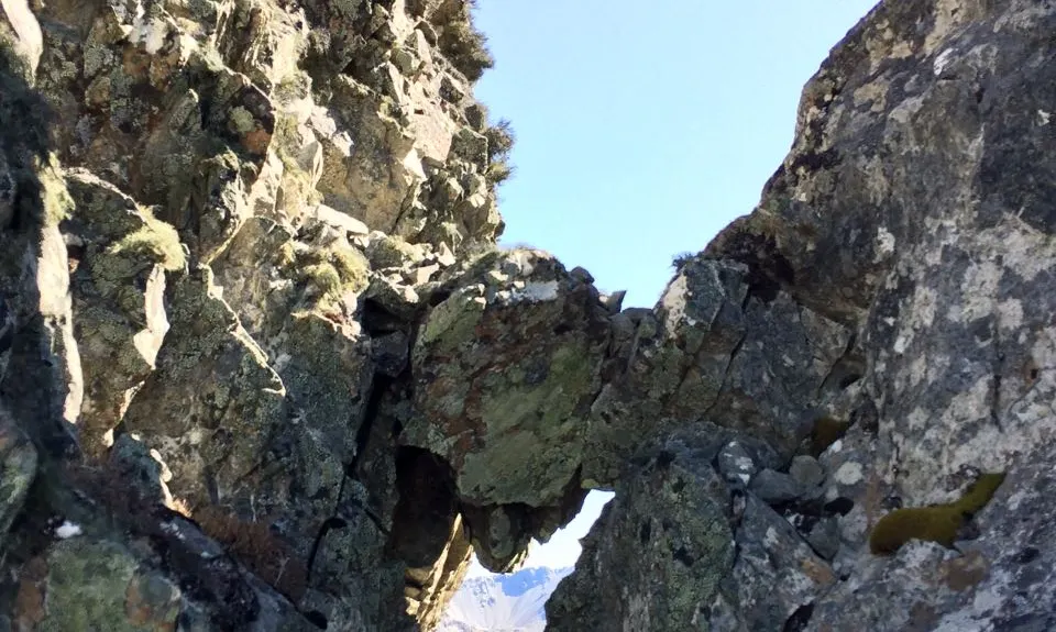
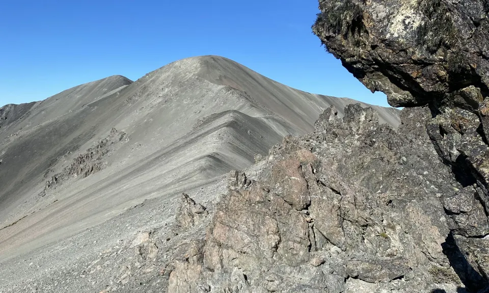
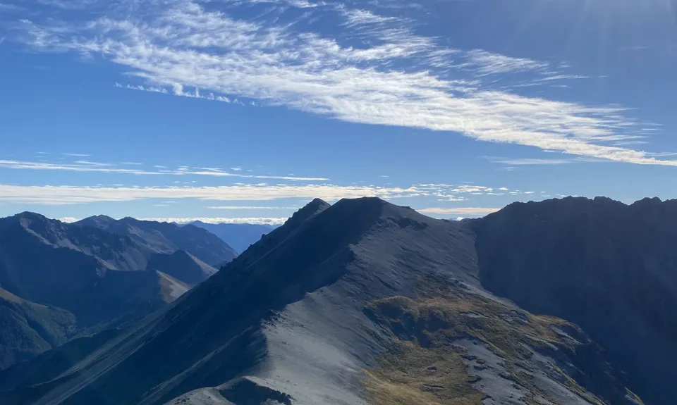
The road ends at the lodge, so find your way up the gravel slopes of Mt Cheeseman Skifield (follow the ski lifts) until you get to the top, where you'll see a sign for Mt Cockayne. Turn right and head along the ridgeline, lots of scree sliding and scrambling fun. The ridge is very exposed and dangerous in windy conditions, play it safe if you're unsure.

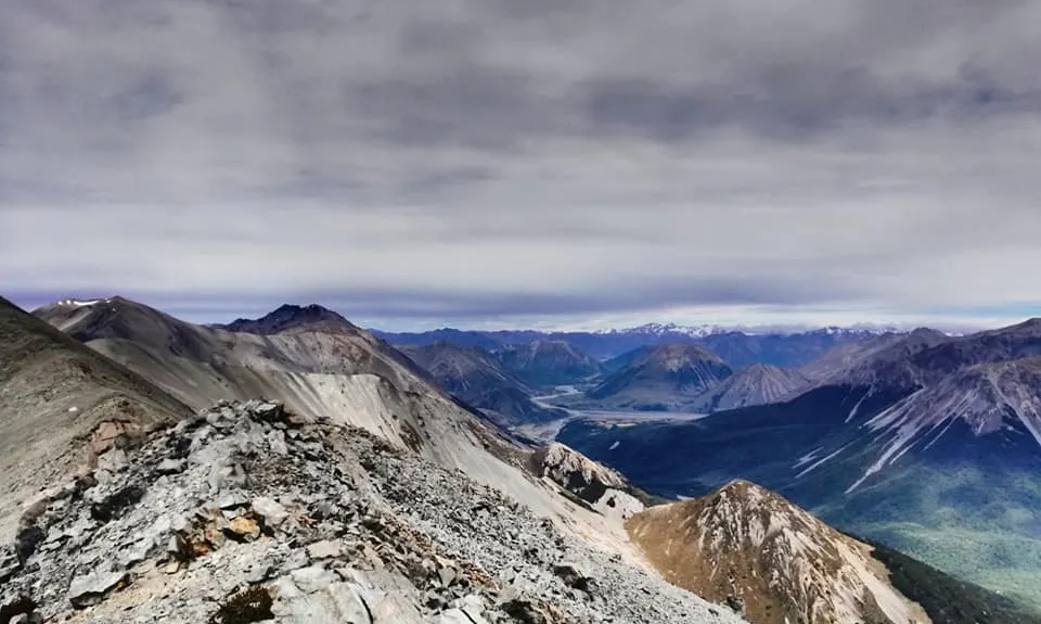
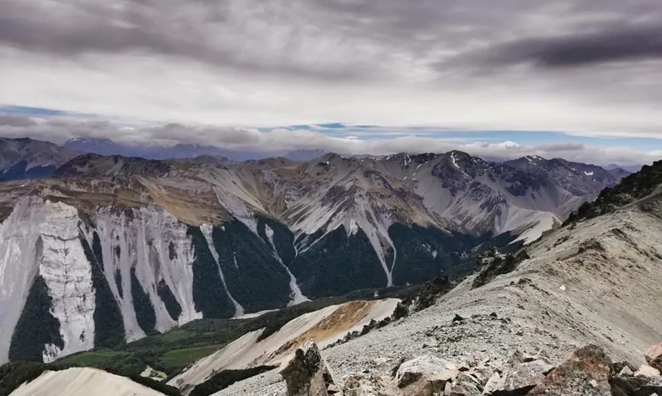
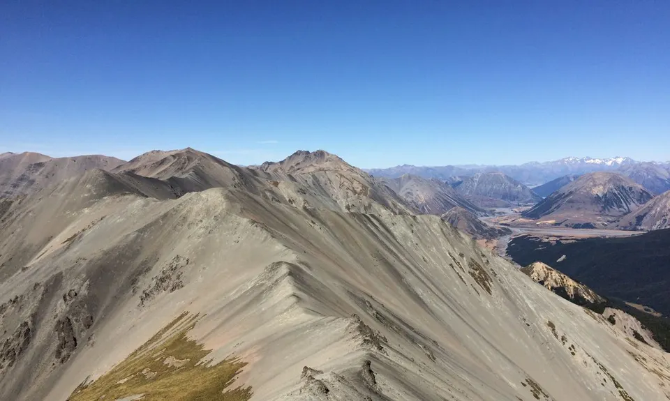
You'll be on the ridgeline for about 6 km. Follow your nose over a couple of peaks towards Broken River Skifield, pass the top of the ski lifts at Nervous Knob, then it's a climb to Hamilton Peak, the highest point at 1920m. There's a bit of track to follow from the knob but it soon disappears. Over the peak is Craigieburn Skifield. Leave the ridge and follow your nose down the skifield slopes towards the Whakamaru Day Lodge, then down the access road for a couple of switchbacks, looking out for the start of Craigieburn Edge Track heading right.

It's off the road and into native bush along this track, which sidles along the contour line for some great stretch-out running after all the scree scrambling! About 3.5 km you'll meet the Lyndon Saddle Track - leave the Edge Track and take the Lyndon Saddle Track uphill until you meet a trail junction (where you can do an out-and-back detour up to the top of Helicopter Hill if you're extra keen). From there, blast down The Luge until you hit the Broken River Skifield Road. Turn right and it's about half a km up the road until you're back to the car.

This trail includes the peaks Hamilton Peak and Mount Cockayne.

Park on the edge of the gravel road leading towards the Environmental Education Centre.

11 km

15 minutes

Unknown

No

Hard.

Patchy.

Thermal leggings, Lightweight fleece top, Long-sleeved thermal top, Seam-sealed waterproof jacket, Gloves, Beanie/thermal headwear, Personal Locator Beacon (PLB), Whistle, First aid kit, Extra food for emergencies, Cellphone, Map, Crampons / microspikes (for winter conditions), Gaiters

No water on route, carry everything you'll need.

Snow-covered in winter. Snow on the ridge possible any time of year, check weather forecast and be prepared. Exposed to cold winds on tops at any time of year.

Scree slopes

Trail Legend

SC

Shiro Chin

has completed Craigieburn Tops once in the last year.

Learn about Trail Legends.

You and Craigieburn Tops

As a VIP member you can record private notes for this trail, see all of your times and more.

Register Now

Already have an account? Login now

Trail Reviews

Really fun run, especially if you like mountain ridges! Awesome views up top, and who doesn't love beech forest trails?

For a bit more distance and elevation, you can add the peak of Mt Cheeseman as an out and back. Just turn left when you reach the end of the ski lift and follow the ridge. This added about 5 km return and maybe 400 metres of elevation. Including Mt Cheeseman and Helicopter Hill, it came to just over 29k and 2350 m elevation gain.

Although there's no water on the higher parts, there's some when you get to the bottom of the Craigieburn ski field.

Linus Corin

January 28, 2023

Really great run, lots of scree up top. The key is to get good weather when you do this as you are pretty exposed up along the ridge line.

Ben Taylor

March 14, 2020

really nice circuit run - works well in the direction described, and the directions are clear (including look out for the Cookoo creek turnoff!).

Mike Steel

February 9, 2020

Login to submit a review

Trail Running Community

Find people who are interested in or have completed this trail run.

You must register or login to view this feature.

Register Now

Overlapping Trails

These overlap with this trail to some degree. You may wish to combine them but please note that to qualify for FKTs on these runs you should record a separate activity for each.

Dracophyllum / Camp Saddle Loop

Dracophyllum / Camp Saddle Loop

Length: 24.0km

Level: Intermediate

Other trails nearby
Helicopter Hill

Helicopter Hill

Length: 7.2km

Level: Beginner

Hogsback Track

Hogsback Track

Length: 14.7km

Level: Beginner - Intermediate

Purple Peak Perpendicular

Purple Peak Perpendicular

Length: 12.0km

Level: Very Experienced

The Loop of Depression

The Loop of Depression

Length: 6.0km

Level: Beginner - Intermediate

Find more trails and peaks nearby