Last Updated: 10th Nov 2023
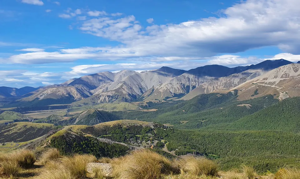
Coal Pit Spur Loop
Last Updated: 10th Nov 2023
Open
Grunt Factor: 21 ?
Gnarl Factor: 25 ?
15.5km
660m
660m
1204m
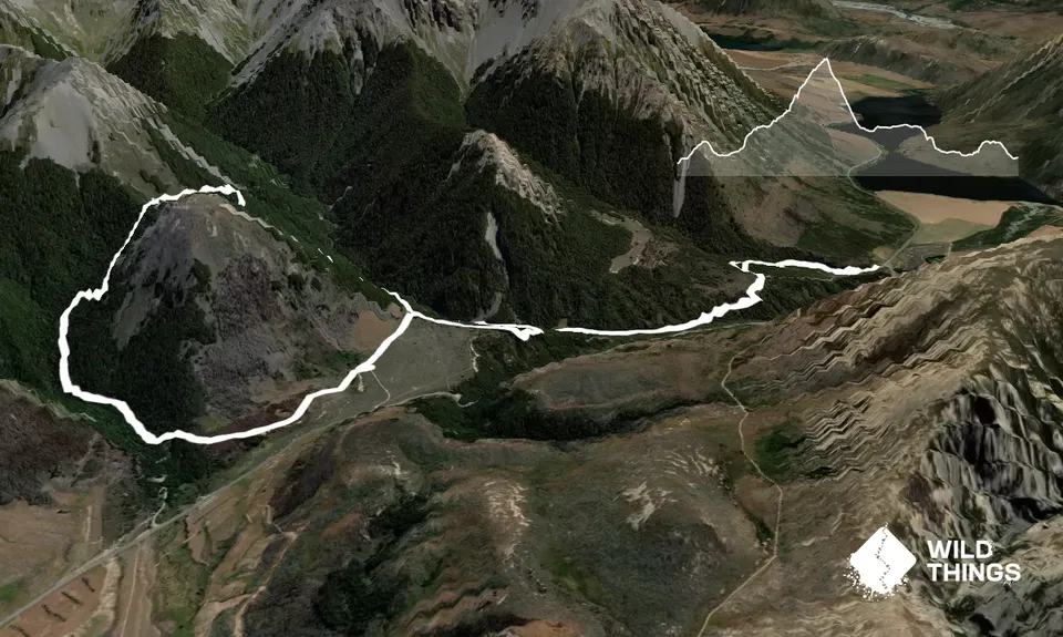
Trail Map
This Topo layer only covers NSW/ACT.
Switch to another map layer when viewing outside this area.
Switch to another map layer when viewing outside this area.


