Last Updated: 21st Sep 2023

Intermediate

Save Trail Save

I've done it Done

Hunua Hillbilly

Last Updated: 21st Sep 2023

Intermediate

Save Trail Save

I've done it Done

Open

Grunt Factor: 93 ?

Gnarl Factor: 43 ?

60.0km

3000m

3000m

688m


Login as a VIP to see driving directions, distance and time.

Trail Map

Type of Run

Front country - easily accessible

Loop

Very hilly

Dog Friendly

Native bush

Run Makeup

20%
20%
25%
35%

Gravel Road

Easy Single Track

Moderate Single Track

Technical Single Track

Average Uphill Gradient: +6.6%

Average Downhill Gradient: -6.6%

Trailhead

Login as a VIP to see the trailhead information.

Estimated Times to Run

14:00

Slow

12:00

Moderate

9

Fast

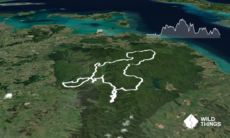
This is the route for the Hunua Hillbilly event.

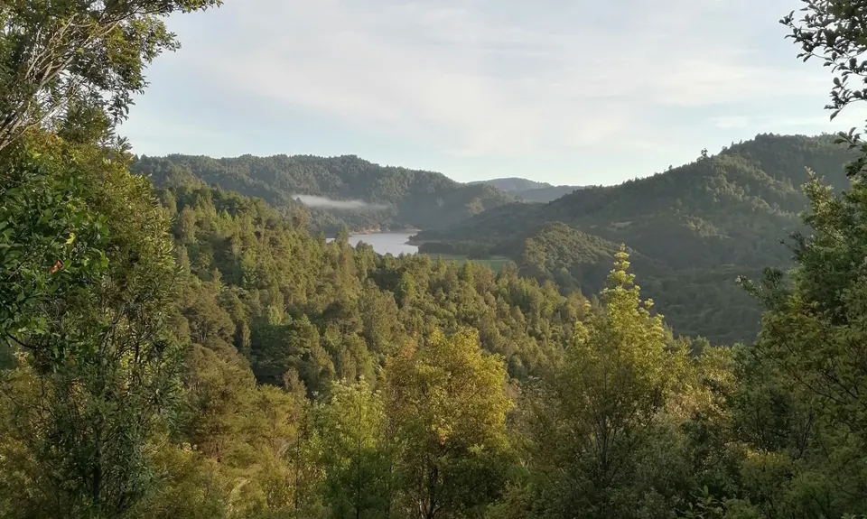
This course has been designed to take in all the good bits of the Hunua Ranges which can currently be accessed. To be honest, it pretty much takes in EVERY open track in the Hunua Ranges, good thing they are all just SO good! 😊. You will be taken on a 60km circumnavigation of the Hunua Ranges Regional Park, with the centre point to your day being the stunning event base location of the upper Mangatawhiri campground – where your run will start and finish.

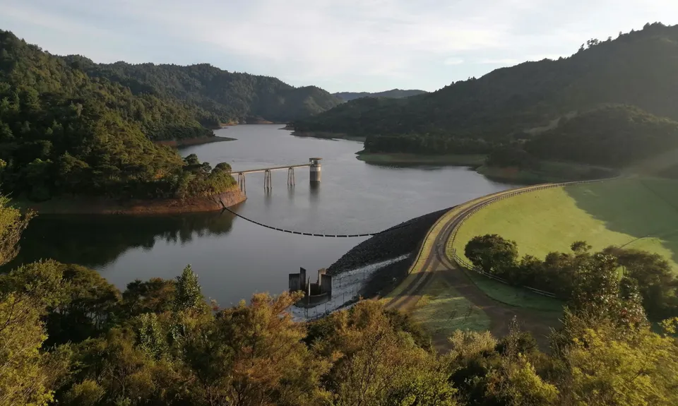
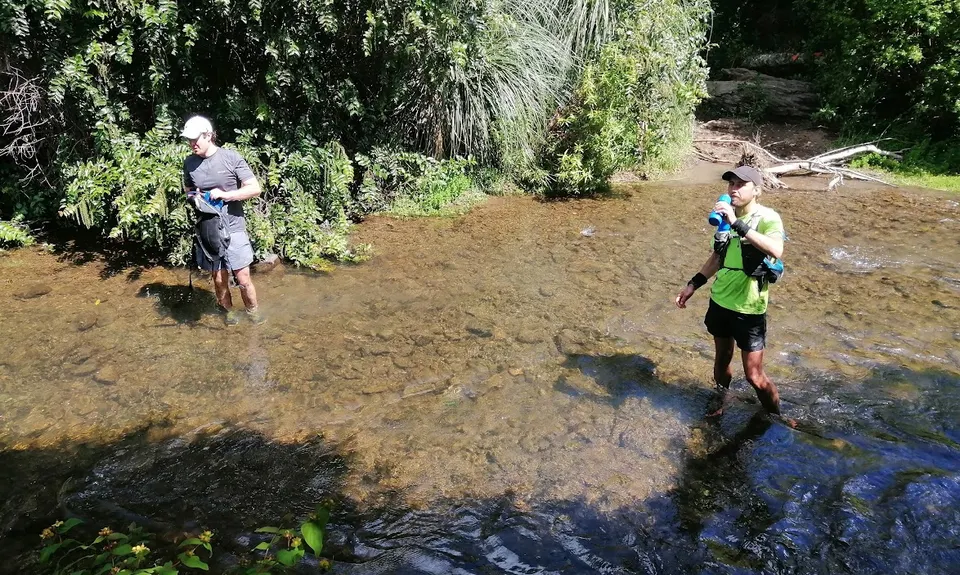
The bulk of the run will be on grunty single track under the cover of stunning native bush. There will also be a combination of gravel roads, MTB trail, boardwalks, swing bridges and even the odd Water Care dam mixed in for good measure.

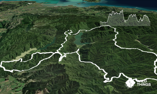
Follow the bulk of the "Farm Loop" through the valley/Mountain Biking trails to start with - this is the trickiest part to navigate but it is also the safest/less remote area of the course. From there, you are following established council tracks with not many junctions, they are well marked and easy to follow with a topo map and even the basic park map if necessary. Keep in mind, that it becomes more technical between the 22km until about 42km in.

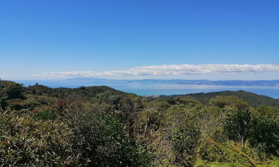
When you aren’t under the very welcome cover of the bush, you will enjoy some of the most stunning 360 views that the Auckland Region and New Zealand has to offer, including reaching the highest point in the city at 688m – Kohukohunui nicknamed, 'K Trig'. This is the sort of run that will have you hoping it never ends and hanging out for the finish line all at once!

This trail includes the peaks Kohukohunui and Pukapuka.

Amazing native bush, great bird life including the Kōkako Management area. Multiple dams/lakes. A small river crossing.

Good council gravel parking area, next to info board/map and toilets.

15 km

20 minutes

Yes

Yes
Name: Auckland Council

Moderate.

Following the bulk of the "Farm Loop" through the valley/MTB trails to start with - this is the trickiest part to navigate. From there, you are following established council tracks with not many junctions.

Very patchy.

Short-sleeved thermal top, Seam-sealed waterproof jacket, Gloves, Beanie/thermal headwear, Whistle, First aid kit, Extra food for emergencies, Cellphone, Map

There are a couple of river crossings (23km & 40km) and huts (22km & 47km) with water - but recommended to be treated at each.

Can get a little muddy after rain.

The middle section (from 22km to 42km) is very tough going and slow - be prepared for this.

Hunua store
Hunua
Decent pie, coffee and cakes. Not much else close by.

Trail Legend

JS

Jared Schnell

has completed Hunua Hillbilly once in the last year.

Learn about Trail Legends.

You and Hunua Hillbilly

As a VIP member you can record private notes for this trail, see all of your times and more.

Register Now

Already have an account? Login now

Trail Reviews

Yee haw! What a ride. First time in the Hunua didn't disappoint. Lots of different terrains, some good, some not so good with few views as it mostly under tree cover. Will be excellent in summer/dry season.

jace jones

August 22, 2022

Login to submit a review

Trail Running Community

Find people who are interested in or have completed this trail run.

You must register or login to view this feature.

Register Now

Overlapping Trails

These overlap with this trail to some degree. You may wish to combine them but please note that to qualify for FKTs on these runs you should record a separate activity for each.

Ernie's loop

Ernie's loop

Length: 15.0km

Level: Beginner - Intermediate

Challenge / Ernies Loop

Challenge / Ernies Loop

Length: 21.0km

Level: Intermediate

Hunua Magic

Hunua Magic

Length: 23.6km

Level: Intermediate

Wairoa Suspension Loop

Wairoa Suspension Loop

Length: 8.0km

Level: Beginner

Hunua Hustle

Hunua Hustle

Length: 13.3km

Level: Beginner - Intermediate

Challenge Track

Challenge Track

Length: 10.0km

Level: Beginner - Intermediate

Ernie's Pukupuka Combined Loop

Ernie's Pukupuka Combined Loop

Length: 23.5km

Level: Beginner - Intermediate

Pukapuka Track

Pukapuka Track

Length: 15.5km

Level: Beginner - Intermediate

Other trails nearby
Hunua Crossing

Hunua Crossing

Length: 38.0km

Level: Intermediate - Experienced

Hunua Falls - Cossey Massey Loop

Hunua Falls - Cossey Massey Loop

Length: 7.7km

Level: Beginner - Intermediate

Suspension Bridge Track

Suspension Bridge Track

Length: 4.3km

Level: Beginner

Orum Road/Te Araroa loop

Orum Road/Te Araroa loop

Length: 11.1km

Level: Beginner - Intermediate

Find more trails and peaks nearby