Last Updated: 22nd Nov 2023
Milltown to Lower Arahura Hut
Last Updated: 22nd Nov 2023
Open
Grunt Factor: 36 ?
Gnarl Factor: 37 ?
20.3km
680m
670m
314m
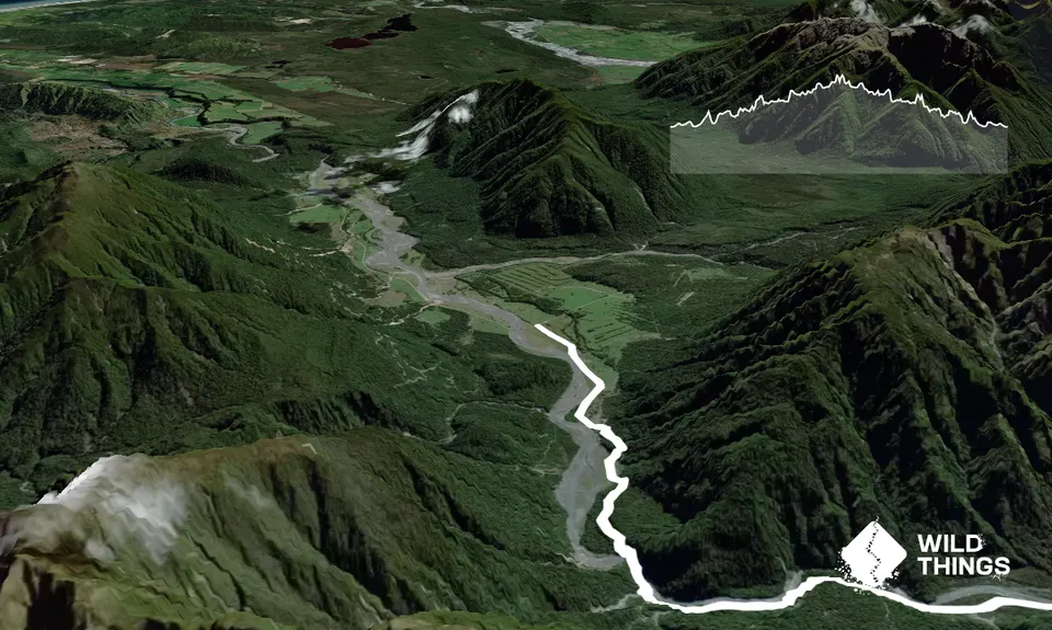
Trail Map
This Topo layer only covers NSW/ACT.
Switch to another map layer when viewing outside this area.
Switch to another map layer when viewing outside this area.


