Last Updated: 28th Jan 2024
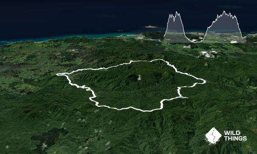
Coromandel Traverse
Last Updated: 28th Jan 2024
Open
Grunt Factor: 33 ?
Gnarl Factor: 29 ?
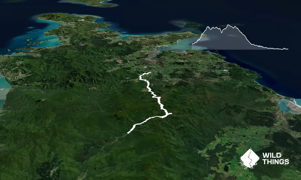
26.0km
1050m
1180m
690m


Trail Map
This Topo layer only covers NSW/ACT.
Switch to another map layer when viewing outside this area.
Switch to another map layer when viewing outside this area.