Last Updated: 21st Sep 2023
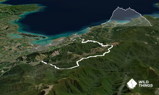
Hackett to Brook St via Rocks
Last Updated: 21st Sep 2023
Open
Grunt Factor: 61 ?
Gnarl Factor: 51 ?
39.0km
1710m
800m
1014m
Last Updated: 21st Sep 2023
Last Updated: 21st Sep 2023
Open
Grunt Factor: 61 ?
Gnarl Factor: 51 ?
39.0km
1710m
800m
1014m
Front country - easily accessible
Point to Point (one way)
Undulating, some big hills
Native bush
Plantation/exotic forest
Riverside
Open ridges/tops
Farm Road / 4WD Track
Moderate Single Track
Technical Single Track
Average Uphill Gradient: +10.8%
Average Downhill Gradient: -11.7%
VIP Feature: Send this route to your Garmin account so you can follow the course on your Garmin device.
Login as a VIP to see the trailhead information.
8:00
Slow
6:00
Moderate
5:00
Fast
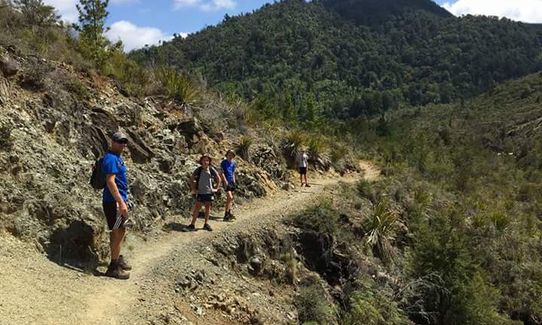
From the Hackett picnic area head across the bridge & up the forestry road. After 1 km, you will cross a swing bridge & then head off on your way up the single track. There are a few places where the river has eaten away at the track so show some caution. At approx. the 4 km mark you will come to a fork in the track, take the left branch towards Browning Hut (the right branch goes to Hackett Hut which is worth a look on another day).
From here you have a few river crossings, on low days you won't get your feet wet, you then head up & over a small hill & then drop down into a small gorge. Be careful here as you have to climb over some large boulders which can be slippery, you then have another river crossing & then head into a climb for a couple of km's before you reach Browning Hut at approx. 8 km.
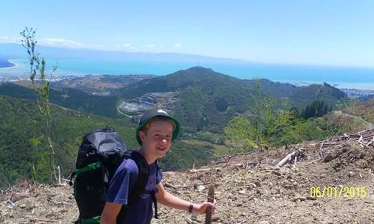
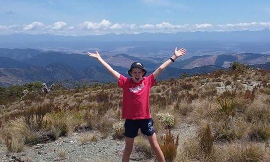
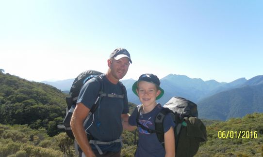
After Browning Hut you have a very steep climb for 1 km & then a more steady climb through the bush before you come out on the open tops for a few hundred metres. On a clear day you will have a good view back towards Brightwater/Wakefield. You then head back into the bush for quite a few km's. There was quite a bit of windfall here a few years back but DOC have cleared a good path through. As you near Rocks Hut the track tends to be quite middy year-round & a lot of roots so good ankle twisting ground.
It's worth a stop at Rocks as this is a major stopping point on the TA Trail so a good chance to meet some tourists. From Rocks Hut head towards Dun Mountain Saddle, then drop down to the Coppermine Saddle & follow NZ's oldest railway line down to Brook St approx. 18 km away. The decent (as you would imagine being a railway line) is easy going so enjoy the run back to Brook St, Nelson. After approx. 6 km you will pass 3rd House, and then another 4 km or so you reach 4 corners (don't turn left here) & then on down to the Tantragee Saddle & follow the road or Codgers Trail down to Brook St.
The Dun Mountain Trail, NZ's oldest railway line
If you know of any public toilets near the trail start or on the route, please login and then let us know so we can update this section.
There is fair amount of parking space at the Hackett picnic area, but as this is not a loop you are better to get dropped here if possible. Although this is quite a busy car park/picnic area it is quite remote & I have often seen cars with broken windows.
29 km
38 minutes
Unknown
No
Moderate.
As per above take a left turn at the fork at 4 km. Also when running thru the bush after the clearing at the top of the large hill after Browning Hut there is one area where the markers are a little hard to spot so keep your eyes open
After leaving Rocks Hut head towards the Dun Saddle, NOT Middy Hut which is the opposite direction.
Very patchy.
Short-sleeved thermal top, Seam-sealed waterproof jacket, Windproof jacket, Gloves, Beanie/thermal headwear, Personal Locator Beacon (PLB), Whistle, First aid kit, Extra food for emergencies, Cellphone, Map
Good water until Browning Hut & then nothing until Rocks Hut, so make sure you fill up in the creek at Browning. You can then get water at Rocks Hut. From Rocks back to Nelson there are generally a couple of creeks across the track year round.
Numerous locations as the finish line is only a km or so from central Nelson City.
Fastest Known Times (FKTs)
You and Hackett to Brook St via Rocks
As a VIP member you can record private notes for this trail, see all of your times and more.
Already have an account? Login now
Great adventure run/walk. It is fairly tree rooty and slow going in the middle third but the final downhill on coppermine is easy goingIts worth a short detour to the top of dun mountain also, which makes it about 42km total.
December 29, 2019
These overlap with this trail to some degree. You may wish to combine them but please note that to qualify for FKTs on these runs you should record a separate activity for each.
Send to your phone
Scan the below QR code to open this trail on your phone.

Tip: position the QR code in your phone camera screen.


