Last Updated: 29th Mar 2025
Involution Loop
Last Updated: 29th Mar 2025
Open
Grunt Factor: 20 ?
Gnarl Factor: 44 ?
12.0km
620m
620m
730m


Last Updated: 29th Mar 2025
Last Updated: 29th Mar 2025
Open
Grunt Factor: 20 ?
Gnarl Factor: 44 ?
12.0km
620m
620m
730m
Front country - easily accessible
Loop
Very hilly
Dog Friendly
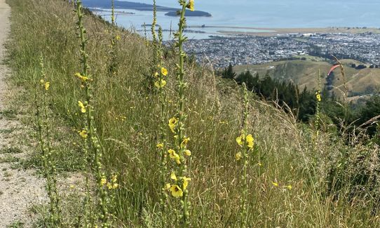
Native bush
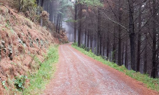
Gravel Road
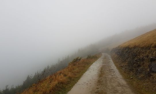
Farm Road / 4WD Track
Easy Single Track
Moderate Single Track
Technical Single Track
Average Uphill Gradient: +12.6%
Average Downhill Gradient: -12.7%
VIP Feature: Send this route to your Garmin account so you can follow the course on your Garmin device.
Login as a VIP to see the trailhead information.
2:00
Slow
1:30
Moderate
1:00
Fast
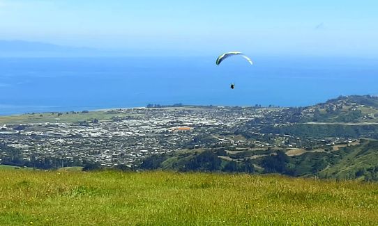
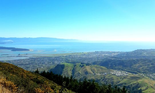
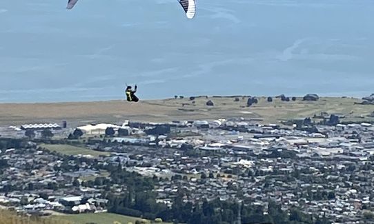
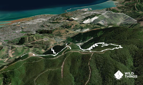
From the carpark head up the road just before the quarry and take a right turn over the bridge. Avoid the right turn, this is where you will return from and run up the road about 500 meters until you get to the Involution track on the left. Run up the track to the top, take note there may be mountain bikers riding down. At the top is a small clearing with several tracks off, take the Widdershins track. Follow this track down and take in the amazing views to another clearing. You will now see a much wider track through some trees, this is the Barnicoat track. Run down this to the bottom to complete the loop. About 500 meters into the Barnicoat track you will see a left turn, take this short detour to a grassy field at the top for spectacular 360 degree views.
Technical, steep uphill, rocky and roots and a couple stream crossings. Exposed single track with views. Smooth wide long downhill to finish.
If you know of any public toilets near the trail start or on the route, please login and then let us know so we can update this section.
Park at the carpark
9 km
14 minutes
Yes
No
Easy.
Generally good.
Thermal leggings, Long-sleeved thermal top, Seam-sealed waterproof jacket, Whistle, First aid kit, Extra food for emergencies, Cellphone, Map
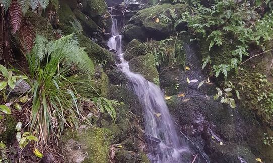
Couple stream crossings
Rocks and roots, muddy in places. Mountain bikes
Trail Legend
Login as a VIP to become a Trail Legend. Learn about Trail Legends.
Fastest Known Times (FKTs)
You and Involution Loop
As a VIP member you can record private notes for this trail, see all of your times and more.
Already have an account? Login now
I recommend doing this one anticlockwise so you go the correct way along the mountain bike tracks. It does mean a hard slog up the 4wd track to the paragliders though. Loved running down the zig zags through the bush. All the trails were open.
December 28, 2023
I really enjoyed getting back into the hills with this run. The zig zagging involution trails is tough but varied enough to not knock out all the stuffing. You get a couple of sneak views thru the trees going up but the best are when you come down the smooth forest trails. Unfortunately at the moment there is a trail closure about 2km from the end which means you have to detour up and then down a very steep track which is a bit of a killer on the knees. The gpx doesn't show it but there is a nice little trail off to the left of the last bit of gravel road that pops you out where the description says at the start which is much nicer than the gravel road.
Running the way described means you get a nice little warm up on the flat before the hills and are facing out to the views on the way down. Think this might become my go to trail for when visiting Richmond.
September 20, 2021
Great trail. I prefer running it counterclockwise downhill through the trees is great!
April 27, 2021
AH
Nice track uphill with rocks and roots to keep it interesting, and can get mucky after rain. Great views at the top, nice forests to run through, even a few little streams. Downhill is smooth forest roads.
January 15, 2021
These overlap with this trail to some degree. You may wish to combine them but please note that to qualify for FKTs on these runs you should record a separate activity for each.
Send to your phone
Scan the below QR code to open this trail on your phone.

Tip: position the QR code in your phone camera screen.


