Last Updated: 24th Apr 2024
Coppermine Climb
Last Updated: 24th Apr 2024
Open
Grunt Factor: 37 ?
Gnarl Factor: 43 ?
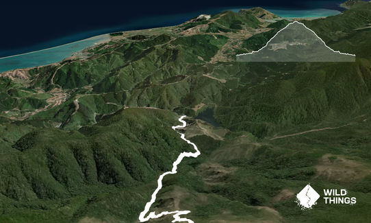
19.0km
850m
850m
883m
Last Updated: 24th Apr 2024
Last Updated: 24th Apr 2024
Open
Grunt Factor: 37 ?
Gnarl Factor: 43 ?
19.0km
850m
850m
883m
Back country - remote
Out and Back
Mountainous
Native bush
Open tussock/grasslands
Open ridges/tops
Other
Sealed Road
Gravel Road
Farm Road / 4WD Track
Easy Single Track
Technical Single Track
Untracked / Route only
Average Uphill Gradient: +12.3%
Average Downhill Gradient: -7.8%
VIP Feature: Send this route to your Garmin account so you can follow the course on your Garmin device.
Login as a VIP to see the trailhead information.
4:00
Slow
2:50
Moderate
2:10
Fast
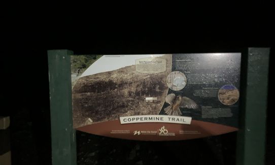
Once parked as described, carry on that tarseal road for a couple of hundred metres, (over the Maitai Dam outflow) until the road ends at a wire fence and sign with walking times for the Dun Mountain trail, Dew Lakes etc. Follow that 4WD track, but keep on the track rather than turning off to the left to go to the Rush Pool or Dew Lakes (another sign a little further on).
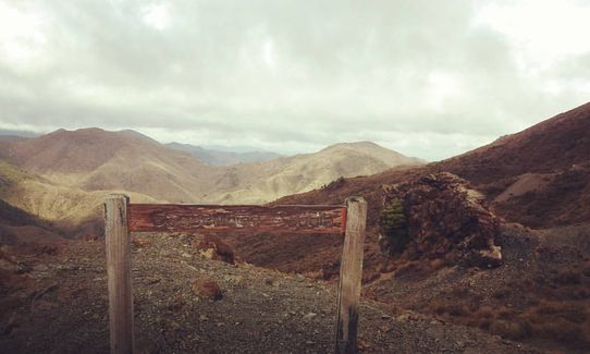
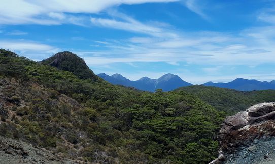
You will cross the Maitai River and leave pines behind for nice flowing single track through native bush. Do not take the side turn off to the Maitai Caves, just stick to the track, which will continue to get steeper, eventually coming out of the bush into more open landscape, with striking reddish rocks and great views out to sea. Look out for mountain bikers flying down the switch backs as you grovel your way up!
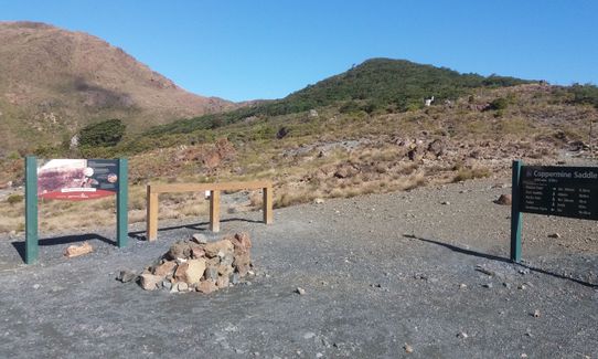
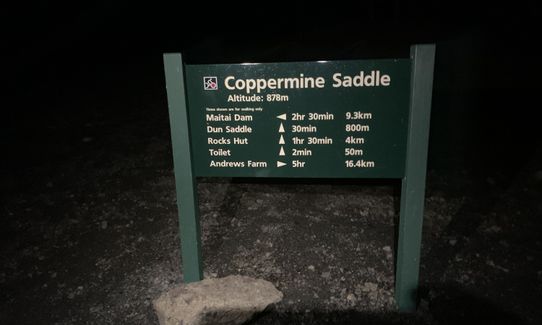
The highest point (and your turnaround point, unless you want to poke your nose further along the track- either towards Windy Point - right, or Dun Mountain - left ) is Coppermine Saddle (878m). Here you have wonderful views of the Richmond Range down to the Maitai Valley. It is a unique landscape, particularly when not that far from Nelson City as the crow flies.
Turn around and head back exactly the way you came.
This route is part of the Dun Mountain Trail- "The Dun Mountain, at the heart of the Nelson Mineral Belt, is one of the most geologically interesting areas in New Zealand. Its diverse minerals also mean it has an interesting history - from early use by MÄori as a source of argillite adzes, and in early European settler times as the centre for hopes of wealth from copper mining. The Nelson Mineral Belt consists of heavy ultramafic rocks such as serpentine, which formed the ocean floor and were thrust into the crust of the Gondwana super-continent some 280 million years ago. New Zealand is a small fragment of Gondwana that began breaking apart about 100 million years ago."
-from: http://www.theprow.org.nz/places/maitai-valley/#.WB7KXi197IU
If you know of any public toilets near the trail start or on the route, please login and then let us know so we can update this section.
Parking is safe. There is a gate a couple of hundred metres from the toilet block/parking area that is sometimes locked, if so you can park there and just start the run a little earlier!
18 km
72 minutes
No
No
Moderate.
The Dun Mountain Trail brochure is a useful one for a general overview, but for more detail take Topo50-BQ26 Nelson.
Patchy.
Waterproof leggings, Long-sleeved thermal top, Seam-sealed waterproof jacket, Gloves, Beanie/thermal headwear, Personal Locator Beacon (PLB), Whistle, First aid kit, Extra food for emergencies, Survival bag, Cellphone, Compass, Map, Headtorch and spare batteries
Carry your own water.
The tops can be very wind blown or cold in the winter, and conversely hot and dry in the winter.
Zumo
42 Rutherford St, Nelson
https://www.facebook.com/ZUMOCoffeeHouse/
You have to return to Nelson for the nearest cafe, where the options are numerous. Zumo is good if you need somewhere casual enough to flop on a couch whilst still dusty and sweaty and are craving a good coffee. Not the biggest range of food, but the coffee is hard to beat and the staff great.
River Kitchen
81 Trafalgar St, Nelson
http://www.riverkitchennelson.co.nz/
Nice location by the river, indoor and outdoor seating- and an excellent range of food.
Trail Legend
Login as a VIP to become a Trail Legend. Learn about Trail Legends.
Fastest Known Times (FKTs)
You and Coppermine Climb
As a VIP member you can record private notes for this trail, see all of your times and more.
Already have an account? Login now
An easy gradient, very runnable up and down, and a great variety of bush on the route. Make sure you find the footbridge over the Maitai river which is 200m back down the dirt road if youre starting from the carpark by the Maitai dam, as we unnecessarily forded the river, which had a decent flow, on the way up, and some locals saw us and let us know about the bridge, a much better option! Also the estimated run times are off, we ran the elite estimated time while chilling and stopping to check the route a few times, elite would be sub two hours I would suggest, maybe 2:30 for intermediate.
July 2, 2020
It's a solid climb up through the bush, but a really cool track and very different to everything else in the area. Run it soon as it will be upgraded shortly to make an easier mtb downhill so may change quite a bit.
November 2, 2018
Couldn't give it 5 stars because it was too steep for me to run up, had to walk quite a chunk. But otherwise an awesome run.
January 18, 2018
These overlap with this trail to some degree. You may wish to combine them but please note that to qualify for FKTs on these runs you should record a separate activity for each.
Send to your phone
Scan the below QR code to open this trail on your phone.

Tip: position the QR code in your phone camera screen.


