Last Updated: 13th Nov 2024
Dew Lakes Climb
Last Updated: 13th Nov 2024
Open
Grunt Factor: 18 ?
Gnarl Factor: 40 ?
6.0km
800m
140m
940m
Last Updated: 13th Nov 2024
Last Updated: 13th Nov 2024
Open
Grunt Factor: 18 ?
Gnarl Factor: 40 ?
6.0km
800m
140m
940m
Front country - easily accessible
Point to Point (one way)
Very hilly
Native bush
Open tussock/grasslands
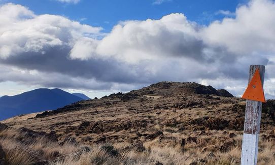
Open ridges/tops
Farm Road / 4WD Track
Easy Single Track
Moderate Single Track
Average Uphill Gradient: +18.8%
Average Downhill Gradient: -14.7%
VIP Feature: Send this route to your Garmin account so you can follow the course on your Garmin device.
Login as a VIP to see the trailhead information.
2:00
Slow
1:20
Moderate
0:50
Fast
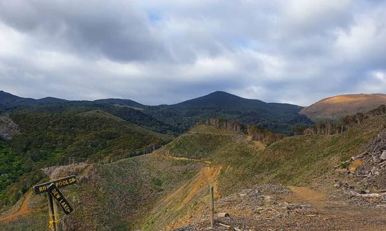
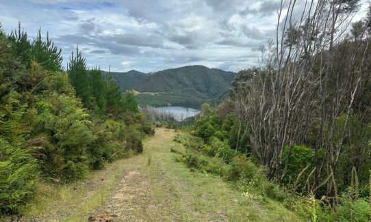
Starting at the Dam, there are good signs for Rush Pool & Dew Lakes. (you go past Rush Pools on the way to Dew Lakes). Hop over the fence and away you go.
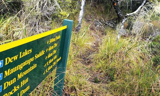
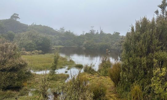
First you'll undulate over some forestry 4WD roads until you reach an obvious sign pointing you into the bush - here's where the fun begins! You'll then follow this single-track old mining route to the top, passing an old anvil rock site used before we had powertools! Keep on trucking to the top where you might get your feet wet - the track can get boggy after heavy rain and the are a couple of patches of the wet stuff. You'll then reach the DoC sign directing you 300m to the Dew Lakes.
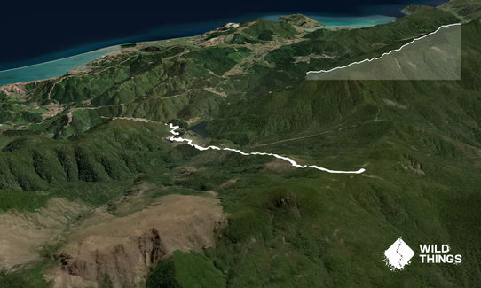
At this point you can either return back the way you came or, go right and over Dun Mountain (4km), Rocks Hut (9.5km) or left to Maungatapu Saddle (4km). Each option opens up more tracks, but both directions have options to get you back down to the Maitai Dam again. But just getting to the top is enough to earn you your 68 Wild Explorer Points.
The route up to the Rush Pools and Dew Lakes are part of Nelson's mineral belt which was mined back in the day. The Rush Pool is a man-made pond, part of an early Maori 'factory' where argillite was chipped from outcrops on the hillside and made into tools.
If you know of any public toilets near the trail start or on the route, please login and then let us know so we can update this section.
Free parking.
13 km
25 minutes
Unknown
No
Moderate.
Patchy.
Windproof jacket, Beanie/thermal headwear, Personal Locator Beacon (PLB), Whistle, First aid kit, Extra food for emergencies, Cellphone, Map
No formal water, but once out of the foresty I drink the natural water. Not endorsing you to do the same though.
Weather can turn quickly up there - take a rain/wind jacket and tell people where you are going.
Trail Legend
Login as a VIP to become a Trail Legend. Learn about Trail Legends.
Fastest Known Times (FKTs)
You and Dew Lakes Climb
As a VIP member you can record private notes for this trail, see all of your times and more.
Already have an account? Login now
Send to your phone
Scan the below QR code to open this trail on your phone.

Tip: position the QR code in your phone camera screen.


