Last Updated: 8th May 2025
Cable Bay - Glenduan
Last Updated: 8th May 2025
Open
Grunt Factor: 26 ?
Gnarl Factor: 43 ?
14.7km
850m
850m
408m


Last Updated: 8th May 2025
Last Updated: 8th May 2025
Open
Grunt Factor: 26 ?
Gnarl Factor: 43 ?
14.7km
850m
850m
408m
Front country - easily accessible
Combo
Very hilly
Native bush
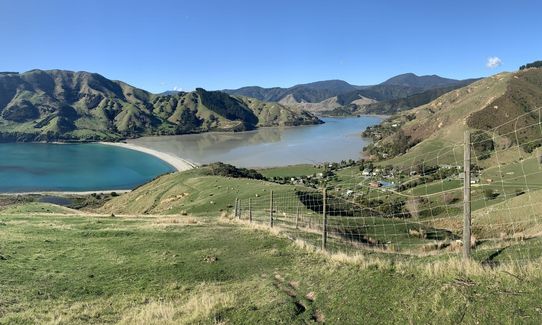
Coastal
Open farmlands
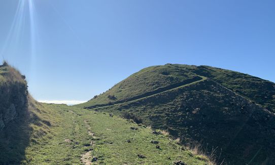
Open ridges/tops
Farm Road / 4WD Track
Untracked / Route only
Average Uphill Gradient: +16.7%
Average Downhill Gradient: -15.9%
VIP Feature: Send this route to your Garmin account so you can follow the course on your Garmin device.
Login as a VIP to see the trailhead information.
3:30
Slow
2:30
Moderate
1:30
Fast
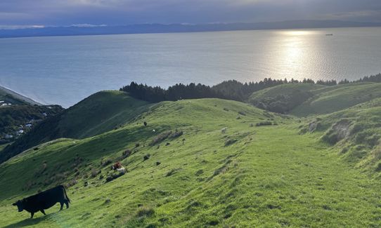
The Stuart family kindly allow this public walkway on their farm. It is open all year other than during lambing season (around 1st August to 10th October). No dogs permitted at any time, it is a working farm. Please respect the stock and stick to the markers.
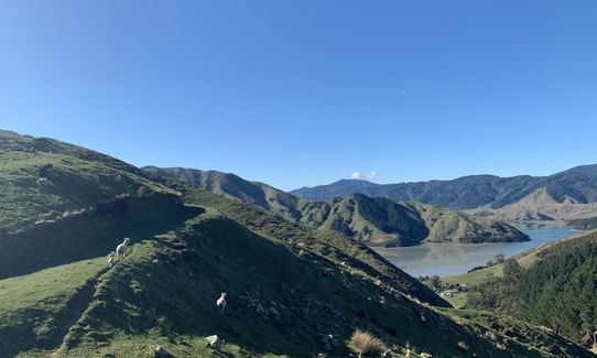
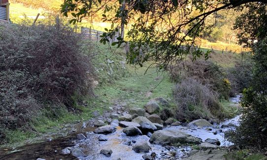
The track can be started at either Glenduan, or Cable Bay. This GPS route and description was run from the Cable Bay end and back, with a loop in the middle. It is a public walkway, mostly on farm, with some nice running through native bush. Follow the tall white marker pegs.
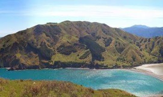
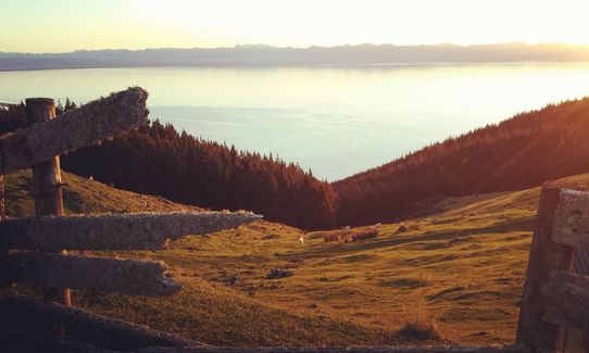
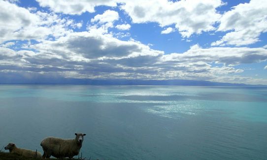
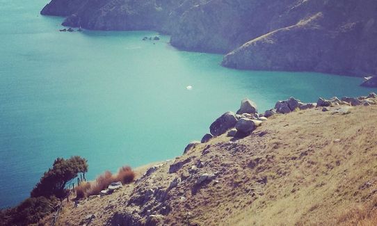
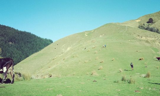
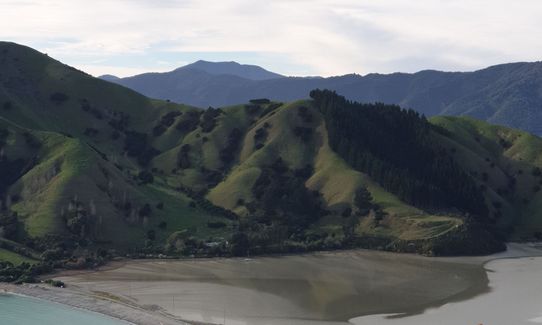
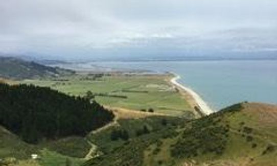
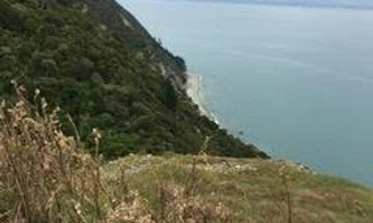
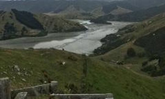
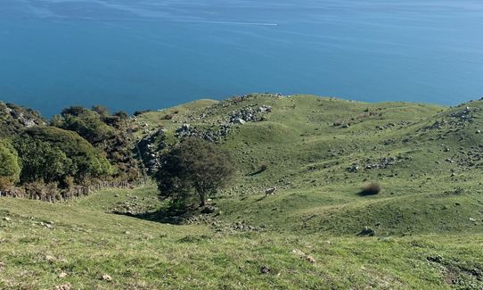
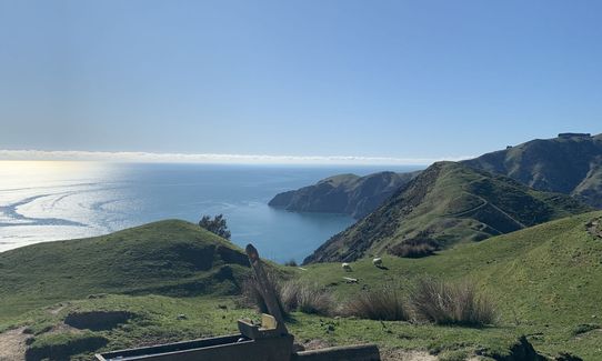
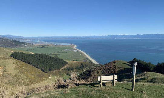
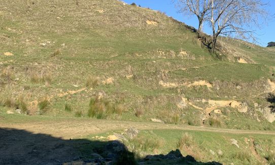
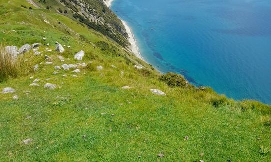
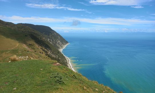
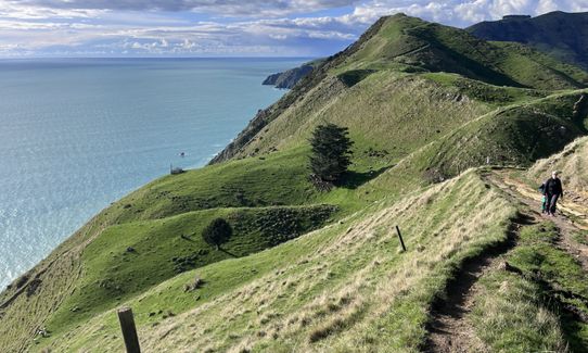
It starts with a steep climb, with wonderful views of the sea, tidal estuary, farmland and Pepin Island. The route then follows farm tracks along the top of the ridge line, more fantastic sea views, before plunging down into a native bush reserve, (look out for wekas).
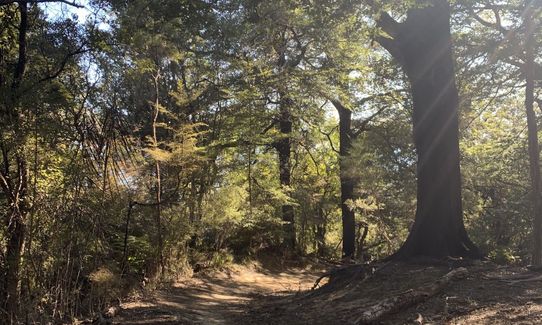
The native bush section is undulating, before a climb up to the airstrip look-out (another toilet here). At this point you veer left onto a 4WD track (connect with this 4WD track either immediately behind the old cattle yards at the airstrip lookout, as per GPS file, or a couple of hundred metres further along/down the hill where you will see a sign).
The 4WD track offers a nice winding downhill through bush, ending at a typically kiwi red woolshed at Glenduan. This is only a km or so above Glenduan beach, should you wish to detour onto tarseal and straight down to the beach. Otherwise follow the markers and signs, and turn right at the woolshed. This takes you over a small creek and up a steep climb, initially on a 4WD track, then up steep open paddocks, with great views of Nelson behind you. This lung-busting climb ends back at the airstrip viewpoint, at which point you continue back to Cable Bay the way you came.
"Evidence of MÄori occupation in the Cable Bay area (Rotokura) dates back to about 1150 AD; the area was a fishing ground and a campsite was maintained there. Delaware Bay, across the estuary, was the site of the main pa. In 1863, the pa occupants heroically rescued the crew of the Delaware during a terrible storm.
Cable Bay was once known as Schroders Mistake, after a Nelson skipper mistook the bay for another and put his boat on the rocks there. The laying of New Zealand's first international telegraph cable gave the bay its modern name. The operation, from Sydney to Cable Bay, took 11 days and transmission began on 21 February 1876. A fire razed the station in 1914 and in 1917 the cable was moved to Titahi Bay, near Wellington"
- from: http://www.doc.govt.nz/parks-and-recreation/places-to-go/nelson-tasman/places/nelson-area/things-to-do/tracks/cable-bay-walkway/
At Cable Bay.
Parking availability and safety is good. You can park just in front of the sign signalling the start of the track, or nearby on the stony beach. There is no public transport.
22 km
22 minutes
No
No
Moderate.
Keep an eye on the markers, and study the map board at the start of the track.
Very patchy.
Long-sleeved thermal top, Seam-sealed waterproof jacket, Beanie/thermal headwear, Whistle, First aid kit, Extra food for emergencies, Survival blanket, Cellphone, Map, Headtorch and spare batteries
There is no drinking water on route. There are a couple of stream crossings however drinking from them not recommended.
The steep grassy climbs and descents can be very slippery after a lot of rain. The ridge line along the top can be exposed to cold winds in poor weather.
Be respectful of all stock.
Cable Bay Cafe
Cable Bay
http://www.cablebaycafe.co.nz/
This is the only cafe at Cable Bay, and is only about 100m from the start of the track. It serves great food and coffee in a lovely setting.
*note it is closed over winter, and reopens late October.
Trail Legend
Login as a VIP to become a Trail Legend. Learn about Trail Legends.
Fastest Known Times (FKTs)
You and Cable Bay - Glenduan
As a VIP member you can record private notes for this trail, see all of your times and more.
Already have an account? Login now
Beautiful views. As a slow runner, took closer to 3:30. Trail could be slightly better signposted, I did a few detours onto farm tracks but came back to the white posts eventually!
May 22, 2022
JE
Most of the train was runnable for me (just an average middle of the pack 42 yo trail runner) but the steep uphill from Cable Bay to the uphill to top of Sentinel Hill was not. All the better to enjoy the spectacular coastal scenery. Loved the varied terrain, coastal scrub, pine, native bush - as others have remarked. Also, started this from The Glen end, and added a few km by splitting of main walkway track starting around 6km (at the sheep/cattle farm) going anti-clockwise around the farm road that hangs out around 300 m elevation and crosses stream 34 (in topo above), Do be aware there's a slightly sketchy section to navigate around big slip. Cool views looking back around the the bay. All in all, this packs a lot of fun punch in a relatively short distance.
January 15, 2022
lovely run but the lack of mobile reception at Cable Bay is problematic if your car keys got lost somewhere on route! :-)
November 22, 2021
Send to your phone
Scan the below QR code to open this trail on your phone.

Tip: position the QR code in your phone camera screen.


