Last Updated: 9th Apr 2024
Big Circuit Run
Last Updated: 9th Apr 2024
Open
Grunt Factor: 86 ?
Gnarl Factor: 38 ?
51.6km
2660m
2660m
1095m


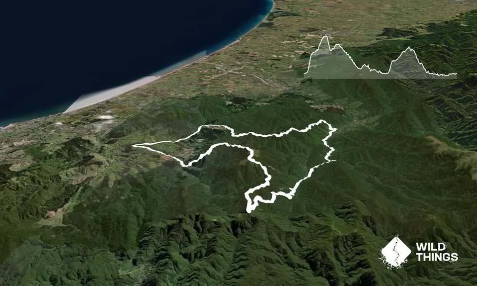
Trail Map
This Topo layer only covers NSW/ACT.
Switch to another map layer when viewing outside this area.
Switch to another map layer when viewing outside this area.


