Last Updated: 22nd Feb 2024

Experienced

Save Trail Save

I've done it Done

Holdsworth to Maungahuka Loop

Mid Waiohine Hut, Aokaparangi Hut, Neill Forks Hut, Maungahuka Hut, Totara Flats Hut

Masterton, Wellington

Submitted by Seanoa Isaac

Last Updated: 22nd Feb 2024

Experienced

Save Trail Save

I've done it Done

Grunt Factor: 112 ?

Gnarl Factor: 75 ?

39.5km

3930m

3925m


Login as a VIP to see driving directions, distance and time.

Trail Map

Type of Run

Back country - remote

Loop

Mountainous

Native bush

Open tussock/grasslands

Open ridges/tops

Run Makeup

10%
30%
60%

Easy Single Track

Moderate Single Track

Technical Single Track

Average Uphill Gradient: +19.9%

Average Downhill Gradient: -19.9%

Trailhead

Login as a VIP to see the trailhead information.

Estimated Times to Run

Not suitable

Slow

14:00

Moderate

10

Fast

Find yourself a park, lace up your runners and kiss your quads goodbye - its gonna be a big day!

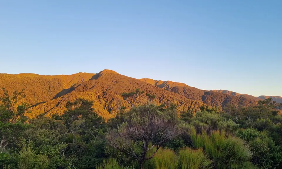
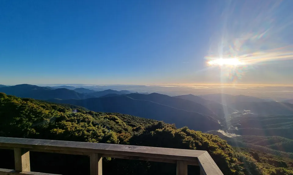
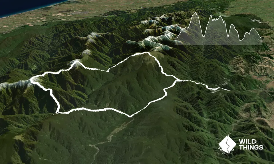
HOLDSWORTH CARPARK to MT HOLDSWORH (9.5km 1150m gain) Starting at the Holdsworth carpark head up the Gentle Annie Track through Mountain House Shelter to Powell Hut 8km. This section of track is very popular, well marked and sign posted. Continue onto Mt. Holdsworth 1.5km note the track becomes exposed tops.

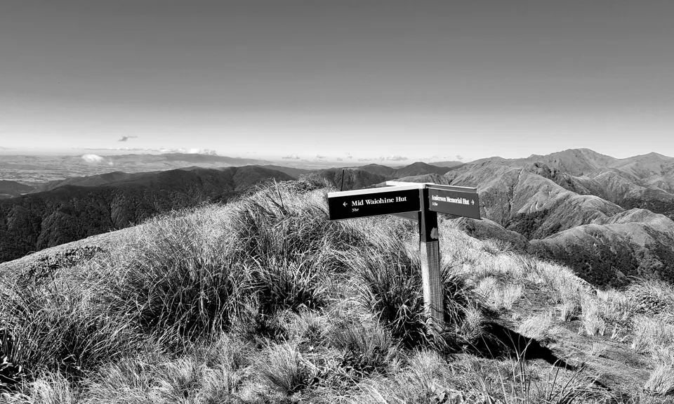
MT HOLDSWORTH to MID WAIOHINE HUT (3.5km 135m gain) From the Mt. Holdsworth trig follow the ridge to the NW towards Isabelle through a short steep saddle. Isabelle down to the bushline is 450m and then down to Mid Waiohine Hut approx. 3.5km. Over 1000m slippery descent, hello quads.

MID WAIOHINE HUT to AOKAPARANGI JUNCTION (3.7km 1000m gain) As you approach the hut the track is to the left (south) side. The track sidles along the river on the true left for 650m before providing a swing bridge to the Main Range side. The climb to Aokaparangi is a goodie... from the bushline to the junction is 550m and track marked with small cairns.

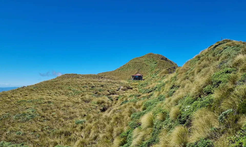
AOKAPORANGI JUNCTION to MAUNGAUHUKA HUT (4.5km 400gain) A straight forward but challenging section through undulating, slippery, tussock covered track with the odd scramble. The track is marked with waratahs. Note* Aokaparangi Hut junction is signposted 150m south from the peak dropping 200m back down into the bushline if shelter is required.

MAUNGAHUKA HUT to NEILL FORKS HUT (4km 150m gain) 200m south of the hut is the signposted junction where you will drop off Maungahuka SE 1km before reaching the bushline and the last of any open tops. Once under the canopy of the goblin forest it's 700m through a shallow saddle to Concertina Knob before a very steep & slippery descent to the hut.

NEILL FORKS HUT to TOTARA FLATS HUT (5.5km 450m gain) The 1.2km track up to Cone Ridge starts steeply before rounding out gradually and arriving at the Cone Ridge track junction. Head NE to Totara Flats Hut taking extra care for the initial 500m following the track. It is intercepted by many game trails and blazers can be hard to locate. You will pass a substantial swing bridge 60m before reaching the hut which is the way out.

TOTARA FLATS HUT to HOLDSWORTH CARPARK (10km 650m gain) Head back to the bridge and follow the well marked track up to the Gentle Annie junction 5.5km before heading East down the Gentle Annie Track, past Rocky Lookout for a dip in the river and well deserved beverage.

This trail includes the peaks Mount Holdsworth, Aokaparangi, Maungahuka, Concertina Knob and Isabelle.

6 huts, 7 named peaks

No public transport available. Non-powered campsites available. Flushing toilets available. https://www.doc.govt.nz/parks-and-recreation/places-to-go/wellington-kapiti/places/tararua-forest-park/things-to-do/campsites/holdsworth-campsite/

22 km

25 minutes

Unknown

No

Hard.

There can be a lot of deadfall on track sections at any time you will have to pick your way around. Be prepared to navigate if the clag sets in. Take your time descending from the Cone Ridge track junction, the goblin forest has swallowed more than a few blazers.

Very patchy.

Waterproof leggings, Thermal leggings, Lightweight fleece top, Long-sleeved thermal top, Seam-sealed waterproof jacket, Gloves, Beanie/thermal headwear, Personal Locator Beacon (PLB), Whistle, First aid kit, Extra food for emergencies, Survival bag, Cellphone, Compass, Map, Headtorch and spare batteries

All the huts have water storage tanks. There are 3 rivers with access near the valley huts (Mid Waiohine, Neill Forks & Totara Flat Huts).

Tararua is prone to extreme weather conditions that can turn to crap very quickly. Water tanks at the tops huts have been known to run dry during extended dry spells. There are 2 tarns close to Maungahuka Hut but these could be affected by weather. Consider taking enough water to go between each river crossing.

Don't underestimate the weather.

Clareville Bakery
Carterton
https://theclarevillebakery.co.nz/
the best pies, bread and coffee

Chapelli's Pizzaria & Bar
Carterton
Good pizza & beer

You and Holdsworth to Maungahuka Loop

As a VIP member you can record private notes for this trail, see all of your times and more.

Register Now

Already have an account? Login now

Trail Reviews

Be the first to submit a review for Holdsworth to Maungahuka Loop!

Login to submit a review

Trail Running Community

Find people who are interested in or have completed this trail run.

You must register or login to view this feature.

Register Now

Overlapping Trails

These overlap with this trail to some degree. You may wish to combine them but please note that to qualify for FKTs on these runs you should record a separate activity for each.

Jumbo - Holdsworth Circuit

Jumbo - Holdsworth Circuit

Length: 24.0km

Level: Intermediate - Experienced

Hooper Loop - Mt Holdsworth

Hooper Loop - Mt Holdsworth

Length: 12.0km

Level: Beginner - Intermediate

Powell Hut

Powell Hut

Length: 15.0km

Level: Intermediate

Holdsworth Lodge to Totara Flats Hut and return

Holdsworth Lodge to Totara Flats Hut and return

Length: 22.0km

Level: Intermediate

Jumbo - Holdsworth Circuit

Jumbo - Holdsworth Circuit

Length: 24.0km

Level: Intermediate - Experienced

Hooper Loop - Mt Holdsworth

Hooper Loop - Mt Holdsworth

Length: 12.0km

Level: Beginner - Intermediate

Powell Hut

Powell Hut

Length: 15.0km

Level: Intermediate

Holdsworth Lodge to Totara Flats Hut and return

Holdsworth Lodge to Totara Flats Hut and return

Length: 22.0km

Level: Intermediate

Other trails nearby
Pinnacle Ridge Plus

Pinnacle Ridge Plus

Length: 23.2km

Level: Intermediate

Deliverance Cove & Lighthouse Loop

Deliverance Cove & Lighthouse Loop

Length: 4.2km

Level: Beginner

Mt Clyde

Mt Clyde

Length: 4.3km

Level: Beginner

Waipoua River & Henley Lake Trail

Waipoua River & Henley Lake Trail

Length: 10.0km

Level: Beginner

Find more trails and peaks nearby