Last Updated: 21st Sep 2023
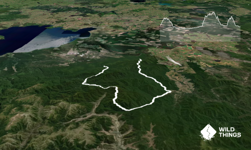
Waihora to Waihaha
Last Updated: 21st Sep 2023
Open
Grunt Factor: 42 ?
Gnarl Factor: 64 ?
21.4km
575m
665m
894m
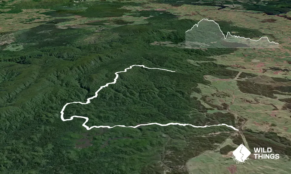
Trail Map
This Topo layer only covers NSW/ACT.
Switch to another map layer when viewing outside this area.
Switch to another map layer when viewing outside this area.