Orahau To KinlochBeginner
Submitted by Melissa Franklin
Front country - easily accessible
Point to Point (one way)
Undulating, some big hills
Native bushLakeside
Beginner
3:00 (Slow)
2:15 (Moderate)
1:30 (Fast)
-7.4%
+6.8%
Fastest Known Times (FKTs)
Please set your gender to see your position on the FKT leaderboards.
The more , the harder the FKT will be to beat. Learn about Fastest Known Times.
Description
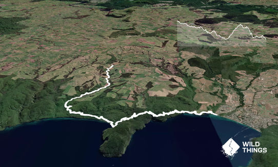
At the Orakau carpark, you will find a shelter with a map, information board and a toilet. From here, the trail follows the beautifully clear Orakau Stream through regenerating native bush and past Harakakeke (native flax) wetlands down towards Kawakawa Bay. You will run across boardwalks, past waterfalls and over ravines as the trail makes its way down towards the lake shore.
As you near the beach at Kawakawa Bay you will cross two bridges that span some really deep ravines. It's worth stopping and peering over the sides as the ravines are quite spectacular. After 10.25 km you will emerge onto the beach at the stunning Kawakawa Bay. There are views across the lake to the mountains of Tongariro National Park, and during summer this is the perfect place for a swim in the clear blue waters of Lake Taupo.
A shelter and campsite lies in a clearing at Kawakawa Bay, and you will often see rock climbers here. There is a long drop toilet available.
From Kawakawa Bay, a 3km switchback climb will take you up onto the Te Kauwae headland before you begin the descent down to the village of Kinloch. Your climbing efforts will be rewarded by magnificent, sweeping views from the top of the hill up towards the western bays. Once down the other side, the trail emerges on the lake front in Kinloch where it continues along the lake shore on a grassy path before reaching the carpark opposite the Kinloch Domain.
You could either arrange to have someone to pick you up at Kinloch or turn around and run back making the run about 34km.
Trail Community
Make Up of Run
Moderate Single Track: 100%
Route Data
Reviews:
Overlapping Runs
The following trails overlap with this run to some degree. You may wish to combine them but please note that to qualify for FKTs on these runs you should record a separate Strava activity for each

Great Lake Trail Loop
Length: 24.50km
Photos:
Your Trail Wishlist
All the runs that are on your To Do list (no limit).
Add to wishlist view wishlistWild Explorers
I did it!-
Access
From Taupo drive 30km to the Orakau carpark on Whangamata Road, 11.3km from Kinloch turn off.
Carpark available at start of trail
34 km
29 minutes
No
No
-
Staying Safe
Easy.
Make navigation of this route super-easy by using the Capra app on your phone. View on Capra .
Very little chance of getting lost as there is no other way to go!
Patchy.
Long-sleeved thermal top, Seam-sealed waterproof jacket, Whistle, First aid kit, Extra food for emergencies, Survival blanket, Cellphone, Map.
Drinking from the lake is possible once getting to Kawakawa bay if you're keen! I wouldn't drink from the streams as this runs off from farm lands.
Tracks can get quite muddy in rain
Watch from mountain bikers
-
Sponsor this trail
See other runs nearby:
Taupo to Huka Falls Loop
Huka Falls to Aratiatia Dam Loop
Tauhara Grunt
Waihaha Trail - Out & Back
W2K
Taupo Redwoods Track
Great Lake Trail - Waihaha Section
Waihora to Waihaha
Te Iringa Track
Craters Intro
SH1 Leg Stretcher
O2K Roller
Opepe Reserve
Rangatira Ramble
Great Lake Trail Loop
Kaimanawa Killer