Last Updated: 7th Jan 2024

Experienced

Save Trail Save

I've done it Done

Kaimanawa Killer

Taupo, Waikato

Submitted by Orla Drylie

Last Updated: 7th Jan 2024

Experienced

Save Trail Save

I've done it Done

Open

Grunt Factor: 108 ?

Gnarl Factor: 70 ?

54.3km

2496m

2496m

1198m


Login as a VIP to see driving directions, distance and time.

Trail Map

Type of Run

Back country - remote

Loop

Mountainous

Dog Friendly

Native bush

Plantation/exotic forest

Run Makeup

25%
5%
15%
55%

Gravel Road

Moderate Single Track

Technical Single Track

Untracked / Route only

Average Uphill Gradient: +7.0%

Average Downhill Gradient: -7.9%

Trailhead

Login as a VIP to see the trailhead information.

Estimated Times to Run

Not suitable

Slow

16:00

Moderate

13

Fast

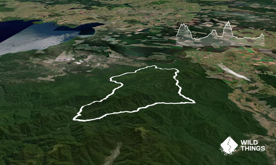
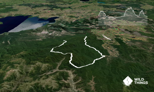
The first 10k or so of this route are shared with the Te Iringa Track run, but makes for a MUCH bigger, MUCH more adventurous loop instead of an out-and-back. It is a challenging trail, and one that probably shouldn't be undertaken solo for safety reasons.

This trail is NOT for the faint hearted or people with bad navigation skills.

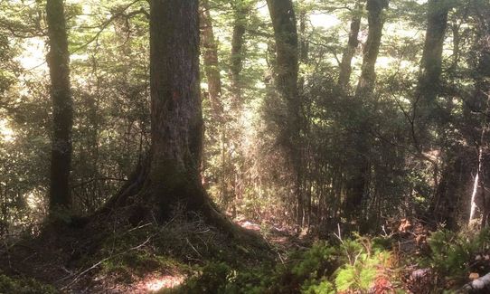
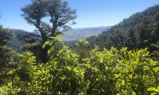
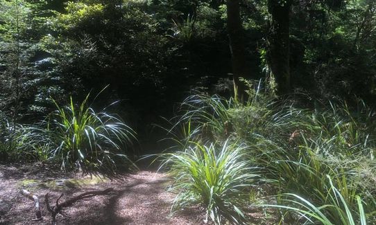
The first 12.5km on Te Iringa Track (sign-posted for Oamaru and Cascade Huts) are a delightful trot (well sign posted) through beautiful New Zealand bush with some gut-busting hills in the mix. You will get the odd glimpse of Ruapehu if you keep an eye out.

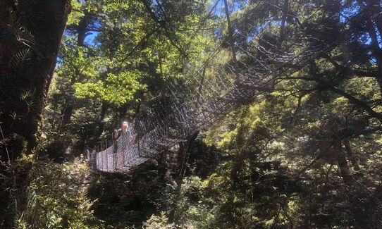
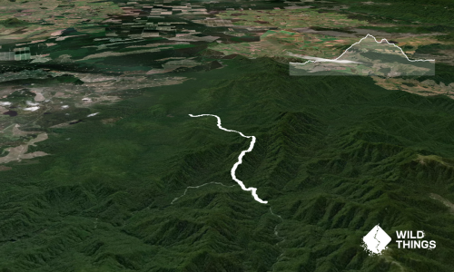
After 12.5km you will cross a one-person suspension bridge and turn right on to Kaipo Valley to Cascade Stream Track (sign-posted for Cascade Hut) The first couple of kms are equally beautiful with some good photo ops, and then the fun begins. For 14kms, you will have to follow the orange triangle markers religiously. You will cross the stream approximately 35-40 times throughout (not more than knee-high during summer months). On most occasions when you get to the stream, ensure to look downstream on the opposite bank as 90% of the time, the trail continues on the opposite side. Navigation is a challenge at times so you may need to do a few trial-and-error out and backs to find the next marker.

This is dense bush with ZERO cellphone coverage, so it is of the utmost importance to stay on track. It is NOT recommended to attempt this trail during darkness or in poor weather with poor visibility. The route is very slow to navigate, with steep climbs, fallen trees to clamber over/under and very rooty terrain underfoot.

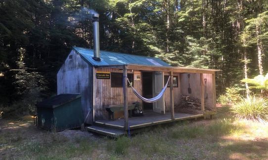
After what may seem like a lifetime, you will eventually reach a very welcome sign informing you that Cascade Hut is a mere 30 minutes away - follow this sign. Enjoy the gorgeous, basic six-bed Cascade Hut. At the back of the hut, the trail continues on Hinemaiaia Track - sign-posted for "Clements Mill Road 4-5 hours". Another stream crossing ensues, and you follow the stream loosely for approximately 2km, then turn inland and the climbing begins. Once again, follow the orange triangle markers as sometimes they tend to disappear due to a fallen tree or some such obstacle.

Over the next 4km, you will do approximately 600 metres of climbing. It is just as steep and challenging going down the other side as it is going up. You then arrive at Clements Mill End campsite and it is a 14km gravel grind (relatively flat) back to Te Iringa campsite.

The Kaimanawa Rock Formation - big hit in the 90s, is at the approximately 45 km mark, on the gravel road on the left

No public transport.

40 km

36 minutes

Yes

No

Hard.

Follow the orange triangles. If you don't see one, re-trace your steps and try a slightly different route until you come across one. An app like View Ranger would be an excellent tool to utilise

Non-existent.

Thermal leggings, Lightweight fleece top, Long-sleeved thermal top, Seam-sealed waterproof jacket, Gloves, Beanie/thermal headwear, Personal Locator Beacon (PLB), Whistle, First aid kit, Extra food for emergencies, Survival bag, Cellphone, Compass, Map, Headtorch and spare batteries, Gaiters

Water only available at streams (drink at your own risk, but it is delicious)

Navigation would be very challenging in poor weather or winter weather, so the recommendation would be to avoid at all costs during poor or cold wet weather

Tree roots, tree roots and more tree roots, with fallen trees a common occurence

Baked with Love Cafe
11 Gascoigne Street, Taupo
http://www.bakedwithlove.co.nz
The doughnuts are out of this world, coffee is great and menu/cabinet food are extensive. Closed at 3pm daily

Dixie Browns
38 Roberts Street, Taupo
http://www.dixiebrowns.co.nz/
Open for breakfast/lunch/dinner daily. This place has an ENORMOUS menu, HUGE portions, and great for a sneaky beer, wine or cider

You and Kaimanawa Killer

As a VIP member you can record private notes for this trail, see all of your times and more.

Register Now

Already have an account? Login now

Trail Reviews

Awesome adventure!

Phil Evans

January 30, 2022

Login to submit a review

Trail Running Community

Find people who are interested in or have completed this trail run.

You must register or login to view this feature.

Register Now

Overlapping Trails

These overlap with this trail to some degree. You may wish to combine them but please note that to qualify for FKTs on these runs you should record a separate activity for each.

Te Iringa Track

Te Iringa Track

Length: 20.0km

Level: Intermediate - Experienced

Other trails nearby
Taupo Redwoods Track

Taupo Redwoods Track

Length: 10.0km

Level: Beginner

Taupo to Huka Falls Loop

Taupo to Huka Falls Loop

Length: 16.0km

Level: Beginner

W2K

W2K

Length: 23.0km

Level: Beginner

Orahau To Kinloch

Orahau To Kinloch

Length: 17.0km

Level: Beginner

Find more trails and peaks nearby