Last Updated: 20th Dec 2023
Iron Gate Hut to Tunupo High Point Loop
Last Updated: 20th Dec 2023
Grunt Factor: 54 ?
Gnarl Factor: 77 ?
24.2km
1160m
1160m
1572m
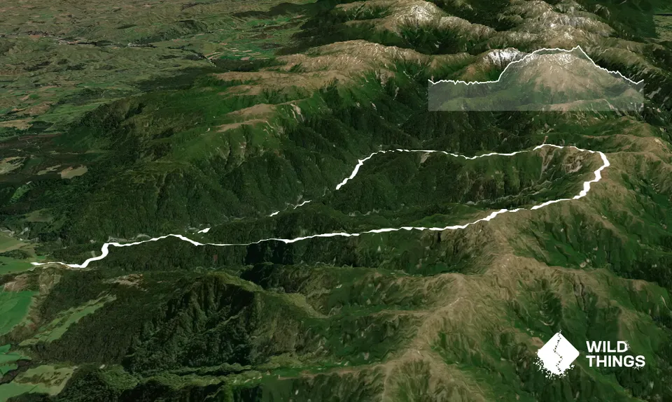
Trail Map
This Topo layer only covers NSW/ACT.
Switch to another map layer when viewing outside this area.
Switch to another map layer when viewing outside this area.


