Wild Things - New Zealand's trail running community
New Zealand's trail running community

Login


don't have an account?

Ruahine Double Crossing, Manawatu - Wanganui

Trail Directory proudly supported by Further Faster

Update Your Header Picture

Ruahine Double CrossingIntermediate - Experienced

Submitted by Kym Skerman

Info Info
Map Loading

Trail Information

20.80km

1800m

1800m


Manawatu - Wanganui

Ashhurst

Back country - remote

Out and Back

Very hilly

Native bush
Open farmlands
Open ridges/tops

Intermediate - Experienced

8:00 (Slow)
6:00 (Moderate)
4:15 (Fast)

-16.3%

+16.6%

Download PDF Guide

Fastest Known Times (FKTs)

FKTs only granted for the full Double out & back trip.

Please set your gender to see your position on the FKT leaderboards.

Men

Women

Filter FKTs

The more , the harder the FKT will be to beat. Learn about Fastest Known Times.

Missing your time?

Register or login as a VIP and get yourself on the FKT leaderboard!

Register Now

Description

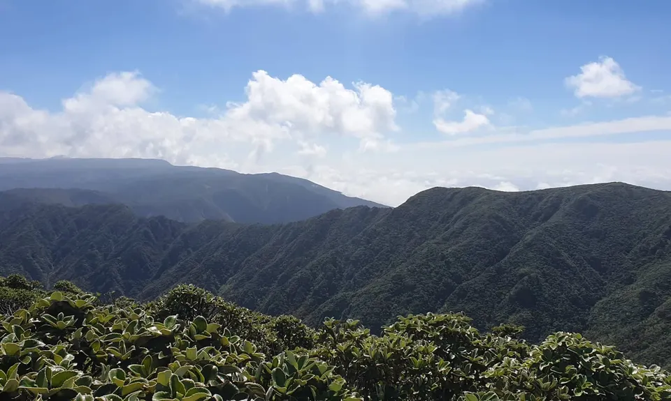
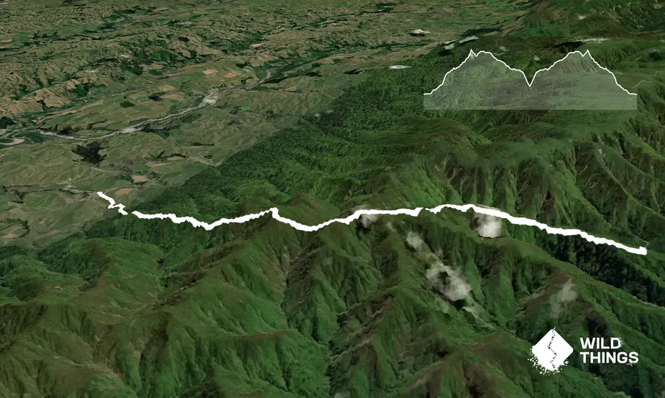
This track starts out across farmland before heading into the bushline. This is a well defined but often muddy track that climbs steeply through typical southern Ruahine rimu, kamahi and tawa forest. Higher up the track passes through more shrubby species such as horopito, flax and pink pine. From here it heads across a series of open, rocky knolls to Mt Maharahara.

From the high point continue on in an easterly direction following the track. You are bordered most of the way by impenetrable leatherwood so is easy to follow the track. The only other turn off is a track to the right (south) that heads to Kiritaki Hut.

The track then turns sharply NE and takes you steeply down to the Mangapuaka Stream. You can either fill your bottles or water bladder here and return back over the range or follow the stream out East to the Kumeti campsite for a pre-arranged pick up.

The track has been cleared of scrub on the West side but is yet to be cleared on the East so care needs to be taken as the ground is quite rough. Even though is is easily accessible by foot you are in the remote backcountry and a PLB would be highly recommended. This would have to be one of the best training run/treks in the Manawatu for the likes of The Goat and the Coast to Coast Mountain Run as it has a mix of technical with some very steep ascents and descents over a relatively short distance.


Trail Community

Find people who are interested in this run.

You must register or login to view this content.

Features of interest

The scratchy, leathery leaved shrub leatherwood is evident on the tops here. The southern Ruahine ranges have the largest, unbroken mass of leatherwood in New Zealand.


Make Up of Run

Untracked / Route only: 10%

Technical Single Track: 60%

Moderate Single Track: 30%


Route Data

Reviews:

You must register or login to view this content.

Photos:

You must register or login to view this content.

Your Trail Wishlist

All the runs that are on your To Do list (no limit).

Add to wishlist view wishlist

Your Trail Dreamlist

The runs you most want to do (limited to 10).

Add to dreamlist view dreamlist

Wild Explorers

I did it!
  • Access

    Start is from Opawe Road which is off Pohangina Valley E Road. Follow the gravel road until you see the sign on your right for the start of the rtrack. You will cross farmland to start but this is open access.

    Parking is on the side of a gravel road.

    28 km

    29 minutes

    No

    No

  • Staying Safe

    Moderate.

    Follow the white markers across farmland and then the orange triangles once in the bush. It always pays to take a map and compass on any backcountry adventure.

    Patchy.

    Thermal leggings, Lightweight fleece top, Long-sleeved thermal top, Seam-sealed waterproof jacket, Gloves, Beanie/thermal headwear, Personal Locator Beacon (PLB), Whistle, First aid kit, Extra food for emergencies, Survival bag, Cellphone, Compass, Map, Headtorch and spare batteries, Gaiters.

    There is a small spring near the top and then the stream on the other side for water refills.

    Do not attempt this in bad weather. You gain elevation very fast and the weather can change super quick up there so be prepared for all scenarios.

  • Sponsor this trail

    If you are interested in learning about sponsorship opportunities, please get in touch below:

    Submit

Got a favourite trail? Tell us about it.

Share the love and add your favourite trail(s) to our growing trail directory.

Submit A Trail

Become a member today

Start enjoying the many benefits to becoming a member of our thriving community.

Become a member

Great brands at great prices with our VIP member's discount

Stay up to date

Sign up to our newsletter for latest offers and trail guides

Share this trail with a friend:

VIP Membership

Please register as a VIP or login to your VIP account to view this content.

Cancel Login Register

Membership Required

You can see up to three trail guides without being logged in but after that we require you to be logged in to your Free or VIP account. If you don’t yet have an account you can register here.

Login Register