Last Updated: 2nd Feb 2024
Clent Eastward in “Barrosa”
Submitted by Mike Steel
Last Updated: 2nd Feb 2024
Open
Grunt Factor: 45 ?
Gnarl Factor: 47 ?
26.3km
1300m
1300m
1364m
Last Updated: 2nd Feb 2024
Submitted by Mike Steel
Last Updated: 2nd Feb 2024
Open
Grunt Factor: 45 ?
Gnarl Factor: 47 ?
26.3km
1300m
1300m
1364m
Front country - easily accessible
Point to Point (one way)
Very hilly
Dog Friendly
Riverside
Lakeside
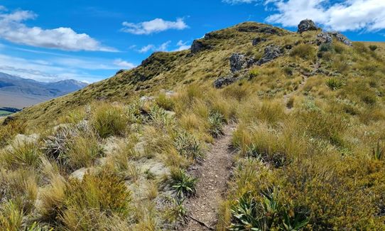
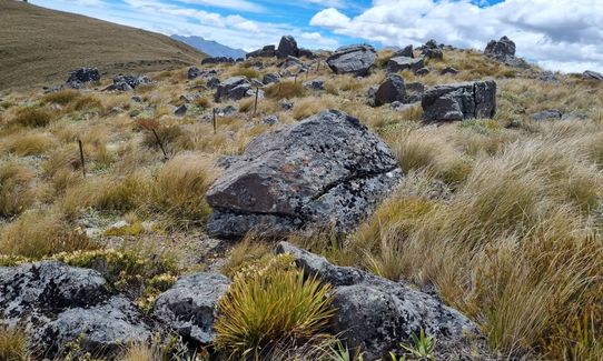
Open tussock/grasslands
Open ridges/tops
Farm Road / 4WD Track
Moderate Single Track
Untracked / Route only
Average Uphill Gradient: +12.6%
Average Downhill Gradient: -10.0%
VIP Feature: Send this route to your Garmin account so you can follow the course on your Garmin device.
Login as a VIP to see the trailhead information.
6:00
Slow
4:00
Moderate
3:00
Fast
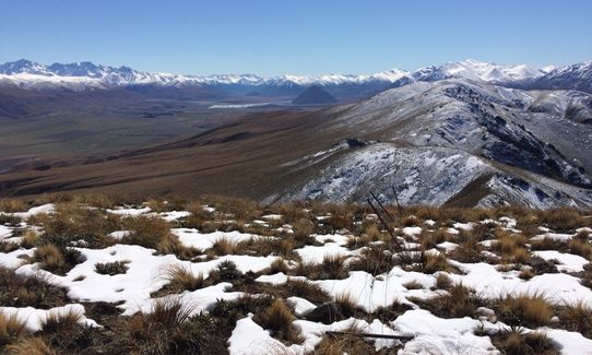
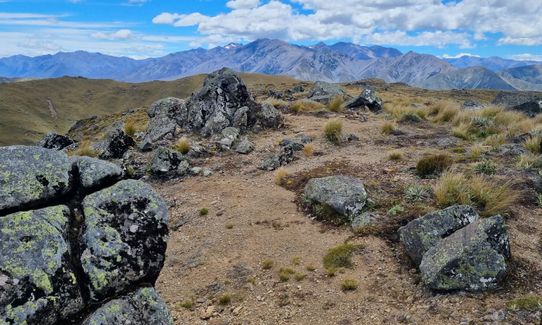
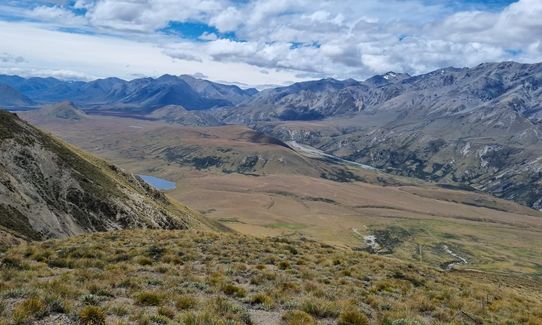
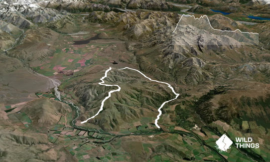
A short feature-length western set in the Haketere country, along the Clent Hills, and back Eastward then south, to near the start on a well-worn wagon trail. Tie up the horse (or bike) at the Stour river and mosey on a few miles up the road to coral the wagons at the marked Mt Barrosa carpark. Gallop up the well-marked track which passes around some rocky tors (watch for bandits) and on to the summit (1364m, about 50 mins from the wagons).
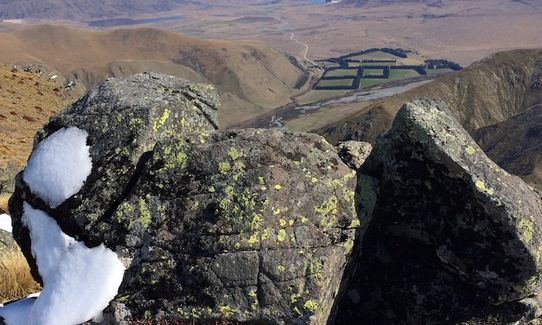
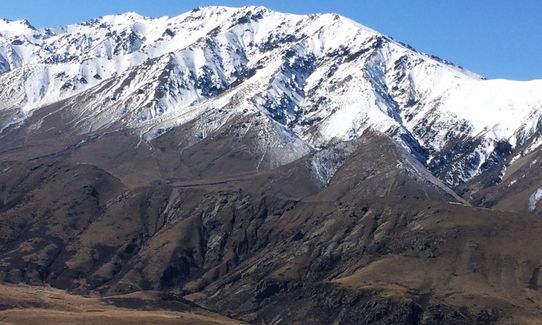
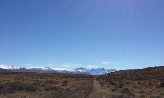
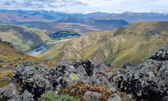
Great views in all directions, and it only gets better as you continue along the Clent Hills (follow the old fence-line, a relic of the old timers who used to farm these parts). An increasing number of ups and down will likely leave you a bit ‘saddle sore’, but eventually you top out with uninterrupted views north at 1331m (a good place to rest up, with some beef jerky and son-of-a-gun stew). Follow the ol’ fenceline as it drops down then forks right to steeply descent the valley floor, with a wagon track on the right of the fence half-way down. Follow this to near where the valley hits a small rise and pick up the Stour River track (look for red-topped markers).
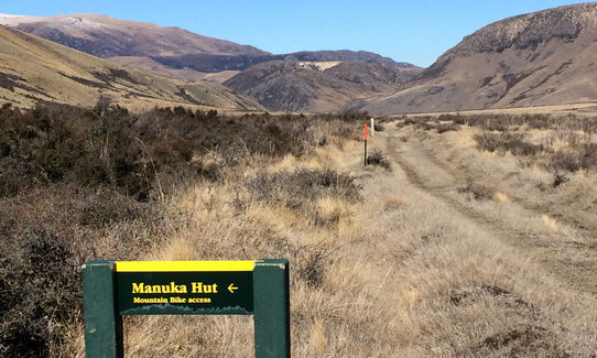
Gallop your way south-east for several miles, passing the turn-off to Manuka hut, then further down-valley pick up the obvious horse trail that winds up over a saddle (near where the track meets a stream). From there it’s a cruisy trot through meandering and occasionally gorged ‘ambush country’ back to the horse/bike. Keen cowboys/girls could extend this trip further by visiting Manuka hut en route (with the option of returning along the top of the Manuka Range).
This trail includes the peak Mount Barrosa.
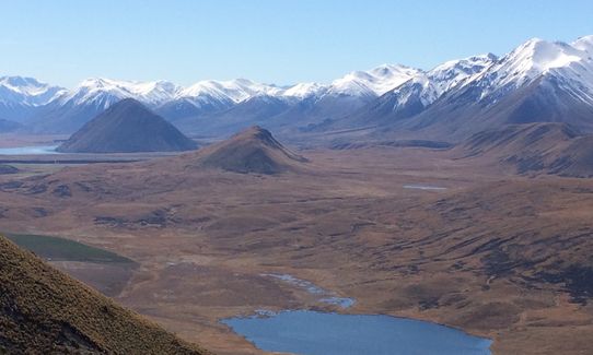
Outstanding views of the Arrowsmith mountains, Mt D'Archiac, the Taylor Range, Lake Heron and other lakes, and the southern Alps off in the distance.
If you know of any public toilets near the trail start or on the route, please login and then let us know so we can update this section.
Spacious carpark; safe.
19 km
14 minutes
Yes
No
Moderate.
Although you are following the old fenceline along the Clent Hills, this forks in several places, and while it is clear which way to go in clear visibility it might not be if cloud came in, so take a topomap.
Non-existent.
Long-sleeved thermal top, Seam-sealed waterproof jacket, Beanie/thermal headwear, Personal Locator Beacon (PLB), Whistle, First aid kit, Extra food for emergencies, Survival blanket, Cellphone, Map, Headtorch and spare batteries
No water on the tops - but plenty in the valley (Stour River and side-streams).
Snow will slow down progress along the Clent Hills. Also don't attempt in a nor'wester - note that there is no bush cover (or en-route huts) on this trip so you are exposed to the elements the whole way. Manuka Hut is a possible side-trip.
Staveley Store
Staveley
http://www.staveleystore.co.nz/
wonderful food and the best caramel milkshakes before Darfield
Trail Legend
Login as a VIP to become a Trail Legend. Learn about Trail Legends.
Fastest Known Times (FKTs)
You and Clent Eastward in “Barrosa”
As a VIP member you can record private notes for this trail, see all of your times and more.
Already have an account? Login now
These overlap with this trail to some degree. You may wish to combine them but please note that to qualify for FKTs on these runs you should record a separate activity for each.
Send to your phone
Scan the below QR code to open this trail on your phone.

Tip: position the QR code in your phone camera screen.


