Last Updated: 25th Apr 2024
Lockett loopish
Lockett Range, Mount Benson, Iron Hill
Cobb Valley Track, Sylvester Hut Track
Last Updated: 25th Apr 2024
Grunt Factor: 68 ?
Gnarl Factor: 60 ?
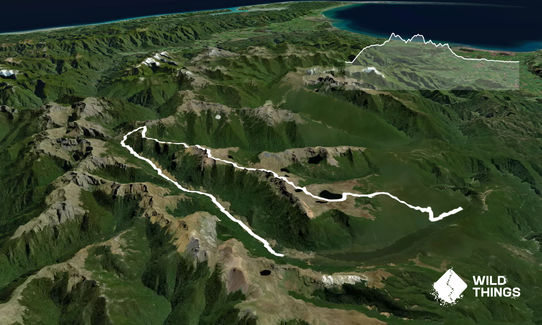
33.5km
2040m
2060m
Last Updated: 25th Apr 2024
Cobb Valley Track, Sylvester Hut Track
Last Updated: 25th Apr 2024
Grunt Factor: 68 ?
Gnarl Factor: 60 ?
33.5km
2040m
2060m
Front country - easily accessible
Loop
Very hilly
Native bush
Riverside
Lakeside
Open tussock/grasslands
Open ridges/tops
Easy Single Track
Technical Single Track
Untracked / Route only
Average Uphill Gradient: +12.1%
Average Downhill Gradient: -12.2%
Login as a VIP to see the trailhead information.
9:00
Slow
7:00
Moderate
6:00
Fast
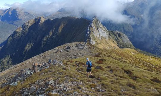
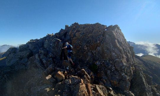
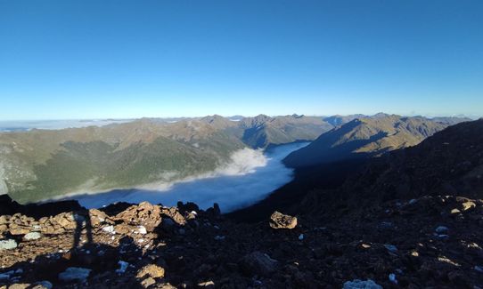
This route up the Lockett Range is mostly above the tree line with following a beautiful, infrequently followed ridge. The travel is mostly above the tree line or on good trail. The ridge scrambling is interesting, varied and never too difficult if you're careful about picking which way to to navigate the gendarmerie.
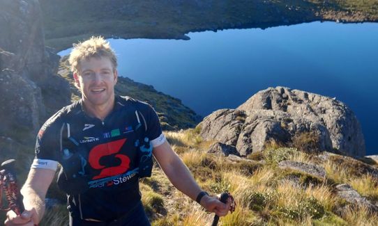
I recommend completing the route anticlockwise as it means you'll be past the exposed ridge earlier in the day - hopefully earning you photogenic, still air without wind chill.
From Sylvester Hut Track Car Park, climb ~500m to Sylvester Hut/Lake where you can fill up with water. Continue past Iron Lake on a cairned trail towards Iron Summit/Peak. From here you stay on the unmarked trail on the Lockett Ridge, past Mt Benson. Before Mt Waingaro, take an obvious cairned trail down past Fenella Hut and on to Trilobite car park.
This trail includes the peaks Iron Hill and Mount Benson.
You'll need at least one car to reach the Cobb Reservoir. There is easy parking at each end of the trail. To recover the car I closed the loop by running 8.5km of easy gravel road running, much of it shaded by manuka forest. Others may want to place a car at each end or grab a ride between the car parks.
63 km
95 minutes
No
No
Very hard.
All of the ridge travel should be carefully considered. There are frequently 3 options that should be considered carefully; left, right and over.
Patchy.
Waterproof leggings, Thermal leggings, Long-sleeved thermal top, Seam-sealed waterproof jacket, Gloves, Beanie/thermal headwear, Personal Locator Beacon (PLB), First aid kit, Survival bag, Cellphone, Map, Headtorch and spare batteries, Crampons / microspikes (for winter conditions)
There is little water on the Lockett ridge after Mt Iron.
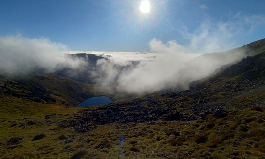
There are a few tarns after Mt Benson.
There is good running water on the trail about 1500m (trail distance) above Fenella hut.
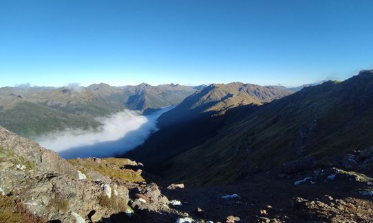
The route takes you up to 1700 metres and is on an exposed ridge for a long time. On a windy day it would be miserable/dangerous to be up there.
Don't fall off the ridge.
Trail Legend
Fastest Known Times (FKTs)
You and Lockett loopish
As a VIP member you can record private notes for this trail, see all of your times and more.
Already have an account? Login now
These overlap with this trail to some degree. You may wish to combine them but please note that to qualify for FKTs on these runs you should record a separate activity for each.
The Wild Things Trail Directory is proudly supported by 
Send to your phone
Scan the below QR code to open this trail on your phone.

Tip: position the QR code in your phone camera screen.


