Last Updated: 17th Oct 2025
Kahurangi Caper
Last Updated: 17th Oct 2025
Open
Grunt Factor: 78 ?
Gnarl Factor: 50 ?
42.1km
1950m
1950m
1460m
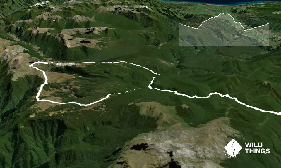
Trail Map
This Topo layer only covers NSW/ACT.
Switch to another map layer when viewing outside this area.
Switch to another map layer when viewing outside this area.


