Last Updated: 23rd Mar 2024
The Ellis
Last Updated: 23rd Mar 2024
Grunt Factor: 41 ?
Gnarl Factor: 67 ?
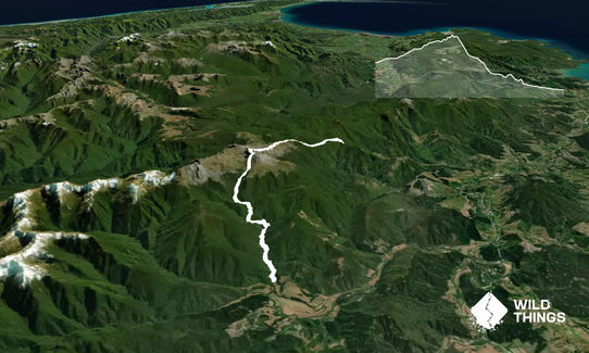
21.0km
1200m
1300m
1723m
Last Updated: 23rd Mar 2024
Last Updated: 23rd Mar 2024
Grunt Factor: 41 ?
Gnarl Factor: 67 ?
21.0km
1200m
1300m
1723m
Front country - easily accessible
Point to Point (one way)
Very hilly
Native bush
Riverside
Open tussock/grasslands
Open ridges/tops
Farm Road / 4WD Track
Easy Single Track
Moderate Single Track
Technical Single Track
Average Uphill Gradient: +11.7%
Average Downhill Gradient: -16.1%
VIP Feature: Send this route to your Garmin account so you can follow the course on your Garmin device.
Login as a VIP to see the trailhead information.
9.0:00
Slow
7.0:00
Moderate
4.0
Fast
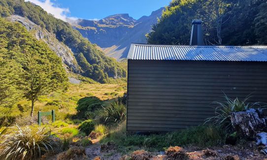
From Flora/Mt Arthur Carpark the track climbs on smooth gravel thru beech forest to Mt Arthur Hut just on the bush line. Fill your water bottles here (beware in summer the water tank can run dry) Then track climbs in the open across Karst rocks and tussocks towards the top of Mt Arthur.
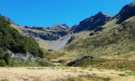
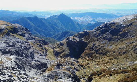
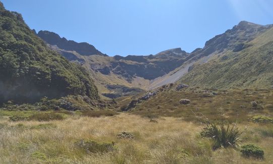
Just below the summit the track into the Ellis Valley turns off to the Left/East. The track crossess more open Karst rock then begins a steep descent into the huge Ampitheatre of the Ellis Basin. All along these exposed tops there are stunning views in all directions over the mountains of Kahurangi, Nelson Lakes, Richmond ranges and the distant high peaks of the Kaikouras plus out to Tasman Bay and Abel Tasman National Park. Don't under estimate these open tops as they are exposed to all weather and you are committed to several hours out on them, plus there is no water until Ellis Hut.
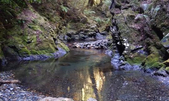
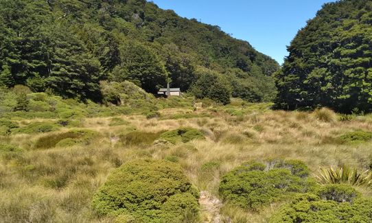
After a very steep descent into alpine tussock and Spaniard grass you arrive at the beautifully located Ellis Basin Hut, a lovely little 6 Bunk Hut have lunch and look at the stunning basin. Then tighten your laces for the rough, uneven, leg twisting rooty descent into The Ellis valley. The route is well marked but is just a route. There is no formed/benched track here as it drops and sidles its way to the Ellis River. It is slow going and very rarely can you run, but eventually you reach the valley floor and after many river crossings you reach the valley road.
Don't attempt this run in bad weather due to the exposure on the tops and the fact that the Ellis River can flood very quickly.
Mt Arthur Karst/Limestone Landscape many open Tomos (holes) Large open Alpine Basin with stunning views over Tasman District.
If you know of any public toilets near the trail start or on the route, please login and then let us know so we can update this section.
Parking is plentiful at Flora Saddle Carpark though at hoilday weekends it can be full with over 40 cars. At the other end in Ellis Valley there is plenty of parking in a valley that's not busy.
31 km
43 minutes
Unknown
No
Moderate.
Track is well marked, though in winter snow poles can be burried or knocked over by avalanches. Be careful after storms in the Ellis Valley as windfalls can hide markers.
Very patchy.
Thermal leggings, Lightweight fleece top, Short-sleeved thermal top, Long-sleeved thermal top, Seam-sealed waterproof jacket, Windproof jacket, Beanie/thermal headwear, Personal Locator Beacon (PLB), Whistle, First aid kit, Extra food for emergencies, Survival bag, Survival blanket, Cellphone, Compass, Map, Crampons / microspikes (for winter conditions), Gaiters
The first 9 kms are devoid of water except for Mt Arthur Hut but the Hut is very popular and in the heat of summer the water in the tank runs out. The last 6 kms you are in and out of the river several times.
In winter this trip can be dangerous with high Avalanche Danger in the Ellis Basin. Also the ridge up Mt Arthur cops weather from all directions, so take plenty of good gear at any time of the year.
Weather and open exposure and the Ellis River during and after heavy rain.
Smoking Barrel Cafe
Motueka
Nice food real nice.
Riverside Cafe
Lower Moutere
Nice food Nice Garden location
Jester House
Tasman
Tasman District Classic Cafe for fine food lovely setting
Fastest Known Times (FKTs)
You and The Ellis
As a VIP member you can record private notes for this trail, see all of your times and more.
Already have an account? Login now
JN
FYI: In 2023 volunteers added a water tank to the Ellis Hut. In Feb2025 the stream was dry for more than an hour below the Hut.
February 25
Stunning day out. Amazing scenery. Not a lot of running to be had, great fun. Ellis Hut may not have water but stream starts flowing about 1.5 km after hut. Some great swimming holes by the ford on the upper Baton Valley Road once you're done.
February 20, 2021
These overlap with this trail to some degree. You may wish to combine them but please note that to qualify for FKTs on these runs you should record a separate activity for each.
Send to your phone
Scan the below QR code to open this trail on your phone.

Tip: position the QR code in your phone camera screen.


