Last Updated: 21st Sep 2023
Resurgence Bound
Last Updated: 21st Sep 2023
Open
Grunt Factor: 21 ?
Gnarl Factor: 48 ?
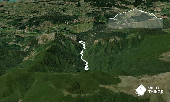
12.4km
525m
525m
Last Updated: 21st Sep 2023
Last Updated: 21st Sep 2023
Open
Grunt Factor: 21 ?
Gnarl Factor: 48 ?
12.4km
525m
525m
Front country - easily accessible
Out and Back
Undulating, small hills only
Native bush
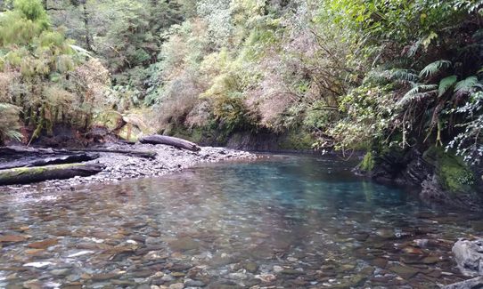
Riverside
Easy Single Track
Moderate Single Track
Technical Single Track
Average Uphill Gradient: +7.9%
Average Downhill Gradient: -7.8%
VIP Feature: Send this route to your Garmin account so you can follow the course on your Garmin device.
Login as a VIP to see the trailhead information.
Not suitable
Slow
3:45
Moderate
3:00
Fast
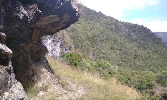
Track easy to follow with markers, but is technical in places and has 11 river crossings so care is required.
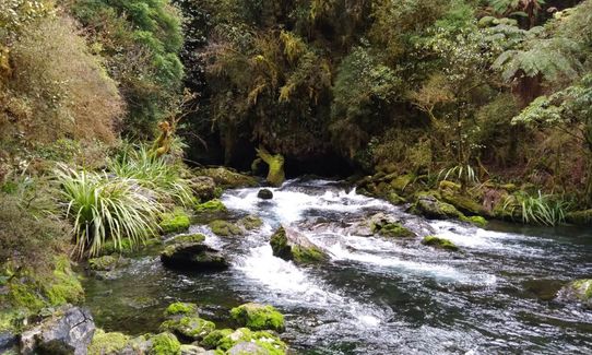
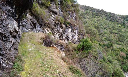
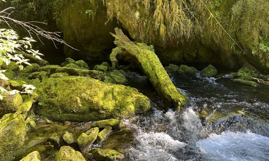
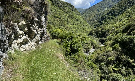
Cross the ford 20m after the start of the track (no dry feet on this run) and follow a well formed track for approx. 2.8km where you cross back onto the true left of the river. After approx. 1km the first of 9 more river crossings is reached. After 2km more you will reach a small grassy clearing. Resurgence is 20m further up. Track is well marked, but gets progressively more technical as you head further up the valley. River crossings are not too tricky, but care and experience at rivers crossings is required if doing solo.
Not to be attempted during or after heavy rain. Keep your eyes peeled for whio and in summer take a dip in one of the many beautiful swimming holes.
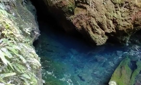
Pearse Resurgence - Part of the Nettlebed cave system. Has been dived to a depth of 194 m. Link to a previous dive attempt.
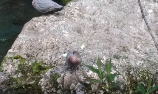
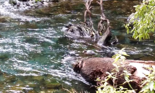
Home to several pairs of beautiful whio.
If you know of any public toilets near the trail start or on the route, please login and then let us know so we can update this section.
Parking for several cars by the DoC sign at start of track and a couple extra back 50m. Please park clear of ford as this provides access to houses.
30 km
33 minutes
Unknown
No
Easy.
No navigation issues
Non-existent.
Long-sleeved thermal top, Seam-sealed waterproof jacket, Gloves, Beanie/thermal headwear, Personal Locator Beacon (PLB), Whistle, First aid kit, Extra food for emergencies, Cellphone, Map
Beautiful clear water to drink all the way.
No.
Water cold year round. Not to be attempted during rain or after heavy rain as river crossings will potentially be dangerous. Some experience at river crossings advised and required if doing solo.
Toad Hall
502 High St Motueka - Main roundabout into Motueka from south.
https://www.toadhallmotueka.co.nz/
Onsite brewery and great food.
The Moutere Inn
1406 Moutere Highway, Upper Moutere - Inland road between Motueka and Nelson
https://www.moutereinn.co.nz/
New Zealand's Oldest pub in it's original building (opened in 1850).
Nice selection of craft beers.
Fastest Known Times (FKTs)
You and Resurgence Bound
As a VIP member you can record private notes for this trail, see all of your times and more.
Already have an account? Login now
ED
I parked at the spot where there's signage saying the council doesn't maintain the rest of the road. Current condition would of been easily traveled with a 2wd, it was similar to the earlier gravel road.
A real adventure track. Short sections of single track to run, and many river crossings!
1 x Ongaonga sting.
January 15, 2023
I’m really glad I read the previous review and wore calf sleeves as a layer of protection, they were a big help but next time I’d go for full gaiters.
It’s hard to stick to the track as it’s overgrown and the markers aren’t clear but as it follows a river you’d be hard pressed to get lost.
I’d stick to summer month if eyeing up this run as you spend a lot of time in the river, great when it’s hot though.
January 9, 2023
Lovely adventure trail but omg! please watch out for the Ongaonga- eg wear long trousers, long sleeves and even gloves. The river crossings are fun. For the adventurous and well prepared half an hour further up the left hand branch (right hand branch is the resurgence) is the dry entrance to Nettlebed cave -one of NZ's deepest and longest.
November 24, 2021
Send to your phone
Scan the below QR code to open this trail on your phone.

Tip: position the QR code in your phone camera screen.


