Last Updated: 30th Dec 2024
Mt Arthur - Flora Huts
Last Updated: 30th Dec 2024
Open
Grunt Factor: 16 ?
Gnarl Factor: 28 ?
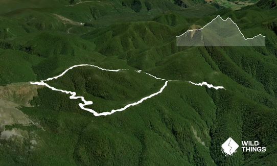
9.2km
545m
545m
1350m
Last Updated: 30th Dec 2024
Last Updated: 30th Dec 2024
Open
Grunt Factor: 16 ?
Gnarl Factor: 28 ?
9.2km
545m
545m
1350m
Front country - easily accessible
Loop
Undulating, some big hills
Native bush
Riverside
Open ridges/tops
Farm Road / 4WD Track
Easy Single Track
Moderate Single Track
Average Uphill Gradient: +11.2%
Average Downhill Gradient: -14.9%
VIP Feature: Send this route to your Garmin account so you can follow the course on your Garmin device.
Login as a VIP to see the trailhead information.
2:00
Slow
1:30
Moderate
1:00
Fast
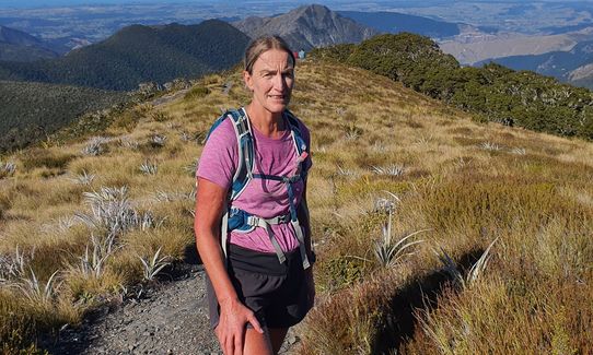
From Flora car park follow the track to Flora Saddle where a well-graded track follows the ridge towards Mt Arthur, winding through beech forest and groves of candelabra-like mountain neinei (Dracophyllum sp.). Mt Arthur hut sits on the bushline at approx. 1,300 m.
100m past the hut you will come to an intersection with signs to Mt Arthur Summit. Follow this for 5min to reach a plateau with rock cairn for views to Mt Arthur and the Tablelands. These are the best views of the Tasman Bay and Kahurangi National Park. Head back down and at the same intersection follow the signs to Flora Hut. This is a more technical, steeper trail through beech forest and alpine scrub than the one up to Mt Arthur hut.
Once at the hut you follow a very easy graded wide trail/road back to the carpark. 500m past the hut there is access to a delightful swimming spot which makes for a great cooldown in summer with enough time left to dry off before you get into your car. If you enjoy an easy trail up and don't mind picking your way down technical trail then do the route as described. If you enjoy a gnarlier climb up and love speed and flowing trails for the downhill then do it in reverse, though if you want to end with a swim you'll have to backtrack 1km towards Flora Hut!
Care is required around the many bluffs, sinkholes and caves
Enjoy views over Wharepapa/Arthur Range and Tasman Bay a short distance from the hut. Watch out for curious weka around the hut. Flora hut is a quaint old style hut built in 1927. Toilets and water can be found at Flora Carpark and at the Mt Arthur Hut.
If you know of any public toilets near the trail start or on the route, please login and then let us know so we can update this section.
Parking at Flora Carpark. Own vehicle (4 wheel drive recommended) required. Can be very busy in the summer months.
33 km
44 minutes
No
No
Easy.
Sign posts are at all the junctions.
Non-existent.
Long-sleeved thermal top, Whistle, First aid kit, Extra food for emergencies, Cellphone, Map
Water at Mt Arthur hut tho it does say to boil first. Water from stream at Flora Hut.
The small section of trail above the bushline at Mt Arthur hut would be exposed in extreme weather given its altitude. Rest of trail is within the bushline for the most part.
Trail Legend
Login as a VIP to become a Trail Legend. Learn about Trail Legends.
Fastest Known Times (FKTs)
To qualify for FKTs you must tag the rock cairn just above Mt Arthur hut (see Detailed Description)
You and Mt Arthur - Flora Huts
As a VIP member you can record private notes for this trail, see all of your times and more.
Already have an account? Login now
These overlap with this trail to some degree. You may wish to combine them but please note that to qualify for FKTs on these runs you should record a separate activity for each.
Send to your phone
Scan the below QR code to open this trail on your phone.

Tip: position the QR code in your phone camera screen.


