Last Updated: 21st Sep 2023
Leslie Karamea Wangapeka Ultra
Last Updated: 21st Sep 2023
Open
Grunt Factor: 156 ?
Gnarl Factor: 65 ?
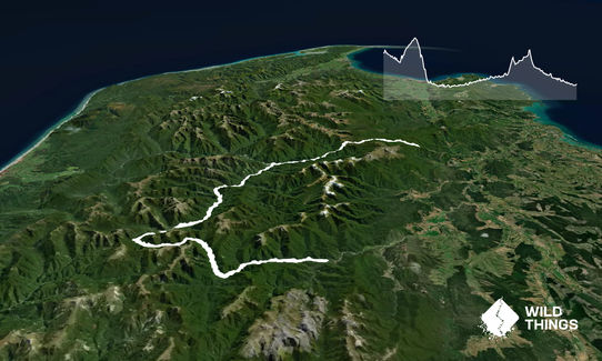
96.3km
3200m
3800m
1400m
Last Updated: 21st Sep 2023
Last Updated: 21st Sep 2023
Open
Grunt Factor: 156 ?
Gnarl Factor: 65 ?
96.3km
3200m
3800m
1400m
Back country - remote
Point to Point (one way)
Mountainous
Native bush
Riverside
Open ridges/tops
Other
Easy Single Track
Moderate Single Track
Technical Single Track
Untracked / Route only
Average Uphill Gradient: +8.0%
Average Downhill Gradient: -9.4%
Login as a VIP to see the trailhead information.
30:00
Slow
24.00:00
Moderate
18.00
Fast
This is a bizarre ultra and only for the serious. Definitely for very experienced, well equipped runners and expect anything as you travel through this wilderness.
WEATHER IS CRITICAL, check the forecast and also check recent west coast rain as this is an area that gets a tremendous amount of it.
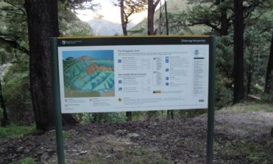
A very pre-dawn start at Flora gets you some good runnable country under your belt before the sun comes up, daybreak on the tablelands is quite cool, neat spot on top of the world. Here's how it goes:
Mt Arthur Section
- Flora Carpark to Flora Hut - easy section of track, very runnable.
- Flora Hut to Salisbury Hut - steady climb up to Salisbury and the tablelands. Runnable
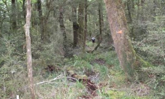
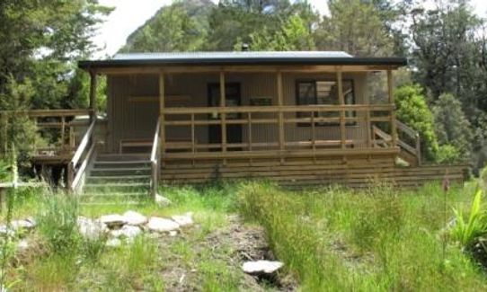
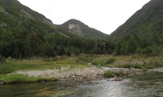
- Salisbury Hut to Karamea Bend Hut - big drop off Tablelands and down to the bend. Cool rock shelter on the way. Subject to windfalls, generally runnable
Karamea Valley Section
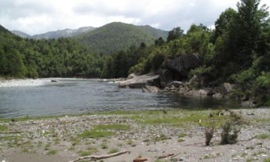
- Karamea Bend Hut to Crow Hut - undulating, up and down following Karamea river, take the track as you find it
- Crow Hut to Venus Hut - undulating, up and down following Karamea river, take the track as you find it
- Venus Hut to Thor Hut - undulating, up and down following Karamea river, take the track as you find it
- Thor Hut to Trevor Carter Hut - undulating, up and down following Karamea river past slips and a lake, take the track as you find it
- Trevor Carter Hut to Helicopter Hut - good grunt up lost valley and then nice drop through trees to helicopter hut. Cross river to hut.
Wangapeka track section
- Helicopter Hut to Stone Hut - climb up to Wangapeka Saddle, then drop steeply off saddle and down valley to Stone Hut
- Stone Hut to Kings Creek Hut - follow river down valley to Kings Creek Hut,
- Kings Creek Hut to Rolling River Hut - track improves every km closer to end, runnable if there is anything left in the tank.
Incredible earthquake torn valley as you travel up the Karamea River. Most of the huts are upgraded but there is some New Zealand Forest Service huts like Thor Hut, the last remaining NZ Forest Service hut in the Upper Karamea. Evidence of gold mining and huts can be seen on the Wangapeka section.
If you know of any public toilets near the trail start or on the route, please login and then let us know so we can update this section.
Carpark for maybe 20 cars, often quite full. Graham Valley Road is frequently shut with slips so check before travelling.
31 km
44 minutes
Unknown
No
Extreme.
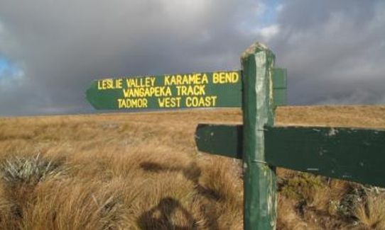
Watch out for where the track changes, in particular getting the right track from the Salisbury hut into the Leslie valley and then navigating lost valley onto the Whangapeka track at Helicopter Hut. Apart from that its a very consistent "follow your nose" for a long long time!
Non-existent.
Thermal leggings, Long-sleeved thermal top, Seam-sealed waterproof jacket, Gloves, Beanie/thermal headwear, Personal Locator Beacon (PLB), Whistle, First aid kit, Extra food for emergencies, Survival blanket, Cellphone, Compass, Map, Headtorch and spare batteries, Gaiters
Once you are in the Karamea Valley water is no problem, rivers are incredible. The first section from Flora and the Tablelands are dry.
This is a recommended 9 day track and not used a lot, slightly more people traffic on the Flora end and Wangapeka end but still very remote. Best done in a good window of weather in mid summer and expect to spend time using headlights either end.
This track is serious wilderness, do not attempt to run if there has been any west coast rain for a few days prior as the rivers can be huge and the mud / track is extreme. Expect to spend a lot of time picking your way through rough spots. If you end up doing it in the dark at either end, make sure you have a running partner and you spend time on the river crossings finding the track markers before you move on. Do not underestimate.
Four Square Tapawera
92 Main Rd Tapawera, Tapawera 7055
Has everything you might or might not need after a run like this, except a shower and bed
Fastest Known Times (FKTs)
You and Leslie Karamea Wangapeka Ultra
As a VIP member you can record private notes for this trail, see all of your times and more.
Already have an account? Login now
These overlap with this trail to some degree. You may wish to combine them but please note that to qualify for FKTs on these runs you should record a separate activity for each.
Send to your phone
Scan the below QR code to open this trail on your phone.

Tip: position the QR code in your phone camera screen.


