Wild Things - New Zealand's trail running community
New Zealand's trail running community

Login


don't have an account?

Northern Tararua Traverse, Manawatu - Wanganui

Trail Directory proudly supported by Further Faster

Update Your Header Picture

Northern Tararua TraverseIntermediate - Experienced

Submitted by Tim Carpenter

Info Info
Map Loading

Trail Information

71.00km

2170m

2112m


Manawatu - Wanganui

Palmerston North

Front country - easily accessible

Loop

Undulating, some big hills

Native bush
Open tussock/grasslands
Open ridges/tops

Intermediate - Experienced

Not Suitable (Slow)
10:00 (Moderate)
8:00 (Fast)

-7.2%

+7.7%

Nov 2019: Due to construction of the new wind farm on South Range road there is strictly no access to South range in order to complete this run

Download PDF Guide

Fastest Known Times (FKTs)

Please set your gender to see your position on the FKT leaderboards.

Men

There are currently no male FKTs for Northern Tararua Traverse.

Women

There are currently no female FKTs for Northern Tararua Traverse.

Filter FKTs

The more , the harder the FKT will be to beat. Learn about Fastest Known Times.

Missing your time?

Register or login as a VIP and get yourself on the FKT leaderboard!

Register Now

Description

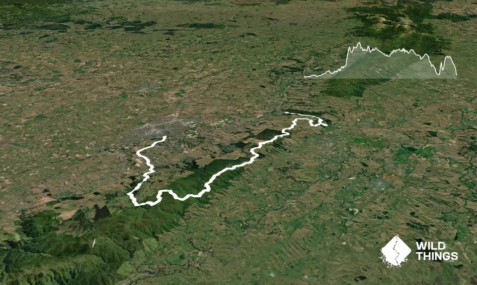
This is a traverse of the northern-most section of the Tararua's, finishing with the Manawatu Gorge Track.

Start at Fitzherbert Ave Bridge, and run out of town on SH54, before turning Left into Old West Road, and then Right onto Kahutarewa Road. Follow Kahutewara Road to the end. This is where the seal finishes and single trail begins. Continue onto the L) side trail of the sledge track, continuing for around 2.8km until turning L) up the hill to The Elevation and Hardies Park. It is approximately 400m climb up The Elevation.

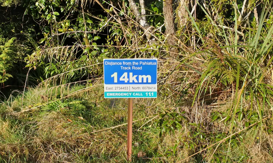
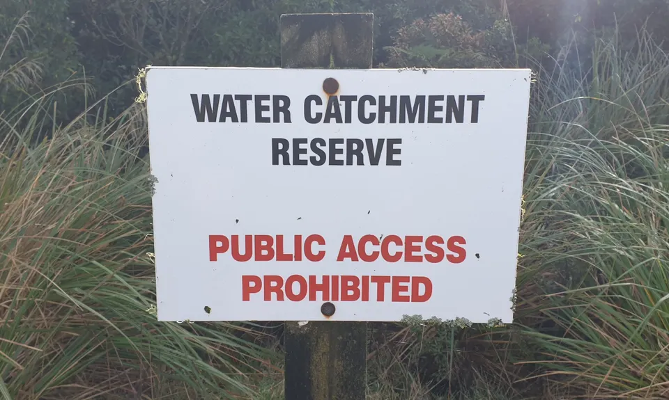
Once at the top, turn R) at Toe Toe Junction, and continue along the trail (marked with Orange triangles) until reaching a large rocky outcrop and a LARGE triangle pointing to the R). This is after crossing the 2 Toe Toe swampy sections and having a steady uphill. This brings you onto South Range Road, turn R) and continue on the gravel road for 15km (you will have to climb the gate at 12km along the road, as area is closed to traffic due to being Palmerston North Water Catchment Area), and reach the Pahiatua Track, before crossing onto the North Range Road.

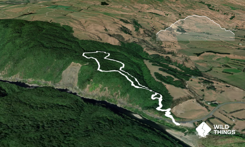
The gravel road continues, undulating wtih puddles and mud, until you reach the 5km downhill of Hall Block Road. At the bottom cross to Beyond the Bridge Cafe [NOW CLOSED] and then continue toward Woodville, reaching the signs for the Manawatu Gorge Track. Climb up and over the 11km of single track to finish at the carpark on the Ashhurst end of the Gorge to finish. If you want to keep going, it is another 15km along limestone and sealed pathways to complete the Northern Tararua Loop.


Trail Community

Find people who are interested in this run.

You must register or login to view this content.


Make Up of Run

Moderate Single Track: 25%

Gravel Road: 50%

Sealed Road: 25%


Route Data

Reviews:

You must register or login to view this content.


Overlapping Runs

The following trails overlap with this run to some degree. You may wish to combine them but please note that to qualify for FKTs on these runs you should record a separate Strava activity for each


Photos:

You must register or login to view this content.

Your Trail Wishlist

All the runs that are on your To Do list (no limit).

Add to wishlist view wishlist

Your Trail Dreamlist

The runs you most want to do (limited to 10).

Add to dreamlist view dreamlist

Wild Explorers

I did it!
  • Access

    Park at Fitzherbert Ave Bridge on Centennial Drive.
    Alternate start point is to get dropped off at the end of Kahutarewa Road

    4 km

    8 minutes

    No

    No

  • Staying Safe

    Moderate.

    When on the single track of Toe Toe Loop, pay attention to where you are going and to the Big Triangle needed for exit to South Range Road

    Patchy.

    Long-sleeved thermal top, Seam-sealed waterproof jacket, Windproof jacket, Gloves, Beanie/thermal headwear, Whistle, First aid kit, Extra food for emergencies, Cellphone, Map.

    There is no water available until 2/3 along North Range Road (~50km in) on the L) side of road, with water tank present.
    At top of Gorge Track (sign posted windmill) there is a long drop which has a water tank attached to it.
    Carry plenty of you own!

    Can be cold and exposed along the ridge lines.

  • Sponsor this trail

    If you are interested in learning about sponsorship opportunities, please get in touch below:

    Submit

Got a favourite trail? Tell us about it.

Share the love and add your favourite trail(s) to our growing trail directory.

Submit A Trail

Become a member today

Start enjoying the many benefits to becoming a member of our thriving community.

Become a member

Great brands at great prices with our VIP member's discount

Stay up to date

Sign up to our newsletter for latest offers and trail guides

Share this trail with a friend:

VIP Membership

Please register as a VIP or login to your VIP account to view this content.

Cancel Login Register

Membership Required

You can see up to three trail guides without being logged in but after that we require you to be logged in to your Free or VIP account. If you don’t yet have an account you can register here.

Login Register