Last Updated: 4th Feb 2026
Dumb-bell Lake Loop
Last Updated: 4th Feb 2026
Open
Grunt Factor: 62 ?
Gnarl Factor: 80 ?
26.0km
1775m
1775m
1975m
Last Updated: 4th Feb 2026
Last Updated: 4th Feb 2026
Open
Grunt Factor: 62 ?
Gnarl Factor: 80 ?
26.0km
1775m
1775m
1975m
Front country - easily accessible
Loop
Mountainous
Native bush
Open tussock/grasslands
Open ridges/tops
Farm Road / 4WD Track
Easy Single Track
Technical Single Track
Untracked / Route only
Average Uphill Gradient: +14.70%
Average Downhill Gradient: -17.30%
VIP Feature: Send this route to your Garmin account so you can follow the course on your Garmin device.
Become a VIP Member to see the trailhead information.
8:00
Slow
6:00
Moderate
4:30
Fast
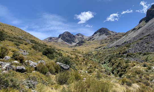
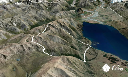
From Parsons Creek car park take trail to A2O, follow this for a few kms to Freehold Creek, take signed trail up creek which is part of Te Araroa trail and is beautiful.
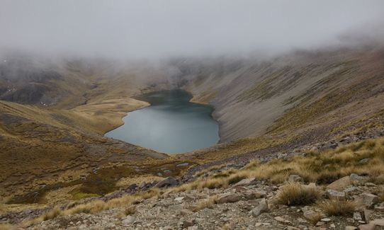
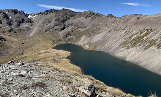
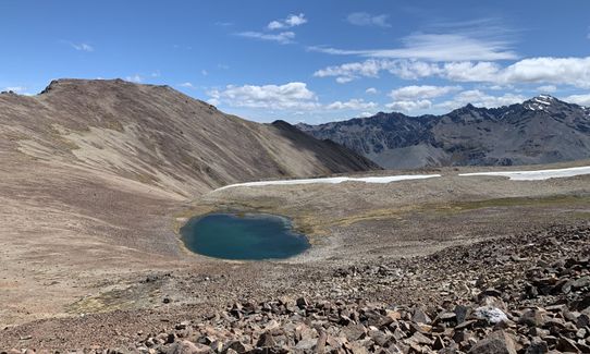
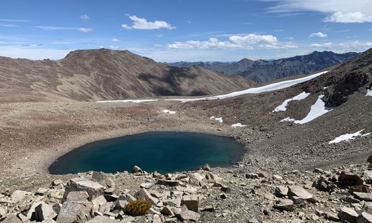
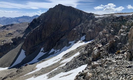
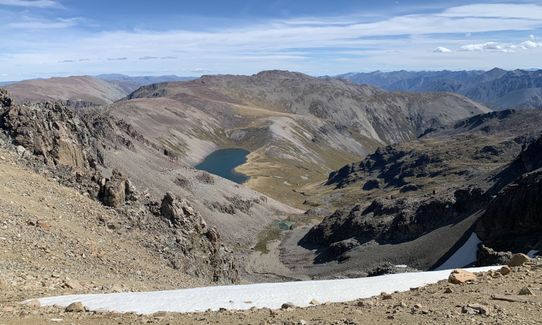
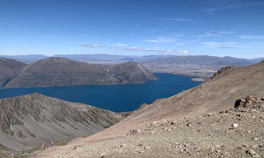
Once above tree line, a well cairned route that veers right (dont follow Te Araroa) will show way to the ridge. From here take a path of least resistance over a couple rolling basins and tarns until you are above Dumb-bell Lake. I dropped down to the lake for a drink (you could also stay on the ridge), pass on western side and continue up into steep basin behind Mt.Sutton.
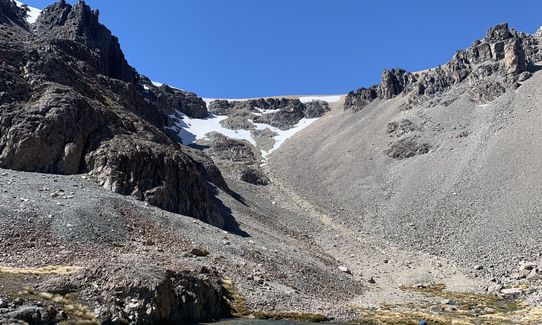
Climb scree slope that looks friendliest and cross the wide saddle that separates you from Ohau skifield. Drop into skifield using whatever slope looks best heading for base station. From here I take the old ski field road which is a bit eroded but more fun and is a more direct line in the gut of the valley. Once out the bottom take A2O back to Parsons Creek car park or more interestingly follow vague trails across Ohau "front country" till you get to Parsons. Job done
Running up Freehold stream, taking ridge line and descending onto pristine Dumb-bell lake, climbing out of climbing cirque behind Mt.Sutton, sidling it and dropping into Ohau skifield. Utilising A2O once down at lake level.
If you know of any public toilets near the trail start or on the route, please login and then let us know so we can update this section.
Free parking
34 km
26 minutes
Unknown
No
Moderate.
Above freehold tree line, take cairned route to right, don't follow Te Araroa
Very patchy.
Thermal leggings, Long-sleeved thermal top, Windproof jacket, Beanie/thermal headwear, Whistle, First aid kit, Extra food for emergencies, Cellphone, Map
Freehold creek, tarns up top, Dumb bell lake, stream below Mt. Sutton, I wouldn't drink below skifield
Snow in winter, issues with avalanche, navigation on ridge in white out
Large boulders sometimes unstable
Do you have a suggestion on where to go afterwards for the best coffee / cake / breakfast / brunch / beer?
Trail Legend
Login as a VIP to become a Trail Legend. Learn about Trail Legends.
Fastest Known Times (FKTs)
You and Dumb-bell Lake Loop
As a VIP member you can record private notes for this trail, see all of your times and more.
Already have an account? Login now
Beautiful alpine terrain! Dumb bell lake was beautiful and a great place to stop for a swim.
I would recommend downloading the gpx as it’s not always that straight forward. I found the decent down to the Ōhau ski field the worst part because it’s just unstable rock - rather than scree. I ended up going down the main ski field road since it didn’t look like much of a trail to go the other way and I figured it would be faster. I ended up doing 29kms and 2100m elevation but I did get lost and end up going up and down an extra ridge!
I would love to do it again and camp at Dumb-bell lake and go back the same direction
March 2
Amazing route, good variety of trails and terrain, beautiful views from the top ridges. Dumbbell Lake is beautiful. I took the old Ohau ski field access road, which was pretty deteriorated and overgrown in places, but doable.
December 24
A great run. A nice mix of terrain. The trail up to the ridge is poled and has a worn trail so is easy to follow. Navigation is simple along the ridge but you'd want a fine day. Lots of tarns and it was way more spectacular than I had anticipated. I also just took the ski field road down- the views were pretty good. The 'shortcut' tracks at the bottom were a bit vague and in summer there's a lot of bracken and vegetation so it's probably quicker just to follow the A20/ marked trails back.
December 16, 2023
Send to your phone
Scan the below QR code to open this trail on your phone.

Tip: position the QR code in your phone camera screen.
Plan smarter, stay motivated, track your progress, and unlock the full Wild Things experience — while saving along the way.