Last Updated: 26th Jul 2024
East Whakanui loop
Last Updated: 26th Jul 2024
Open
Grunt Factor: 66 ?
Gnarl Factor: 92 ?
19.7km
2010m
1990m
800m

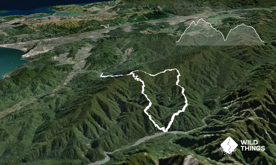
Trail Map
This Topo layer only covers NSW/ACT.
Switch to another map layer when viewing outside this area.
Switch to another map layer when viewing outside this area.


