Last Updated: 18th Dec 2023
South Main Range Loop
Last Updated: 18th Dec 2023
Open
Grunt Factor: 128 ?
Gnarl Factor: 87 ?
47.0km
3900m
3900m
1408m
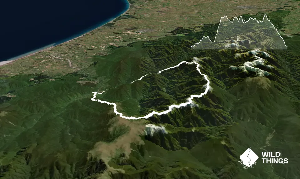
Trail Map
This Topo layer only covers NSW/ACT.
Switch to another map layer when viewing outside this area.
Switch to another map layer when viewing outside this area.


