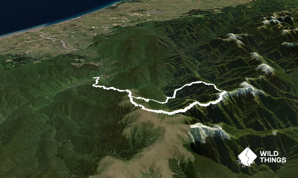
From the Ōtaki Forks car park, follow the signs to Field hut along Field Track as it crosses the Waiotauru footbridge and climbs steadily. Just above Field hut, you break out onto the tops and about 1.5km further on, a sign directs you off to the left to Penn Creek Hut. Ignore the warning signs of wash outs (this is for the route along Penn Creek back to the main car park).
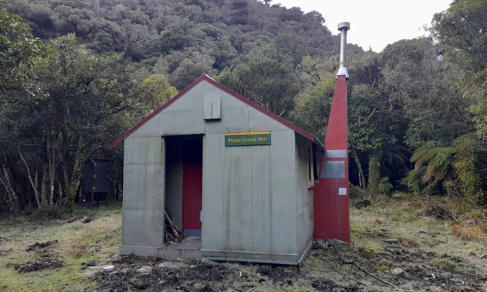
The track goes straight down before it levels out for a while before Penn Creek Hut. Two minutes beyond the sign that directs you to the route across across the river and up Pakihore Ridge is Penn Creek Hut. Head to the hut, and sign the hut book before taking on Pakihore Ridge.
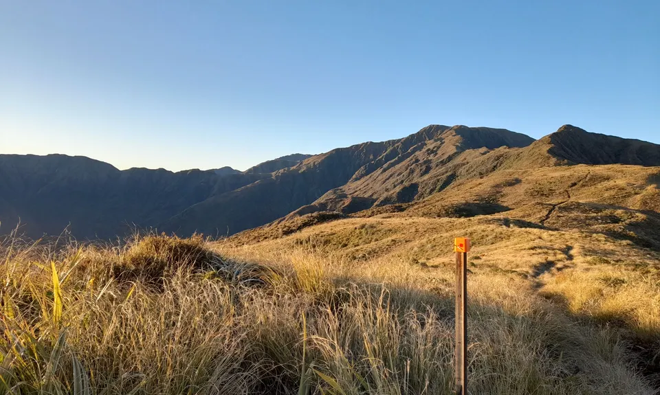
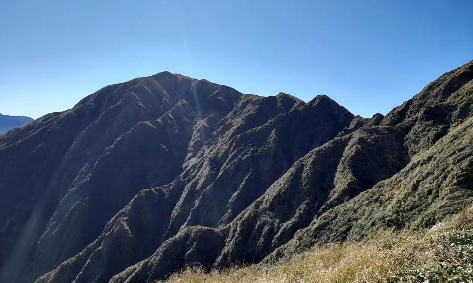
Across the river, the track is a muddy, steep scramble that's hard to follow. However, it is marked and it does improve. It's long and relentless. Out of the bush, snow poles mark the route to the main range, and the sign post pointing right towards Kime Hut. Follow the ridgeline, keeping an eye out for the poles in bad weather.
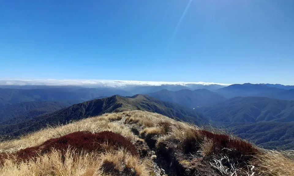
At Bridge Peak, hang a right until you hit the main Southern Crossing route and the sign pointing back to Field hut. The rest of the route is straight forward.
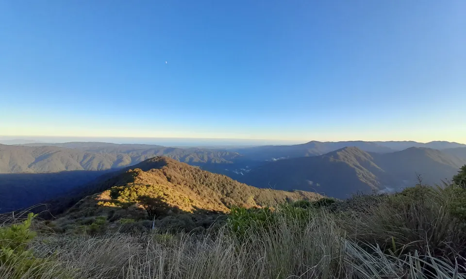
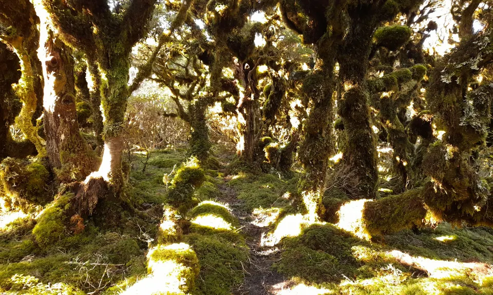
The route takes you up Field Track to Table Top past the historic Field hut, one of the first purpose built tramping huts in the country, and is the oldest surviving recreational hut in the Tararua Ranges. This is also the start of the popular Southern Crossing route. Along the bush sections of the route, listen out for whitehead, riflemen, kākāriki, along with many other native birds common along the tracks. During summer you'll hear both shining and long tailed cuckoo. Pakihore Ridge has some amazing bush and goblin forests.
If you know of any public toilets near the trail start or on the route, please login and then let us know so we can update this section.
There is no public transport. The main car park is at Boielle Flat, and this is the closest to the start of the tracks. It is the least secured, so if you're planning on spending the night at a hut along the way, park at the rangers house (the next left along the road). There is no cell phone reception here, but you can use the phone up at the rangers house for emergencies/flat car batteries/something more drastic.
18 km
30 minutes
Yes
No
Hard.
Once on the main range (McIntosh to Bridge Peak) the trail can easily be lost in bad weather and you could end up heading down the wrong spur. Don't attempt this if you're not confident in this sort of terrain.
Water is available at the main car park, Field hut, and Penn Creek and Penn Creek hut. Signs suggest treating all water, it's drinkable, but if you're one to err on the side of caution, throw in some purification tablets. The water at the huts can taste nasty due to fires and soot run off from the roof.
During winter there is likely to be snow along the tops. The whole route is likely to be muddy year round. If it's going to be windy, you'll probably be unable to stand along the tops. Best weather window is usually straight after a southerly storm.
People die almost yearly up in these parts of the Tararua Ranges, so don't take it lightly.
This is a technical route, and whilst it's mostly runable, almost everywhere along it is trying to break you. If it's raining, you may not be able to cross Penn Creek.
Do you have a suggestion on where to go afterwards for the best coffee / cake / breakfast / brunch / beer?
These overlap with this trail to some degree. You may wish to combine them but please note that to qualify for FKTs on these runs you should record a separate activity for each.
We don't store or share your location; it's only used for these features. You can continue without it, just without distance sorting and live map features.
Send to your phone
Scan the below QR code to open this trail on your phone.
Tip: position the QR code in your phone camera screen.