Last Updated: 8th Jul 2024
Pureora Double
Submitted by Malcolm Law
Last Updated: 8th Jul 2024
Grunt Factor: 30 ?
Gnarl Factor: 46 ?
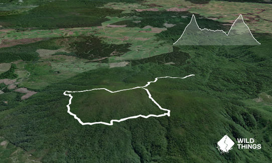
11.4km
690m
690m
1165m
Last Updated: 8th Jul 2024
Submitted by Malcolm Law
Last Updated: 8th Jul 2024
Grunt Factor: 30 ?
Gnarl Factor: 46 ?
11.4km
690m
690m
1165m
Back country - remote
Combo
Very hilly
Dog Friendly
Native bush
Open ridges/tops
Easy Single Track
Technical Single Track
Average Uphill Gradient: +11.4%
Average Downhill Gradient: -12.2%
VIP Feature: Send this route to your Garmin account so you can follow the course on your Garmin device.
Login as a VIP to see the trailhead information.
2:30
Slow
1:50
Moderate
1:25
Fast
Dog Friendly if kept on a lead - permits thru DOC
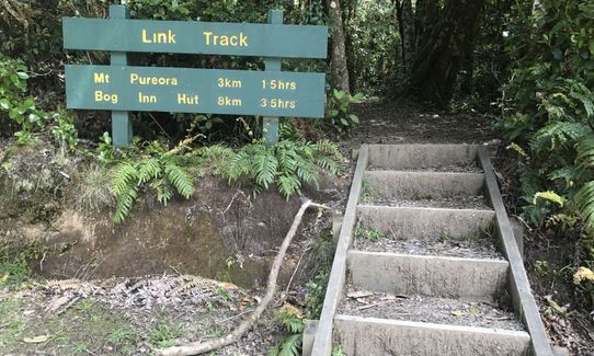
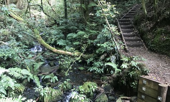
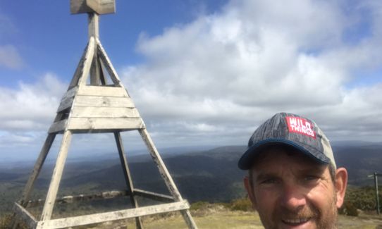
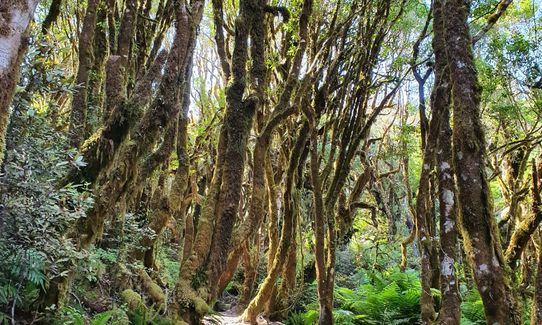
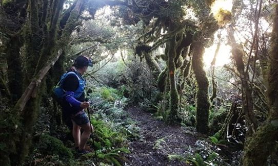
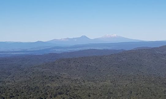
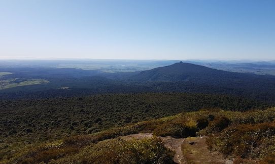
The trail starts on the Link Track. Mt Pureora is signed as being 3kms away but it's closer to 2.5k in reality. It's all uphill, steep in places, with LOTS of steps (I tried counting them but gave up!) You'll be in beautiful bush filled with birdsong almost right to the top, where the trail bursts into the open to give great views in every direction. You'll see Mt Tuatara to the south-east, Putauaki (Mt Edgecumbe) to the north-east and Pirongia to the north-west.
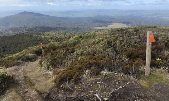
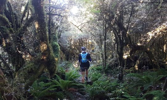
Leave the summit by the opposite side to that which you arrived (signposted to Bog Inn Hut) and follow the very gnarly, technical, washed-out trail steeply downhill for 1km to a junction with the Timber Trail. Turn right and follow this broad, well-made cycle trail for about 3.5km to the junction with the Toi Toi Track. Turn right here and follow this technically challenging trail uphill for 1.8 km to take the summit of Pureora for a second time.
The way down is the same as the way you came up at the start of the run - only this time it's fast, flowing Yeeha! downhill running - enjoy!
NB When you get to the trig, the trail out the other side now has a sign saying "This track is no longer maintained by DOC". The first few hundred metres are a bit overgrown but you can find your way easy enough and once you reach the bushline it is easy to follow.
This trail includes the peak Pureora.
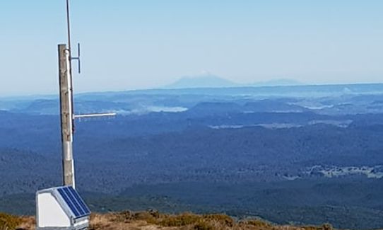
Stunning 360 views from the summit and one of the North Island's best downhill runs to finish with.
If you know of any public toilets near the trail start or on the route, please login and then let us know so we can update this section.
There's a pull-out on the opposite side of the road to the track start, sufficient for 3-4 cars. Don't leave valuables in the car - not sure whether there's a history of car break-ins or not, but this is a very secluded, quiet spot.
63 km
55 minutes
Yes
No
Easy.
Just keep an eye out for the signposts and you shouldn't go wrong
Non-existent.
Short-sleeved thermal top, Seam-sealed waterproof jacket, Gloves, Beanie/thermal headwear, Personal Locator Beacon (PLB), Whistle, First aid kit, Extra food for emergencies, Survival blanket, Cellphone, Map
There's no safe drinking water on the route so take your own.
The trails, particularly the Link and Toi Toi Tracks could be very muddy and slippery after heavy rain.
Tree roots and the edges of steps - run don't fly!
Trail Legend
Login as a VIP to become a Trail Legend. Learn about Trail Legends.
Fastest Known Times (FKTs)
You and Pureora Double
As a VIP member you can record private notes for this trail, see all of your times and more.
Already have an account? Login now
I did this trail after Titiraupenga as a bit of a mission to get here and thought it a good idea at the time to tick them both off. Took me 2 hours as a rough guide for time for this leg. There are magnificent unimpeded 360 degree views which also take in Titiraupenga. The track no longer maintained by DOC is pretty rough but still easily manageable.
October 9, 2022
This is such a gem of place! on a clear day you can see as far as Mount Taranaki- that is really far! I absolutely loved the the un-maintained downhill track, your legs get a bit scratched from the small scrub at the top but once under the tree canopy its primo as. The timber trail, easy going under the huge towering trees covered in moss. my cup is full after doing this, just what i needed after the covid lockdown.
May 21, 2020
Beautiful View at the top - could see ALL the mountains. Very well maintained trail. Dog friendly if kept on a lead & DOC permit.Entrance to this trail is Across the road from the small carpark.
March 17, 2020
Great wee run... if it wasn't the difficulty getting to the start area and for the stairs (about 950 just in the first section to the trig) then it probably would have been a 5. Just the right mix, technical trail, moderate trails and the hard and fast cycle trail.... enough climbing to keep you honest without totally wrecking you... and some magic views on top... a bit murky today with residue from the Aussie bush fires, but still stunning!
November 24, 2019
Send to your phone
Scan the below QR code to open this trail on your phone.

Tip: position the QR code in your phone camera screen.


