Last Updated: 2nd Jan 2025
Scout loop
Last Updated: 2nd Jan 2025
Open
Grunt Factor: 13 ?
Gnarl Factor: 53 ?
5.4km
445m
440m
585m
Last Updated: 2nd Jan 2025
Last Updated: 2nd Jan 2025
Open
Grunt Factor: 13 ?
Gnarl Factor: 53 ?
5.4km
445m
440m
585m
Front country - easily accessible
Loop
Very hilly
Dog Friendly
Native bush
Farm Road / 4WD Track
Easy Single Track
Moderate Single Track
Technical Single Track
Average Uphill Gradient: +16.40%
Average Downhill Gradient: -16.10%
VIP Feature: Send this route to your Garmin account so you can follow the course on your Garmin device.
Become a VIP Member to see the trailhead information.
1:40
Slow
1:00
Moderate
00:40
Fast
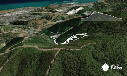
Well signposted carpark at the end of the road just before the Quarry. The start location is from the carpark, head up the road approximately 200m and cross over the bridge and through the gate.
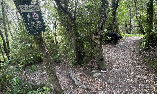
Follow the 4WD road all the way up keeping left until you reach a single track trail and a small stream crossing further on. From the stream, it's all uphill until you reach the Involution trail crossing. Take a left onto Involution and follow it down all the way back to the carpark.
If you know of any public toilets near the trail start or on the route, please login and then let us know so we can update this section.
Lots of space available, safe during daylight hours. Keep valuables on you and/or out of sight in the car.
5 km
7 minutes
Yes
No
Moderate.
Patchy.
Whistle, First aid kit, Extra food for emergencies, Cellphone, Map
Stream at the bottom and two stream crossings on the way down.
Can be very muddy and slippery after rain.
The climb up is very steep with the grade being 55%.
Do you have a suggestion on where to go afterwards for the best coffee / cake / breakfast / brunch / beer?
Trail Legend
Login as a VIP to become a Trail Legend. Learn about Trail Legends.
Fastest Known Times (FKTs)
You and Scout loop
As a VIP member you can record private notes for this trail, see all of your times and more.
Already have an account? Login now
Seriously impressed with those doing this in under 45min it’s. It took me around 30minutes to get through that ascent which was far more technical then the track description would elude to. No track markers in sight and very limited cell reception made me feel unsafe at times. Really glad I had the GPX track. For that first ascent I agree with others that I would not want to come down that for sure.
I went back via reservoir loop track to add on some extra distance and found a nice swimming hole nearby. Again track is not well marked so keep your wits about you as there are plenty of decoy tracks to take you other places.
Downhill switchbacks were really fun and a highlight was the two waterfalls along that section.
September 1, 2024
Good short and shape hit out. I don't recommend doing it in reverse and down the Scout Track after a recent downpour. Very slippery and then some decent stream crossings!
May 11, 2023
This is a nice loop for punishing the quads and glutes. The uphill is 1.6ish km at 25%. After the waterfall/weir it is natural rock and root steps straight up the hill. The return is very runnable at an average of 10% downhill on a mixed use mountain bike track. Running quickly requires me to focus on foot placement due to rocks and roots. Marsden valley is dog friendly and the overlapping and surrounding tracks are worth a look. I save the scout track uphill for when I need extra punishment.
November 16, 2022
These overlap with this trail to some degree. You may wish to combine them but please note that to qualify for FKTs on these runs you should record a separate activity for each.
Send to your phone
Scan the below QR code to open this trail on your phone.

Tip: position the QR code in your phone camera screen.

Plan smarter, stay motivated, track your progress, and unlock the full Wild Things experience — while saving along the way.






