Last Updated: 25th Mar 2024

Intermediate

Save Trail Save

I've done it Done

Richmond Hills

Richmond, Tasman

Submitted by Talei Hayward

Last Updated: 25th Mar 2024

Intermediate

Save Trail Save

I've done it Done

Open

Grunt Factor: 23 ?

Gnarl Factor: 32 ?

16.0km

850m

770m

724m


Login as a VIP to see driving directions, distance and time.

Trail Map

Type of Run

Front country - easily accessible

Point to Point (one way)

Very hilly

Native bush

Plantation/exotic forest

Run Makeup

50%
25%
25%

Gravel Road

Easy Single Track

Technical Single Track

Average Uphill Gradient: +11.5%

Average Downhill Gradient: -12.7%

Trailhead

Login as a VIP to see the trailhead information.

Estimated Times to Run

3:30

Slow

2:30

Moderate

1:30

Fast

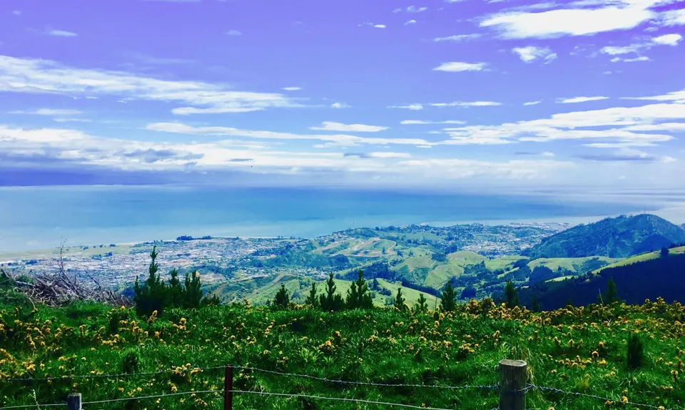
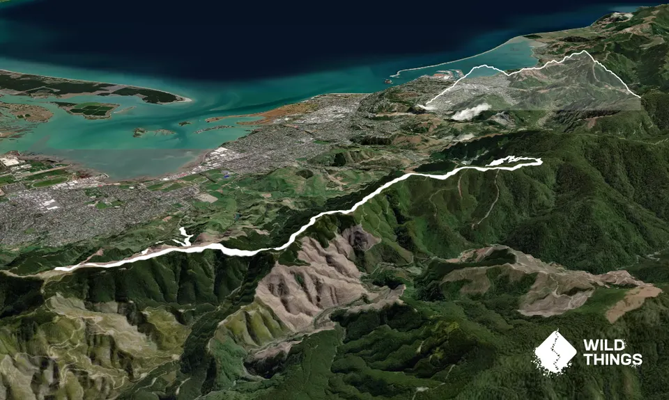
From the Silvan Mountainbike Carpark, head up the gravel road which winds its way to the top of the Richmond Hills, always heading straight as opposed to turning off left or right at any of the junctions. Approximately 4kms in you will be at the top and in sight of the Firehouse in a clearing at the top. Instead of jumping the fence and going up to the Firehouse (good views up there if you want to though), follow the gravel trail to the left of the Firehouse hill.

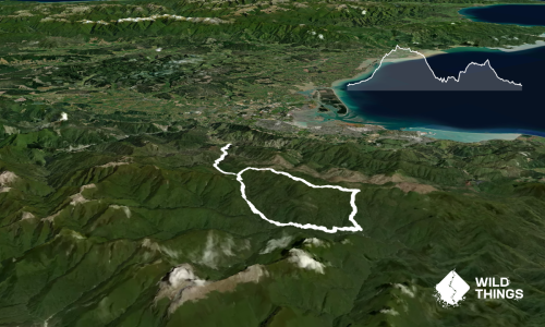
When the trail ends you will need to backtrack slightly and locate an opening in the bushes on the right to pop through and hop onto the ridgeline trail. This is the trickiest bit of navigation and unfortunately is not signposted. Once done, follow this trail north all the way along the ridgeline, up and down hills until you get to the trail marker for Involution/Barnicoat. There is one point along the ridge where the trail goes up an extremely steep hill which is a bit of a scramble, but I'm told there is an alternative that is easier. Have a look around for it if scrambling up the steep hill doesnt appeal!

You can go down either Barnicoat or Involution and end up at the same place but this example is for Involution. Involution is a mountain bike trail so watch for bikes at all times. It is also wicked fun; rooty, twisty and all downhill! The trail ends at the Barnicoat Carpark at the top of Marsden Valley Road. If you have left a car here, you're home free. If your car is at Silvan Forest Mountainbike Park, you'll need to run back through suburbia; all the way down Marsden Valley Road, turn left onto The Ridgeway, onto Suffolk Road, through Saxton Park, left onto Main Road Stoke and Salisbury Road, left onto Champion Road and finally back to Silvan Forest! I'm not sure how long this would make the run in total. Maybe 25km or 30km?

Wonderful views at the top and along the ridge line.

You can either leave a car at each end (one at Silvan Mountainbike Park and the other at the Barnicoat Carpark at the top of Marsden Valley Road) or run a loop back to your car through suburbia. This example shows a car at each end.

0 km

1 minutes

Unknown

No

Hard.

At the point where the uphill trail ends (around 4km in) along the top of the Richmond Hills. Also the point along the ridgeline where the track goes up an incredibly steep hill. There is a work around but I didn't know about it when I did this so my map shows me scrambling up the hill. See detailed description for more.
Silvan Forest Mountain Bike map here (follow orange and white trail): http://www.mtbtrailstrust.org.nz/store/doc/Silvan-Map-1.5.16.pdf

Generally good.

Windproof jacket, First aid kit, Cellphone, Map.

None that I saw

Muddy in wet weather and cloud often sits along the tops of these hills

Trail Legend

Kate Annan

Kate Annan

has completed Richmond Hills once in the last year.

Learn about Trail Legends.

You and Richmond Hills

As a VIP member you can record private notes for this trail, see all of your times and more.

Register Now

Already have an account? Login now

Trail Reviews

Have done this run many times, plus variations on the same theme. Live in Richmond so run a 22k loop from home. Regularly see rabbits, occasionally weka and the odd hare. Can also go down the other side towards the Hacket Carpark, and there are several routes down into Richmond. Can also continue north towards Dun Mountain.

Gareth Worboys

January 18, 2018

Login to submit a review

Trail Running Community

Find people who are interested in or have completed this trail run.

You must register or login to view this feature.

Register Now

Other trails nearby
Ruby Bay Circuit

Ruby Bay Circuit

Length: 14.0km

Level: Beginner

Arthur & Gordons

Arthur & Gordons

Length: 25.0km

Level: Intermediate

Big Gum Boogie

Big Gum Boogie

Length: 8.8km

Level: Intermediate

Boy Scout - Barnicoat

Boy Scout - Barnicoat

Length: 8.9km

Level: Beginner - Intermediate

Find more trails and peaks nearby