Last Updated: 20th May 2024
Mt Arthur Up & Back
Last Updated: 20th May 2024
Open
Grunt Factor: 40 ?
Gnarl Factor: 61 ?
17.0km
900m
900m
1795m
Last Updated: 20th May 2024
Last Updated: 20th May 2024
Open
Grunt Factor: 40 ?
Gnarl Factor: 61 ?
17.0km
900m
900m
1795m
Back country - remote
Out and Back
Mountainous
Native bush
Open ridges/tops
Easy Single Track
Moderate Single Track
Technical Single Track
Untracked / Route only
Average Uphill Gradient: +13.5%
Average Downhill Gradient: -13.5%
VIP Feature: Send this route to your Garmin account so you can follow the course on your Garmin device.
Login as a VIP to see the trailhead information.
4:00
Slow
3:00
Moderate
2:00
Fast
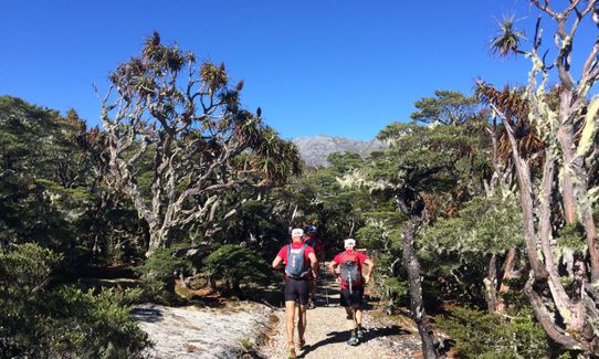
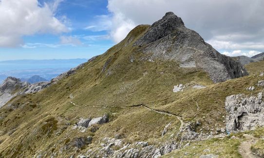
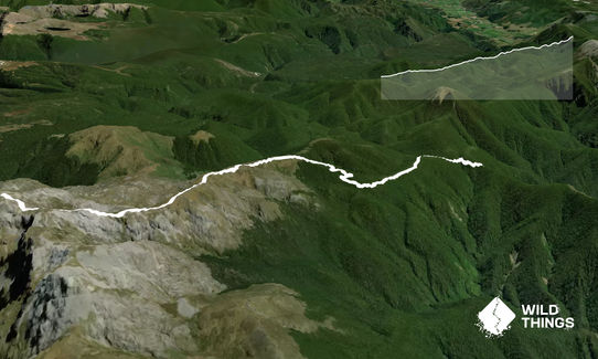
From Flora car park follow the track to Flora Saddle where a well-graded track turns left and follows the ridge towards Mt Arthur, winding through beech forest and groves of candelabra-like mountain neinei (Dracophyllum or 'Dr Zeuss plant!) Mt Arthur Hut is just on the tree line.
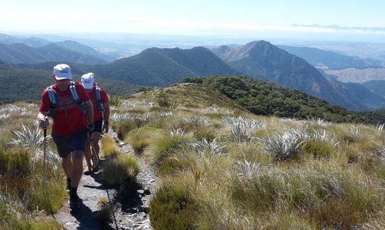
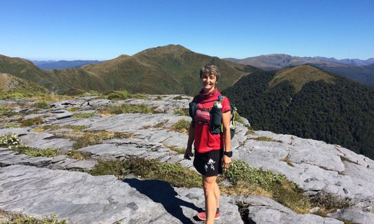
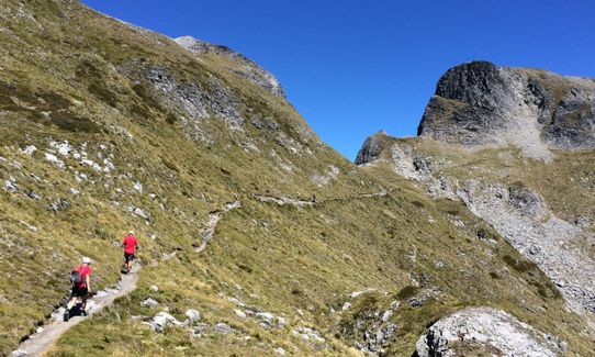
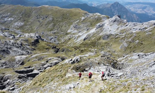
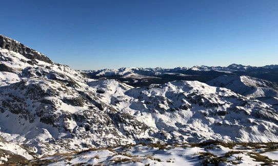
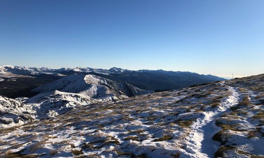
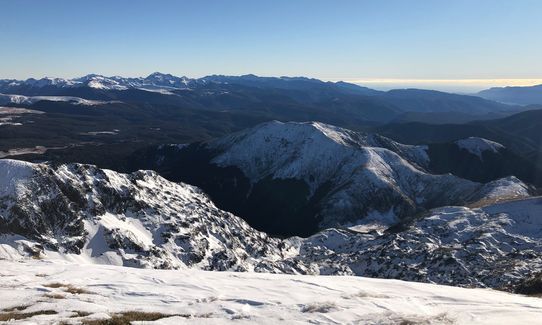
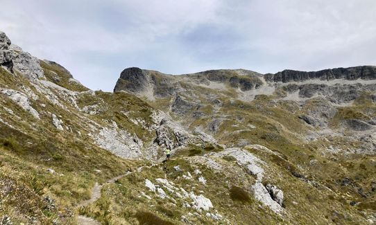
Beyond here you are on open ridges, some parts of which have a lot of loose rock on. The views are superb and from the summit on a clear day it's possible to see Mt. Taranaki!
Return by retracing your steps downhill.
This trail includes the peak Mount Arthur.
The awesome groves of dracophyllum that you pass through on the way to Mt Arthur Hut & the sensational views from the summit.
If you know of any public toilets near the trail start or on the route, please login and then let us know so we can update this section.
Plenty of parking, toilet and information board/shelter at the DoC car park
23 km
29 minutes
No
No
Moderate.
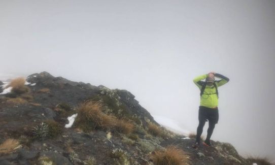
Finding the way is easy enough in good weather but with poor visibility you will need to remain alert on the tops. Avoid taking the poled route that leads off to your right (on the way up) towards Gordons Pyramid.
Unknown.
Long-sleeved thermal top, Seam-sealed waterproof jacket, Gloves, Beanie/thermal headwear, Personal Locator Beacon (PLB), Whistle, First aid kit, Extra food for emergencies, Survival blanket, Cellphone, Map, Crampons / microspikes (for winter conditions)
Mt. Arthur Hut is the only source of water on the route
This is a great winter route for those with the experience to handle it - be aware of avalanche risk, particularly towards the summit. For others it's best to treat as a summer-only route.
Care is required around the many bluffs, sinkholes and caves.
Trail Legend
Login as a VIP to become a Trail Legend. Learn about Trail Legends.
Fastest Known Times (FKTs)
You and Mt Arthur Up & Back
As a VIP member you can record private notes for this trail, see all of your times and more.
Already have an account? Login now
A great route with some unusual features. Very nice to be greeted by Bellbirds at the Flora Carpark, and then the Kea told me to hurry up as I got near the hut. Weka on patrol as I arrived and several people getting their breakfast sorted.
I picked the wrong weather day, so will have to return to get the views.
April 28, 2022
Beautiful scenery everywhere. A hard slog for this unfit lass, but worth the effort.
January 26, 2022
Absolutely beautiful, stick to the trail as there are some serious caves and sink holes off trail. Just ran the trail to the Mt Arthur hut, the upper part is not easy to run
December 16, 2020
These overlap with this trail to some degree. You may wish to combine them but please note that to qualify for FKTs on these runs you should record a separate activity for each.
Send to your phone
Scan the below QR code to open this trail on your phone.

Tip: position the QR code in your phone camera screen.


