Last Updated: 14th Mar 2025
Kahurangi Caper
Last Updated: 14th Mar 2025
Open
Grunt Factor: 78 ?
Gnarl Factor: 50 ?
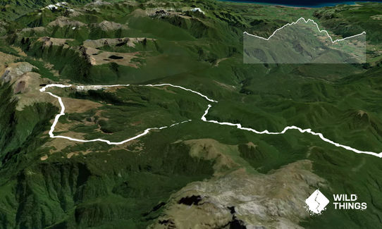
42.1km
1950m
1950m
1460m
Last Updated: 14th Mar 2025
Last Updated: 14th Mar 2025
Open
Grunt Factor: 78 ?
Gnarl Factor: 50 ?
42.1km
1950m
1950m
1460m
Back country - remote
Combo
Undulating, some big hills
Native bush
Open tussock/grasslands
Open ridges/tops
Easy Single Track
Moderate Single Track
Technical Single Track
Untracked / Route only
Average Uphill Gradient: +7.8%
Average Downhill Gradient: -9.1%
VIP Feature: Send this route to your Garmin account so you can follow the course on your Garmin device.
Login as a VIP to see the trailhead information.
9:00
Slow
6:45
Moderate
4:30
Fast
January 2021: Note that in summer near Cobb Reservoir, parts of the track can be very overgrown/un-runnable. Also note that signs for Bullock and Upper Takaka track have been removed: follow signs for Peat Flat and Broken Bridge (and of course Flora) to stay on course!
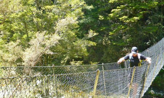
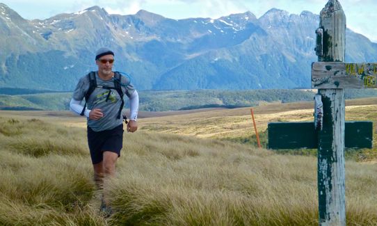
From the car park follow the signs for Flora Hut, which is just about 2k away on a broad piece of single track. Beyond this historic hut the trail narrows and runs close to Flora Stream through beautiful native bush.
Check out the incredible Gridiron Rock Shelter and continue on sublime single track for another couple of kms before turning left following signs to Salisbury Lodge. The trail now starts to climb through more stunning bush and then breaks out on to the tussock lands at the fringe of the Tablelands. Salisbury Lodge is not much farther along - a good place to top up on water supplies.
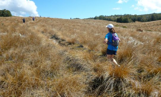
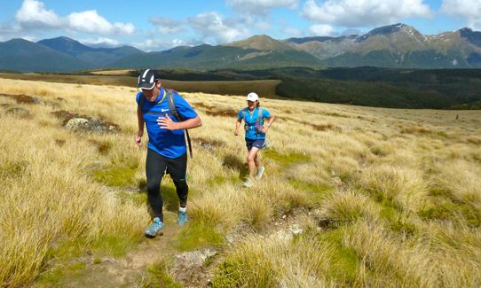
From Salisbury Lodge follow the signs for Balloon Hut - a gradual climb over open tussock lands with superb views starting to open up. Beyond Balloon Hut these views just get better and better as the steady climb continues.
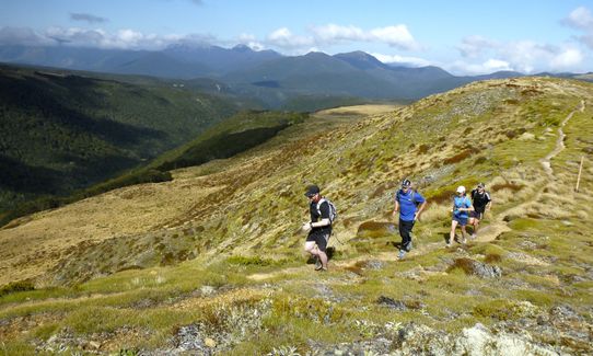
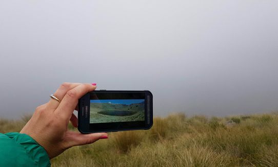
From the high point of the run follow the poled route down technical single track to Lake Peel, nestled in its high alpine tarn setting. Beyond this stunning lake the trail climbs gradually to join a ridge. Ignore the signs for Cobb Reservoir and instead follow the poled route along and down the ridge, eventually picking up a marked trail through the bush.
At the intersection with the Bullock Track turn right. After a short way this drops towards the Takaka River. Turn right to cross the river and right again on to the Upper Takaka Track. Within 3k you reach Upper Junction and turn right to retrace your outward steps up a long gradual climb back to the Flora Saddle car park.
This trail includes the peak Balloon Hill.
Some of the most beautiful native bush single track in the country and the jewel of an alpine lake that is Lake Peel.
Gridiron Rock shelters - the best bivvy in the land!
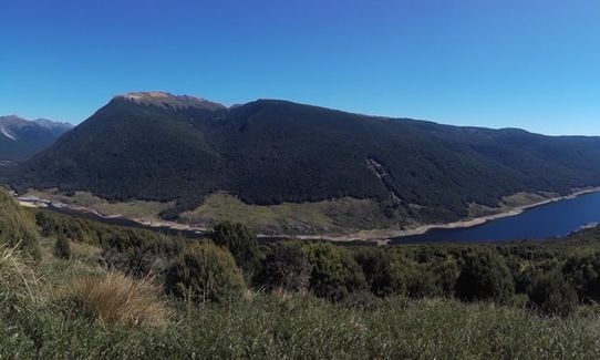
This route traverses the Tablelands and has stunning panoramic views once clear of the bush.
If you know of any public toilets near the trail start or on the route, please login and then let us know so we can update this section.
Plenty of parking, toilet and information board/shelter at the DoC car park
23 km
29 minutes
Unknown
No
Moderate.
Travel in the bush is well signposted but much of the open tops are a poled route only. Keep an eye on the map and the poles to avoid taking a wrong turn.
Very patchy.
Short-sleeved thermal top, Seam-sealed waterproof jacket, Gloves, Beanie/thermal headwear, Whistle, First aid kit, Extra food for emergencies, Survival blanket, Cellphone, Compass, Map, Crampons / microspikes (for winter conditions)
The first good water is at Salisbury Lodge and there is also water at Balloon Hut (just off the track.) The stream flowing out of Lake Peel is a good source of pure mountain water and thereafter there are plenty of clean creeks and streams to top up from.
The bush trails can be very muddy in winter or after heavy rain. Snow and ice can be encountered on the tops pretty much any time of the year.
Exposed tops that can be challenging and miserable in bad weather - go prepared!
Fastest Known Times (FKTs)
You and Kahurangi Caper
As a VIP member you can record private notes for this trail, see all of your times and more.
Already have an account? Login now
What a stunning loop and the short overgrown section at far end only serves to emphasise how runnable the rest of the trail is- totally recommend!
January 10, 2022
Good day out. I ran it counterclockwise just to have the support of the huts in the second part of the run if needed.
December 26, 2020
These overlap with this trail to some degree. You may wish to combine them but please note that to qualify for FKTs on these runs you should record a separate activity for each.
Send to your phone
Scan the below QR code to open this trail on your phone.

Tip: position the QR code in your phone camera screen.


