Tanekaha TrailsBeginner - Intermediate
Submitted by Mike Tennent
Front country - easily accessible
Loop
Very hilly
Native bushPlantation/exotic forestRiversideOpen ridges/tops
Beginner - Intermediate
2:00 (Slow)
1:20 (Moderate)
0:50 (Fast)
-10.9%
+9.8%
Fastest Known Times (FKTs)
Please set your gender to see your position on the FKT leaderboards.
The more , the harder the FKT will be to beat. Learn about Fastest Known Times.
Description
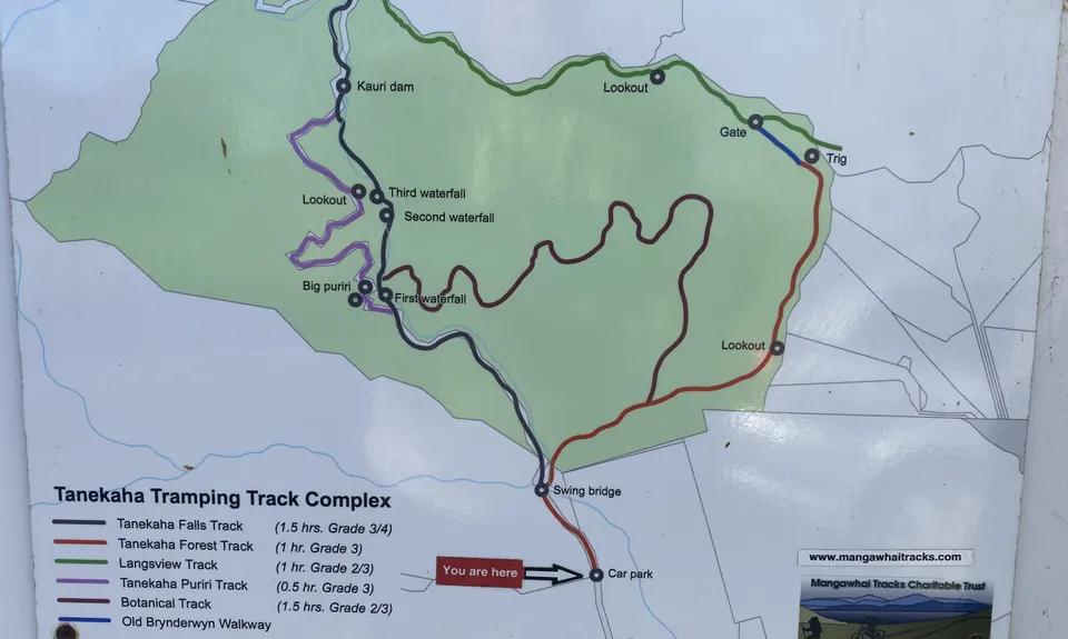
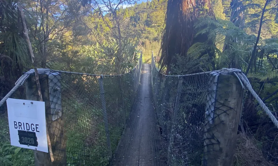
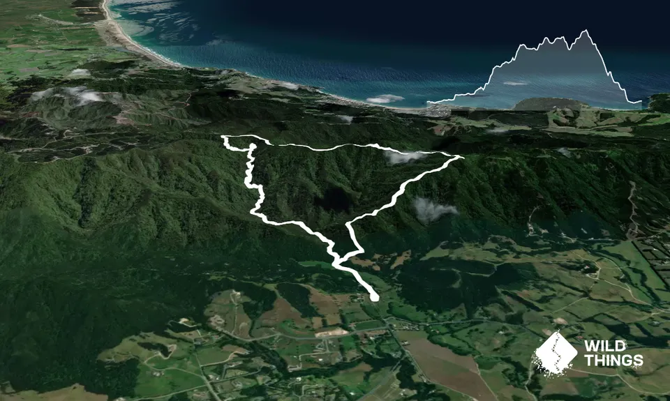
Leaving the carpark you follow the gravel farm road to the stile, cross the stile and follow the grass track to the swingbridge... cross over and head straight across the picnic area to the trail exiting ahead of you. At the sign there you will see a trail coming in from the right - that is where you will finish. Follow the main trail which at first is pretty flat and runnable. You are taking the Falls Track.
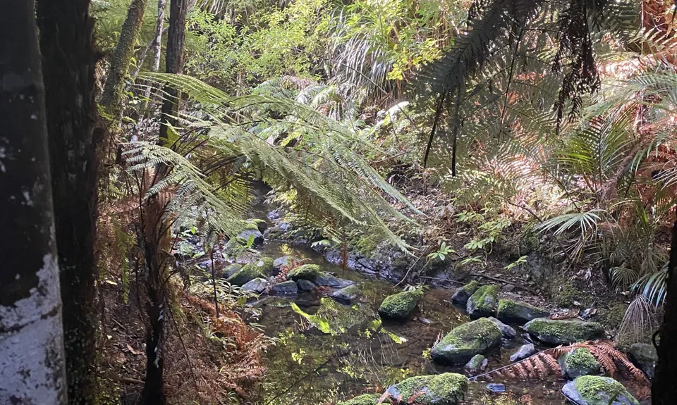
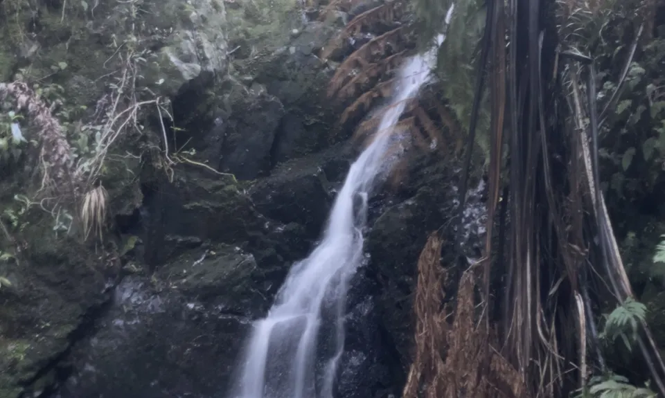
On your way up there are two side trails - the Puriri Track (2 entrances) and the Botanical track. Ignore both of these and follow the Falls Track. After you reach the first falls you start climbing... lots! Plenty of steps and elevation as you wind your way up. There are frequent stream crossings , but the whole trail is looked after by volunteers and as so often with volunteers, they go the extra mile, with grippy patchs of stone chip cemented to rocks of stream crossings, steps cut out by spade to make climbing easier and lots of constructed wooden steps as well.
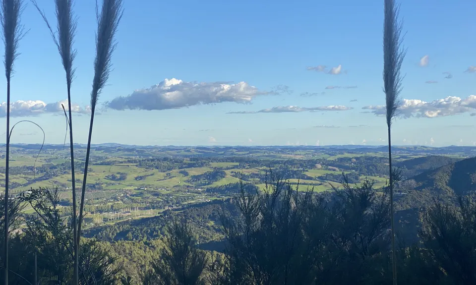
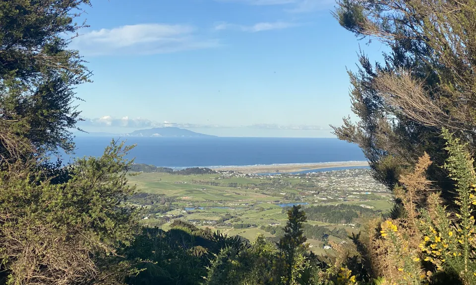
There are seats at some of the falls and quite a few signs. However there are still plenty of slippery areas and care need to be taken. Eventually, after plenty of climbing you will reach the end of the trail which then heads left into Langsview Track... at first you think, 'oh no, 4wd track' but after a short strip it's back onto single trail and a ridgeline 'rollercoaster' of ups and downs, including some fantastic runnable downs that you will just lap up.
After roughly 2.5km you will reach the split, take the right turn to the Tanekaha Forest Track, but make sure you stop at the Trig for a pic or two. Follow the Forest Track all the way back to the picnic area and then to your car.
Trail Community
Features of interest
Waterfalls and great views and awesome single trail
Make Up of Run
Untracked / Route only: 0%
Technical Single Track: 30%
Moderate Single Track: 30%
Easy Single Track: 30%
Farm Road / 4WD Track: 10%
Gravel Road: 0%
Sealed Road: 0%
Route Data
Reviews:
Overlapping Runs
The following trails overlap with this run to some degree. You may wish to combine them but please note that to qualify for FKTs on these runs you should record a separate Strava activity for each
Photos:
Your Trail Wishlist
All the runs that are on your To Do list (no limit).
Add to wishlist view wishlistWild Explorers
I did it!-
Access
Head out of Mangawhai Heads heading north but when you reach Cove Road turn left inland... follow Cove Rd until you reach King Road and turn right into King Rd. Follow King Road and the trails are clearly signposted.
Plenty of parking
10 km
11 minutes
No
No
-
Staying Safe
Easy.
Just follow the Falls Track, then the Langsview Track and finally the Tanekaha Forest Track
Generally good.
Waterproof leggings, Long-sleeved thermal top, Windproof jacket, Personal Locator Beacon (PLB), Whistle, First aid kit, Extra food for emergencies, Survival bag, Cellphone, Map, Headtorch and spare batteries.
A stream next to you all the way up... after that nothing until the end.
Would imagine it would be nearly impossible if very wet and muddy.
Slippery rocks, stream crossings, steep climbing... oh and more slippery rocks!
-
Sponsor this trail
See other runs nearby:
Mangawhai Heads Snarler
Goldschmidt Panoramic Trail
Mangawhai Adventure Day
Langs View Track