Langs View TrackBeginner - Intermediate
Submitted by Craig De Ardenne
Front country - easily accessible
Out and Back
Undulating, some big hills
Native bushCoastalOpen ridges/tops
Beginner - Intermediate
2:30 (Slow)
1:45 (Moderate)
1:15 (Fast)
-9.7%
+9.7%
Fastest Known Times (FKTs)
Please set your gender to see your position on the FKT leaderboards.
The more , the harder the FKT will be to beat. Learn about Fastest Known Times.
Description
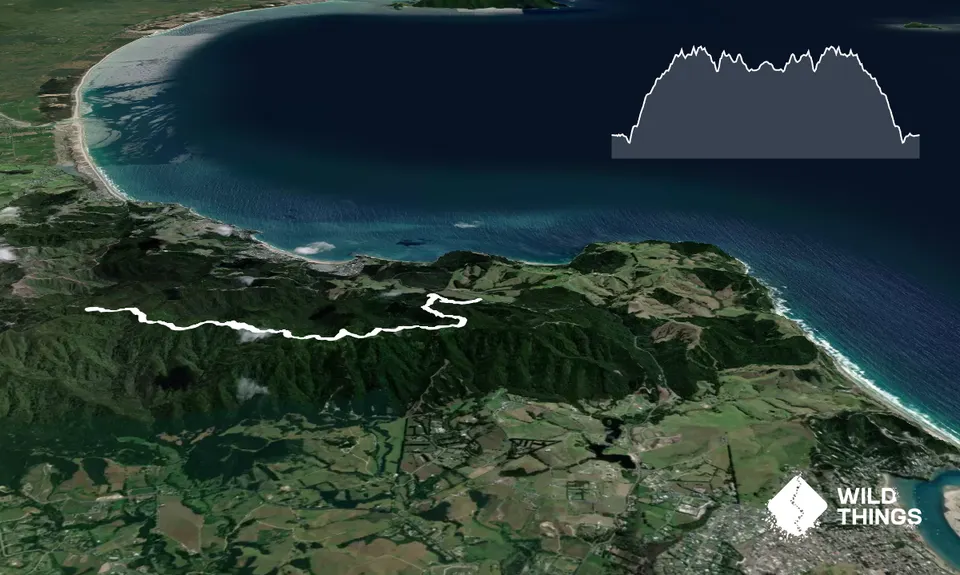
The track is described here from the eastern entrance on Cove Road. From the carpark, follow the orange markers along a short bush walk that comes out on a private subdivision road. Turn left and follow this up the hill – the surfaced road gives way to a rough trail that continues to the top of the ridgeline.
Follow the marked route and respect private property. Once past the last house at the end of the road the track continues along the undulating ridgeline through a series of grassy clearings towards the trig station at 297m. To access the trig follow a short track up the hill just past the kissing gate. Although not part of the Langsview Track this is a formed track developed by local volunteers.
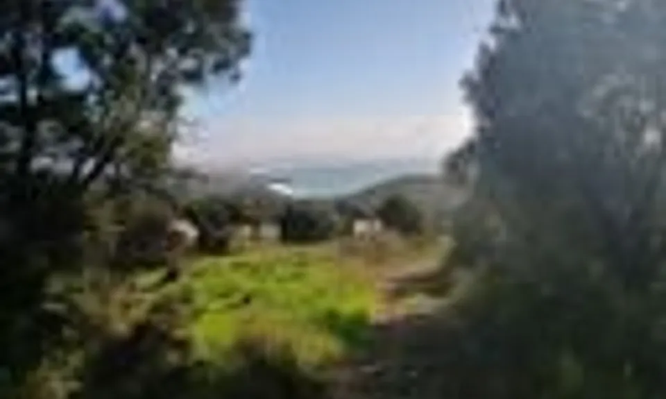
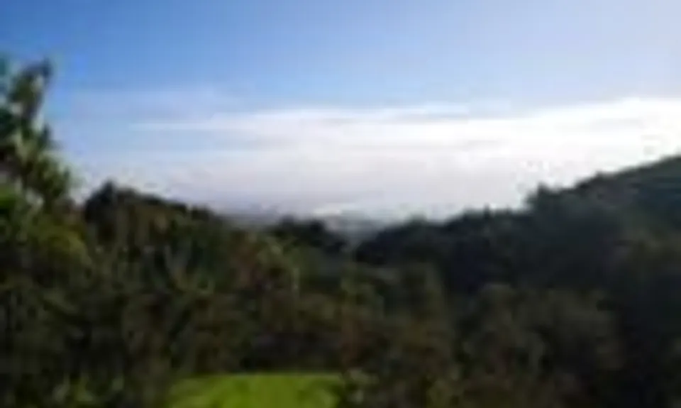
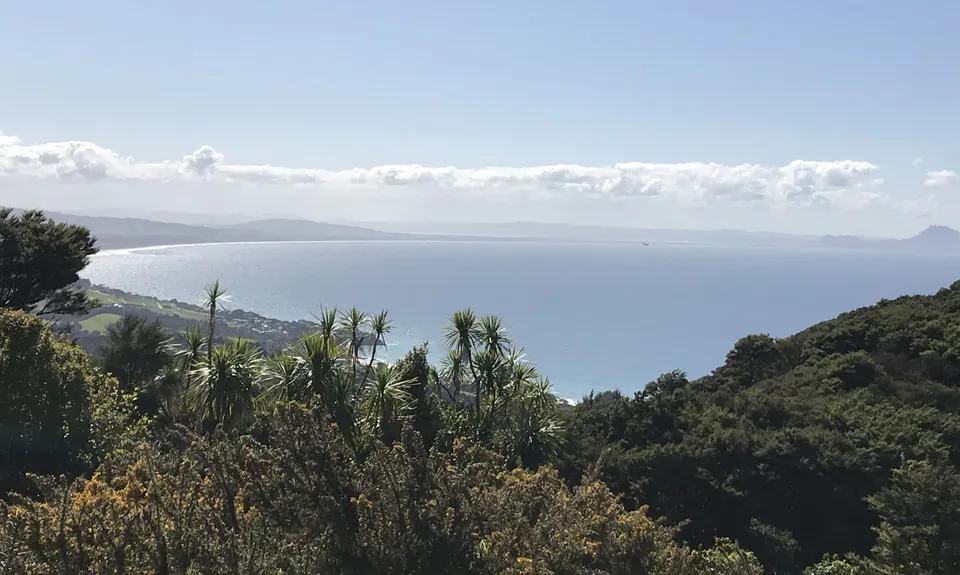
From the trig there are amazing views of the countryside – north across Bream Bay, south down the Mangawhai coast and out to the offshore islands. The track continues along the ridgeline through regenerating bush with occasional views both north and south before meeting a roadway which leads past more private houses. Continue to follow the orange markers to eventually meet the end of Cullen Road and the eastern end of the Brynderwyn Hills Walk.
Return the way you came.
Trail Community
Features of interest
Great views to the north and south overlooking Langs beach, Waipu Cove and Mangawhai.
Make Up of Run
Technical Single Track: 10%
Moderate Single Track: 10%
Easy Single Track: 35%
Farm Road / 4WD Track: 20%
Gravel Road: 20%
Sealed Road: 5%
Route Data
Reviews:
Overlapping Runs
The following trails overlap with this run to some degree. You may wish to combine them but please note that to qualify for FKTs on these runs you should record a separate Strava activity for each
Photos:
Your Trail Wishlist
All the runs that are on your To Do list (no limit).
Add to wishlist view wishlistWild Explorers
I did it!-
Access
Eastern entrance: The Eastern entrance is along Cove Road just south of Bream Tail Road. There is a carpark here and a short bush walk that leads to the track itself.
Western entrance: The western entrance is at the top of Cullen Road where it intersects with a forestry road. Cullen Road runs off Cove Road between Waipu and Waipu Cove. It's also a section of the Te Araroa Trail. If driving to this point, park before the water tanks. The track entrance is signposted and the track follows a private access road for resident’s vehicles only.No public transport at either end but pretty safe car parking.
11 km
13 minutes
No
No
-
Staying Safe
Easy.
Make navigation of this route super-easy by using the Capra app on your phone. View on Capra .
Generally good.
Long-sleeved thermal top, Seam-sealed waterproof jacket, Gloves, Beanie/thermal headwear, Whistle, First aid kit, Extra food for emergencies, Cellphone, Map.
None,
Some very steep clay steps that can be very slippery when wet.
-
Post run indulgence
The Cove Cafe
Waipu Cove
Just a nice relaxing spot to have a beer after your run. -
Sponsor this trail
See other runs nearby:
Mangawhai Heads Snarler
Goldschmidt Panoramic Trail
Mangawhai Adventure Day
Tanekaha Trails