Update Jan 2025 - the Information Centre has been removed, but there is still plenty of parking close to the start. An alternative start would be Mangawhai Heads surf beach so you can finish with a swim and use the showers. The coastal section directly before Langs is low tide only, but there is an alternative route via the footpath from Ding Bay. The unpleasant road section from Langs to Bream Tail Rd has been replaced with a new trail created by Wairahi Tracks Charitable Trust - please consider a donation. Turn off the main road after Langs beach at Hector Lang Dr and follow through to Seacrest Blvd.
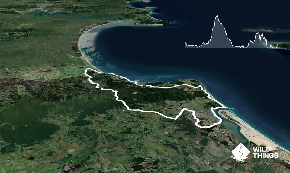
A loop course starting and finishing in Mangawhai Heads. Although there's a bit of sealed road, it's worth it to join up an incredible mix of running terrain. Manuka scrub, native bush in a privately owned reserve with some impressive waterfalls, elevated forestry roads with sweeping views, and a stunning coastal section that carries you through to Mangawhai Heads surf beach. There are also shorter options available. Navigation is pretty straightforward and it's probably 95% runnable.
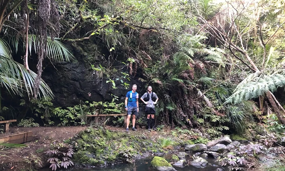
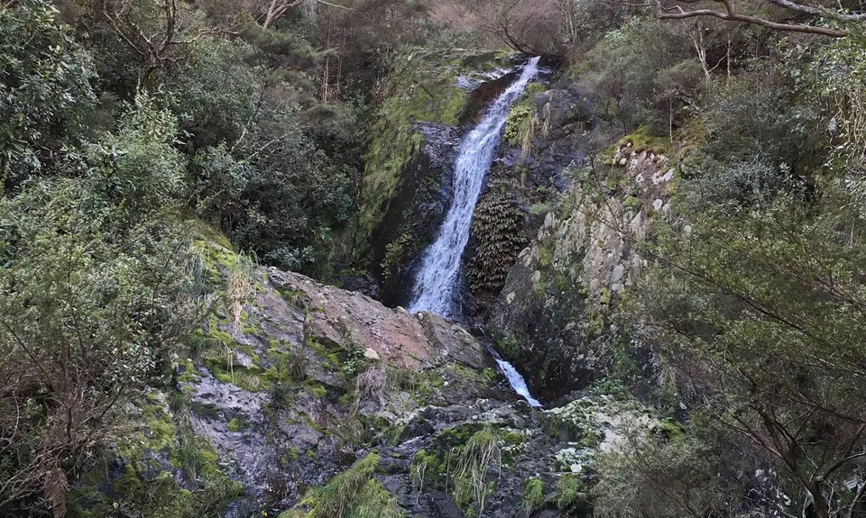
As you will be running through a kauri reserve please start with clean shoes. From the information centre, head down the unsealed road and take the left into the bush reserve, following Pauls Track. The small detour to the lookout is highly recommended. Turn right when you see the signpost for Thelma Rd, then follow your nose out to Cove Rd, turn left, then eventually right onto King Rd. You are heading for the Tanekaha Reserve (on Google Maps) which is the aforementioned kauri reserve, privately owned and maintained by a local trust. (If you want to shorten the run, and take out a long road section, get a friend to drop you here.) Take the main trail up past the three waterfalls, each more impressive than the last, except for the third one. The trail mainly follows the stream, occasionally climbing up over an outcrop, then eventually climbs sharply uphill.
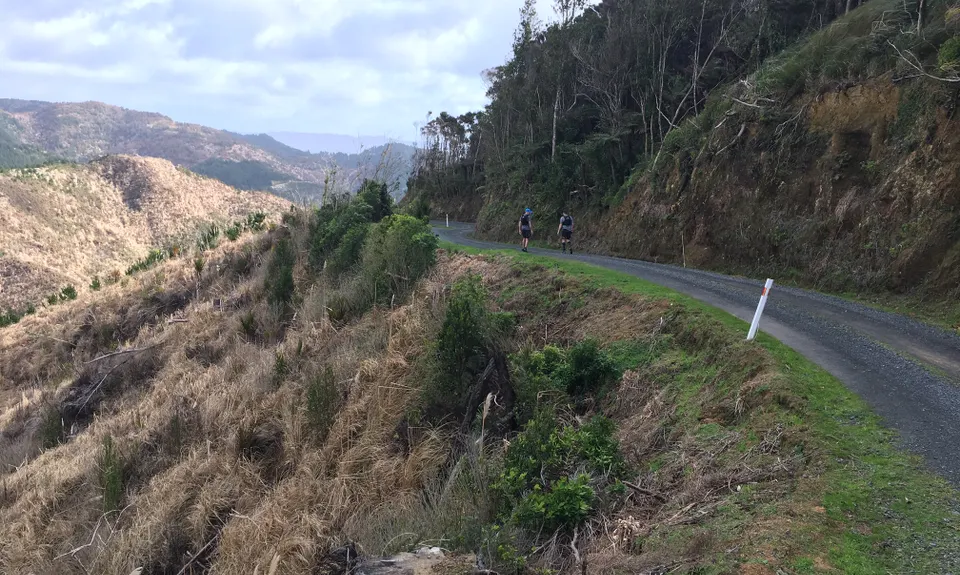
At the top the DOC-maintained Langsview Track heads off to the right, but you turn left. (However Langsview Track gives a shortcut to Bream Tail Rd, which creates a considerably easier loop). Just when you think you have taken a wrong turn onto someone's driveway you'll emerge onto the tail end of Cullen Rd, which will now carry you all the way down to Waipu Cove. The higher reaches of the road are unsealed and follow a ridge through some forestry areas, with sweeping views to the sea.
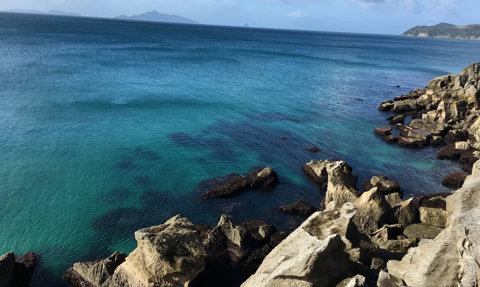
The last few km's of Cullen Rd are unsealed, until you reach the main road and turn back to Waipu Cove. (Although it looks like there should be a shorter way to Waipu Cove, the forestry roads you can see on Google Earth are overgrown and impassable, sorry.) Enjoy a well earned break at The Cove restaurant, though you might want to hold back a little on the cabinet food, there's a wee way to go. From The Cove you can just see the start of the Waipu coastal walkway, with a pole on the far side of the stream marking the start. A few km of stunning, isolated coastline takes you to Langs Beach, then a few km of highway to your left turn at the unsealed Bream Tail Rd.
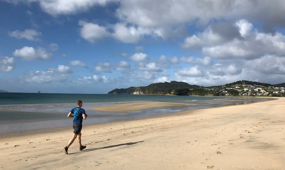
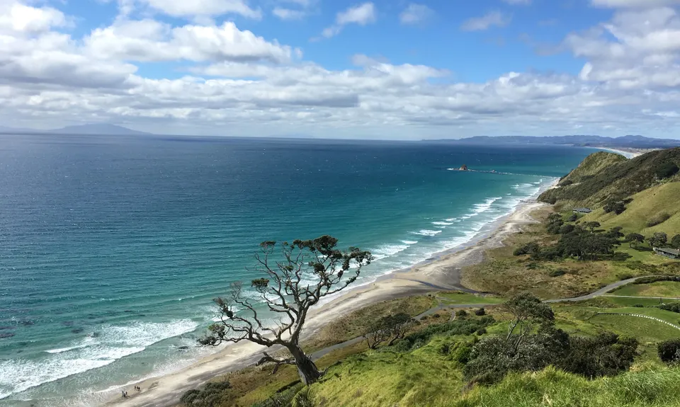
The remaining section of the run follows the Te Araroa trail, and is well marked. Once you've climbed the hill you'll cross onto a farm track, reminiscent of rambling the English countryside, then a final sheep track carries you into another stand of kauri. Finally you reach the Mangawhai Coastal Walkway, a well formed trail with breathtaking views that takes you through to Mangawhai Heads surf beach.
There's more water available at the public toilets at the end of the beach, and sometimes a coffee & ice cream stand too. At very low tide continue around the rocks from the surf beach, otherwise follow Wintle St for a few minutes until you reach the first marked path for beach access. Follow the sand past the waterfront campground and along the wide, sheltered estuary. Two options from here - climb the first set of stairs, for a birds eye view of the estuary, or at mid tide or lower follow the beach around the rocks to the smaller bay where a grass track takes you up to Eveline St. Whichever option you take, all roads lead to the main road, with the Information Centre at the top of the hill.