Last Updated: 5th Apr 2026
Old Coach Road Ohakune - return trip
Last Updated: 5th Apr 2026
Open
Grunt Factor: 24 ?
Gnarl Factor: 30 ?
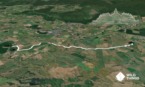
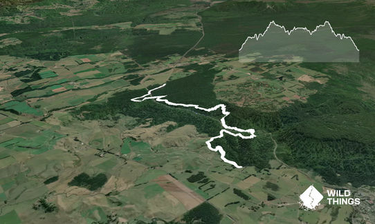
20.0km
492m
492m
761m
Last Updated: 5th Apr 2026
Last Updated: 5th Apr 2026
Open
Grunt Factor: 24 ?
Gnarl Factor: 30 ?
20.0km
492m
492m
761m
Front country - easily accessible
Combo
Very hilly
Native bush
Easy Single Track
Moderate Single Track
Average Uphill Gradient: +7.10%
Average Downhill Gradient: -7.30%
VIP Feature: Send this route to your Garmin account so you can follow the course on your Garmin device.
Become a VIP Member to see the trailhead information.
2:40
Slow
2:00
Moderate
1:30
Fast
Note this is for running from Marshalls road, to the end of the trail (start of 4WD track) at Horopito end, this can also be run in one direction with transport.
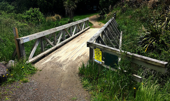
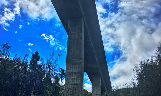
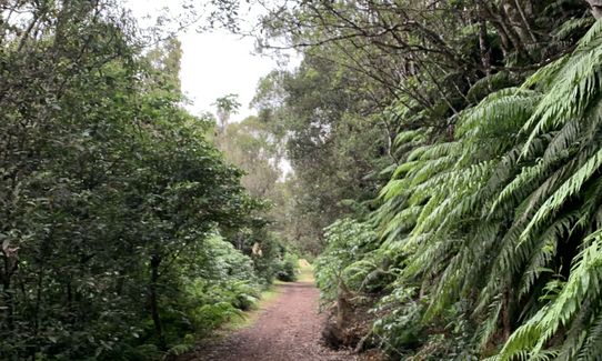
From carpark cross the bridge.
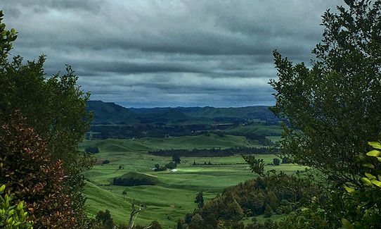
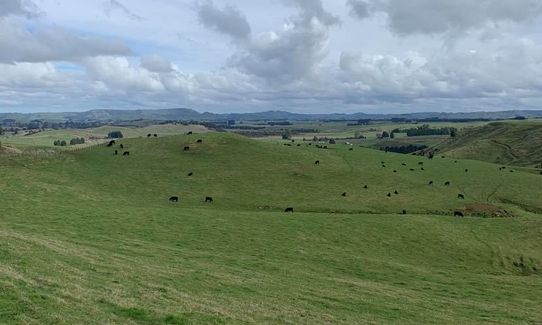
First few kms is up the old coach road, grass/stones, wide open area.
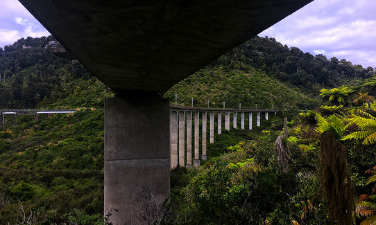
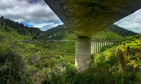
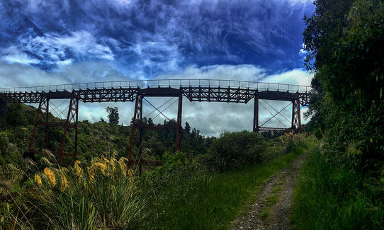
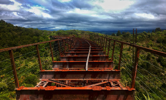
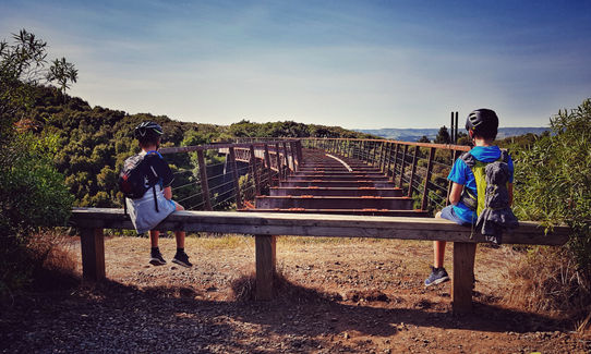
At the top follow sign and turn R) for some easy single trail ascent, coming down the other side to the first viaduct. Either take the very worthwhile detour to the viaduct or turn L) to head on single trail.
Trail opens back to grass land before running onto compacted gravel to finish the ascent.
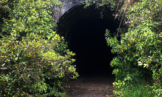
At the end of the compacted trail, (high point of trail) turns back into cobblestone road i.e rocks, mud, and roots but still wide.
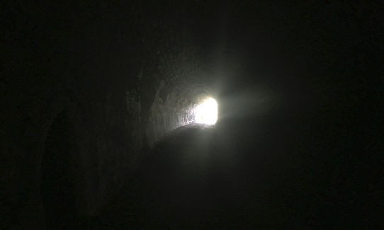
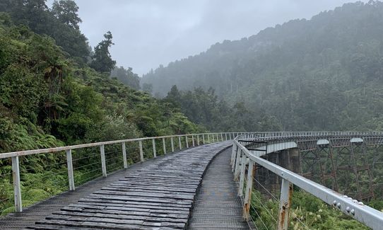
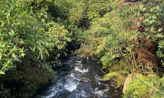
The trail will then venture back into the forest and the single trail, descending to a bridge to cross the river.
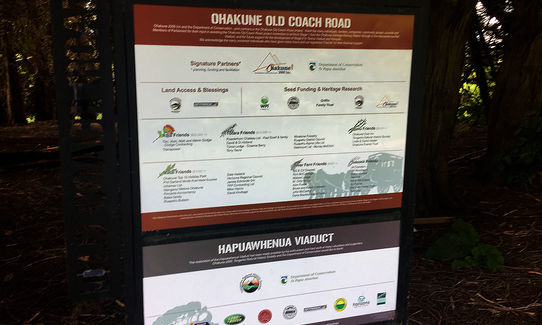
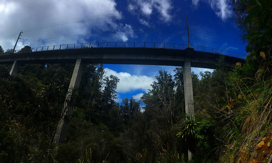
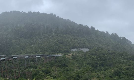
At the top of the climb there is the next viaduct.
Trail is then undulating, with a train track crossing (careful trains) and continues undulating before dropping down to a bridge with a sharp uphill to the stile.
The stile marks the end of the single trail and the start of the 4WD out to Horopito.
Either turn around and return to start, or if you have organised transport, continue out for the last couple of kms to Horopito.
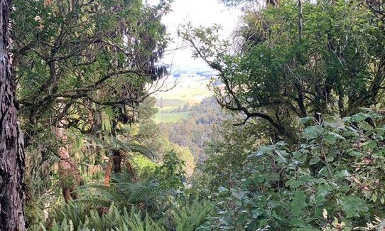
You can see the old viaducts as well as the current train track on the run.
If you know of any public toilets near the trail start or on the route, please login and then let us know so we can update this section.
Parking is available. This is a remote area out of town, ensure car is locked/secured
3 km
6 minutes
No
No
Easy.
Is well signposted and trail is easy to follow
Patchy.
Long-sleeved thermal top, Seam-sealed waterproof jacket, Gloves, Beanie/thermal headwear, Whistle, First aid kit, Extra food for emergencies, Survival bag, Cellphone, Map
There are a couple of streams that can be accessed if required, but carry your own.
Is at altitude so in winter can snow (high point 761 metres next to Mt Ruapehu) and generally wet in the winter.
The snow will not normally be thick at this level and will often not settle.
Take care for Mountain Bikers, this is a shared track
Powderhorn
Mangawhero Terrace, Ohakune
http://www.powderhorn.co.nz
Great place for a beer and some good pub food
Cyprus Tree
77 Clyde Street, Ohakune
http://www.cyprustree.co.nz
Great for food and excellent for taking the kids to, has a dedicated play/toy area.
Do you have another suggestion on where to go afterwards for the best coffee / cake / breakfast / brunch / beer?
Trail Legend
Login as a VIP to become a Trail Legend. Learn about Trail Legends.
Fastest Known Times (FKTs)
You and Old Coach Road Ohakune - return trip
As a VIP member you can record private notes for this trail, see all of your times and more.
Already have an account? Login now
Awesome run. Very historic and lots of variety in the run. A great return run with some challenging hills. Beware the trains.
June 16, 2021
A great walk/run when the mountain is closed or the weather isn't so great. Mostly really sheltered. We didn't quite make it to Marshall rd before we turned back and stlll got 23km so a great day out.
September 28, 2020
For a Solo Woman its a very safe run. Trial is well maintained and its just beautiful.
August 24, 2020
These overlap with this trail to some degree. You may wish to combine them but please note that to qualify for FKTs on these runs you should record a separate activity for each.
Send to your phone
Scan the below QR code to open this trail on your phone.

Tip: position the QR code in your phone camera screen.