A recce of the northern end or Dundas Ridge is advised as well as Tarn Ridge itself. You will need to be capable with map and compass if visibility is poor as the first half is more of a route than a track until Jumbo. In clear weather navigation is fairly straightforward. Recommend to reach out to others who have done the route. Check out Wellington Big Sunday Run Group on Facebook.
FOR THE EXPERIENCED MOUNTAIN RUNNER ONLY: there are long unmarked sections and you really need to be self-sufficient on this run as there are limited bail out options once you're on the tops, until about the halfway mark. The weather can be gnarly, so choose your day wisely!
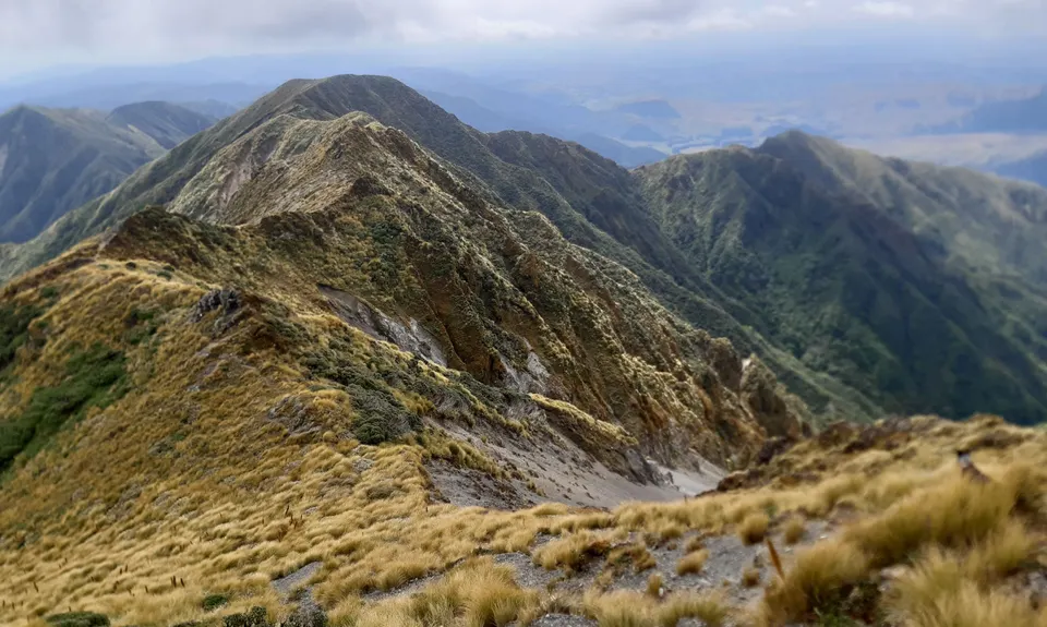
The route covers 8 x 1500m peaks plus a few others like Mt. Holdsworth. You also pass a few graves, Brockett Rocks, the Waiohine Pinnacles and Broken Axe Pinnacles.
If you know of any public toilets near the trail start or on the route, please login and then let us know so we can update this section.
Parking isn't a problem, although can get busy on nice weather weekends.
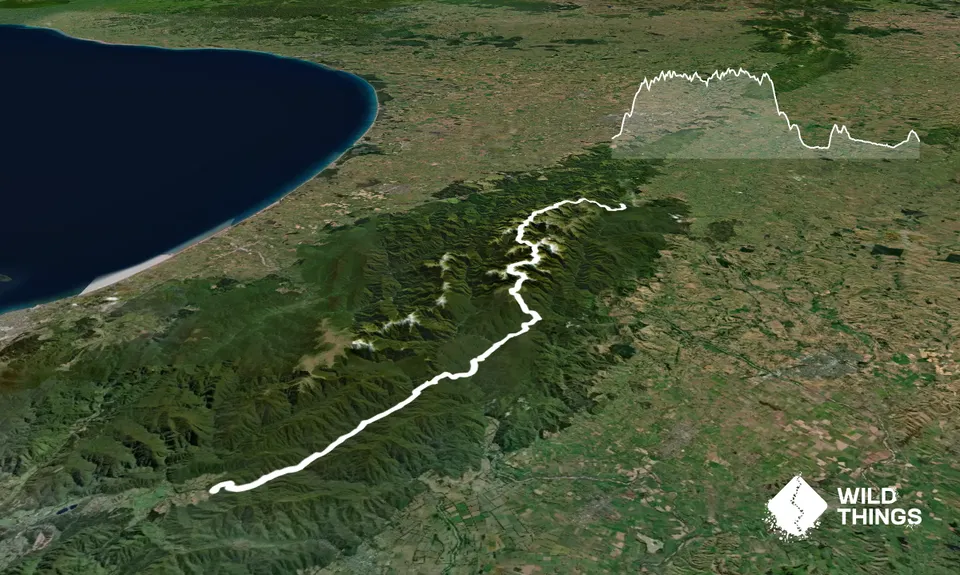
19 km
25 minutes
Unknown
No
Extreme.
Most of the difficult nav is early in the journey especially if you start in the dark. A recce is advised.
Navigation over Cone Saddle in particular can be a problem as this section will often be completed in the dark.
Water is usually fine at the huts but pays to check if its been very dry. There are long sections between huts. There are also tarns which are OK if with aquatabs/ filter but also pays to check local knowledge on their condition. You will need to plan your water refills for this.
Water can be a problem after long dry spells, so aim to carry at least 2L at a time during summer.
Tararua tops can be brutal any time of year and not to be underestimated. Good weather is almost certainly desired as the first half of the route is exposed tops.
Some sidling and clambering around Waiohine Pinnacles, Girdlestone, North King and Broken Axe Pinnacles is required. Recommend that you are comfortable in this terrain.
DIY
Kaitoke carpark
Purely up to how you organise support throughout or at the end as you'll be poked and you finish in a dusty car park 20min drive from anything
Do you have another suggestion on where to go afterwards for the best coffee / cake / breakfast / brunch / beer?
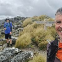
Katie and I had a challenging day in tough conditions, but would totally do it again as I know the views are amazing, and I'm a bit of a sucker for punishment!
These overlap with this trail to some degree. You may wish to combine them but please note that to qualify for FKTs on these runs you should record a separate activity for each.
We don't store or share your location; it's only used for these features. You can continue without it, just without distance sorting and live map features.
Send to your phone
Scan the below QR code to open this trail on your phone.
Tip: position the QR code in your phone camera screen.