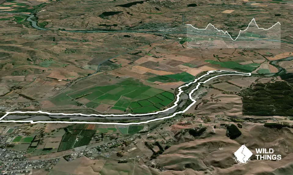
Be warned this route can be a little hard to follow. Sometimes grass is long on one section about 4km into the run. Take instructions with you!
Start your run under the bridge on the limestone track. Run for about 500m on the track. Once the path goes left you want to continue straight ahead toward the trees. You will probably see bike tracks and a water culvert on you left. In about 200m this should narrow down and reveal the start of the trail.
Continue on this trail (be careful it sometimes crosses a bridle path) and at about 4.5km you will pop out near another water culvert. Turn left here (hopefully grass not too overgrown) and follow the culvert until you see a little bridge cross. Follow the trail up on to a more 4WD section. This is when things get a bit tricky. Follow this trail for about another 500m and on your right (after a rise) you should see a single track going to right.
Turn right here and follow until you end up on the river bed by the swing bridge (about 6.5km into the run). You should notice that after a couple of steps the trail goes back up off the bank, follow this and you should go up the stop bank to the bridge and cross the bridge. Once on the other side of the bridge, you will notice the beautiful Tukituki trall sign. To the right of this through the trees you should see a trail, run through here and follow this until you evidently pop out on to a wide unsealed road (about 7.8km into your run).
Go straight head towards the river and you should see the track continue on you left. Follow the trail until you pop out on to another unsealed road which goes down to the river from the quarry. Go left here but look to your right to see the trail continue behind the quarry. You will weave through some trees and in about 200m you will have the option of going right or left again. Go left here and follow the trail for about 150m until you go around a large pine tree and you should see the limestone track going along by the road. Leave the trees down to the limestone track and follow this down to a little bridge on your right.
Cross this bridge and instead of following the limestone track go straight ahead and follow the single track until you get to another 4WD track after about 200m and go right here. Look for the single track continuing on your right in about 30m. Follow this trail until you pop out on to another 4WD track coming down from the stop bank towards the river. Go left here and you should see the trail continue alongside the stop bank. This should relatively easy to follow until you get about 13km into your run and you will need to cross the 4WD track (which has been on your right while you have been on the single track) towards the river and you should see the trail continue by the river. You want to follow this to your left and it will bring you out under the bridge. Go under the bridge and follow the limestone track up to the footpath and cross the bridge back to where you parked the car.